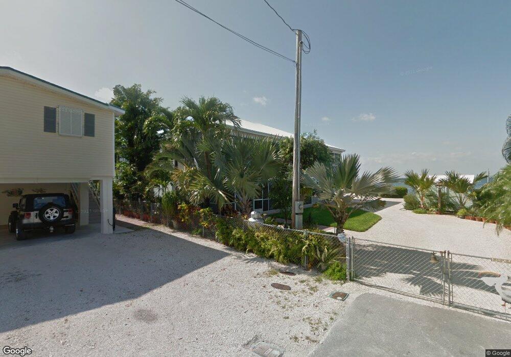
795 Narragansett Ln Key Largo, FL 33037
Estimated Value: $2,564,990 - $2,902,000
3
Beds
2
Baths
2,021
Sq Ft
$1,364/Sq Ft
Est. Value
About This Home
This home is located at 795 Narragansett Ln, Key Largo, FL 33037 and is currently estimated at $2,756,498, approximately $1,363 per square foot. 795 Narragansett Ln is a home located in Monroe County with nearby schools including Key Largo School, Coral Shores High School, and St. Justin Marine Academy.
Ownership History
Date
Name
Owned For
Owner Type
Purchase Details
Closed on
Aug 2, 2019
Sold by
Fink Eugene Craig and Fink Carol B
Bought by
S And S Investments Llc
Current Estimated Value
Purchase Details
Closed on
Jan 26, 2016
Sold by
Fink Eugene Craig and Fink Carol B
Bought by
Wilkerson Travis R
Purchase Details
Closed on
Oct 9, 1998
Sold by
Lippman Milton and Lippman Lillian
Bought by
Fink Eugene C and Fink Carol B
Home Financials for this Owner
Home Financials are based on the most recent Mortgage that was taken out on this home.
Original Mortgage
$180,000
Interest Rate
6.95%
Mortgage Type
New Conventional
Purchase Details
Closed on
Feb 1, 1974
Bought by
Fink Eugene Craig and Fink Carol B
Create a Home Valuation Report for This Property
The Home Valuation Report is an in-depth analysis detailing your home's value as well as a comparison with similar homes in the area
Home Values in the Area
Average Home Value in this Area
Purchase History
| Date | Buyer | Sale Price | Title Company |
|---|---|---|---|
| S And S Investments Llc | $1,485,000 | Attorney | |
| Wilkerson Travis R | -- | Attorney | |
| Fink Eugene C | $320,000 | -- | |
| Fink Eugene Craig | $15,000 | -- |
Source: Public Records
Mortgage History
| Date | Status | Borrower | Loan Amount |
|---|---|---|---|
| Previous Owner | Fink Eugene C | $600,000 | |
| Previous Owner | Fink Eugene C | $464,000 | |
| Previous Owner | Fink Eugene C | $460,000 | |
| Previous Owner | Fink Eugene C | $180,000 |
Source: Public Records
Tax History Compared to Growth
Tax History
| Year | Tax Paid | Tax Assessment Tax Assessment Total Assessment is a certain percentage of the fair market value that is determined by local assessors to be the total taxable value of land and additions on the property. | Land | Improvement |
|---|---|---|---|---|
| 2024 | $14,463 | $2,410,833 | $1,737,713 | $673,120 |
| 2023 | $14,463 | $2,115,328 | $1,459,868 | $655,460 |
| 2022 | $12,987 | $1,965,995 | $1,301,368 | $664,627 |
| 2021 | $10,456 | $1,200,010 | $696,565 | $503,445 |
| 2020 | $10,575 | $1,206,070 | $696,565 | $509,505 |
| 2019 | $6,441 | $738,330 | $0 | $0 |
| 2018 | $6,442 | $724,564 | $0 | $0 |
| 2017 | $6,306 | $709,662 | $0 | $0 |
| 2016 | $6,395 | $695,066 | $0 | $0 |
| 2015 | $6,466 | $690,234 | $0 | $0 |
| 2014 | $6,595 | $684,756 | $0 | $0 |
Source: Public Records
Map
Nearby Homes
- 794 Narragansett Ln
- 851 Narragansett Ln
- 1032 Adams Dr
- 723 Boyd Dr
- 721 Garden State Ln
- 621 Santa Anita Ln
- 705 Garden State Ln
- 1021 Adams Dr
- 1020 Adams Dr
- 553 Oldsmar Ln
- 1015 Adams Dr
- 1514 Shaw Dr
- 1313 Calder Rd
- 456 Bowie Ln
- 1502 Shaw Dr
- 410 Bowie Ln
- 1515 Aqueduct Ln
- 311 Belmont Ln
- 894 Ellen Dr
- 693 N Lake Dr
- 878 Narragansett Ln
- 865 Narragansett Ln
- 1048 Adams Dr
- 802 Narragansett Ln
- 1046 Adams Dr
- 1044 Adams Dr
- 808 Narragansett Ln
- 1045 Adams Dr
- 1042 Adams Dr
- 870 Narragansett Ln
- 859 Narragansett Ln
- 1043 Adams Dr
- 868 Narragansett Ln
- 858 Narragansett Ln
- 1041 Adams Dr
- 1040 Adams Dr
- 857 Narragansett Ln
- 1039 Adams Dr
- 773 Michael Dr
- 23 Michael Dr