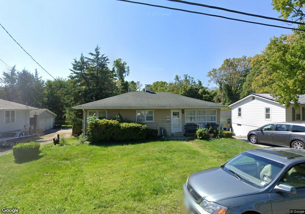
795 Portland Ave Collinsville, IL 62234
Estimated Value: $149,000 - $175,000
3
Beds
2
Baths
1,025
Sq Ft
$154/Sq Ft
Est. Value
About This Home
This home is located at 795 Portland Ave, Collinsville, IL 62234 and is currently estimated at $158,217, approximately $154 per square foot. 795 Portland Ave is a home located in Madison County with nearby schools including John A Renfro Elementary School, Dorris Intermediate School, and Collinsville Middle School.
Ownership History
Date
Name
Owned For
Owner Type
Purchase Details
Closed on
Nov 8, 2010
Sold by
Burns Dorothy M and Burns John T
Bought by
Hayden Brian
Current Estimated Value
Home Financials for this Owner
Home Financials are based on the most recent Mortgage that was taken out on this home.
Original Mortgage
$92,591
Outstanding Balance
$61,090
Interest Rate
4.27%
Mortgage Type
FHA
Estimated Equity
$97,127
Create a Home Valuation Report for This Property
The Home Valuation Report is an in-depth analysis detailing your home's value as well as a comparison with similar homes in the area
Home Values in the Area
Average Home Value in this Area
Purchase History
| Date | Buyer | Sale Price | Title Company |
|---|---|---|---|
| Hayden Brian | $95,000 | First American Title Ins Co |
Source: Public Records
Mortgage History
| Date | Status | Borrower | Loan Amount |
|---|---|---|---|
| Open | Hayden Brian | $92,591 |
Source: Public Records
Tax History Compared to Growth
Tax History
| Year | Tax Paid | Tax Assessment Tax Assessment Total Assessment is a certain percentage of the fair market value that is determined by local assessors to be the total taxable value of land and additions on the property. | Land | Improvement |
|---|---|---|---|---|
| 2024 | $2,764 | $43,230 | $7,200 | $36,030 |
| 2023 | $2,764 | $40,010 | $6,660 | $33,350 |
| 2022 | $2,633 | $35,900 | $5,960 | $29,940 |
| 2021 | $2,330 | $33,730 | $5,600 | $28,130 |
| 2020 | $2,246 | $32,180 | $5,340 | $26,840 |
| 2019 | $2,187 | $31,080 | $5,160 | $25,920 |
| 2018 | $2,258 | $31,110 | $4,870 | $26,240 |
| 2017 | $2,262 | $30,490 | $4,770 | $25,720 |
| 2016 | $2,383 | $30,490 | $4,770 | $25,720 |
| 2015 | $1,774 | $29,700 | $4,650 | $25,050 |
| 2014 | $1,774 | $29,700 | $4,650 | $25,050 |
| 2013 | $1,774 | $29,700 | $4,650 | $25,050 |
Source: Public Records
Map
Nearby Homes
- 919 Vine St
- 501 Spring
- 921 Prospect St
- 1210 Constance St
- 1227 Ridge Ave
- 892 Lester Ave
- 1120 Williams St
- 308 Brown Ave
- 238 Mill St
- 706 Illinois Ave
- 617 N Morrison Ave
- 404 E Church St
- 216 S Chestnut St
- 1002 California Ave
- 123 W Wickliffe Ave
- 203 Greenfield Dr
- 6430 Lebanon Rd
- 110 E Church St
- 1224 Cedar Ridge Ct
- 1322 Leland St
- 797 Portland Ave
- 793 Portland Ave
- 799 Portland Ave
- 100 Portland Terrace
- 791 Portland Ave
- 796 Portland Ave
- 700 Portland Ave
- 102 Portland Terrace
- 109 Julia St
- 104 Portland Terrace
- 800 Portland Ave
- 787 Portland Ave
- 889 Portland Ave
- 107 Julia St
- 101 Portland Terrace
- 898 Portland Ave
- 106 Portland Terrace
- 201 Julia St
- 103 Portland Terrace
- 696 Portland Ave