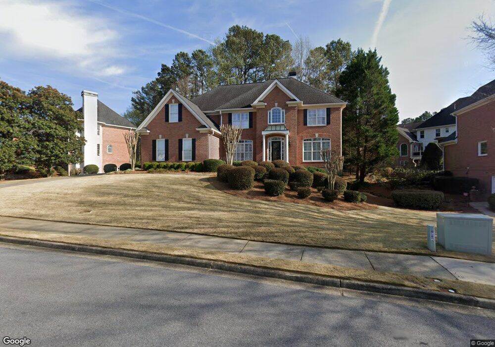
795 Thornberry Dr Unit 1 Alpharetta, GA 30022
Estimated Value: $816,000 - $1,294,000
4
Beds
4
Baths
3,856
Sq Ft
$266/Sq Ft
Est. Value
About This Home
This home is located at 795 Thornberry Dr Unit 1, Alpharetta, GA 30022 and is currently estimated at $1,025,516, approximately $265 per square foot. 795 Thornberry Dr Unit 1 is a home located in Fulton County with nearby schools including Northwood Elementary School, Haynes Bridge Middle School, and Centennial High School.
Ownership History
Date
Name
Owned For
Owner Type
Purchase Details
Closed on
Apr 16, 2001
Sold by
Smith Mark E
Bought by
Smith Mark E and Smith Mariaane
Current Estimated Value
Home Financials for this Owner
Home Financials are based on the most recent Mortgage that was taken out on this home.
Original Mortgage
$250,000
Outstanding Balance
$92,160
Interest Rate
7.02%
Mortgage Type
New Conventional
Estimated Equity
$933,356
Purchase Details
Closed on
Jan 31, 1997
Sold by
C R Vick Inc
Bought by
Kopcke John L Jane A
Create a Home Valuation Report for This Property
The Home Valuation Report is an in-depth analysis detailing your home's value as well as a comparison with similar homes in the area
Home Values in the Area
Average Home Value in this Area
Purchase History
| Date | Buyer | Sale Price | Title Company |
|---|---|---|---|
| Smith Mark E | -- | -- | |
| Smith Mark E | $447,500 | -- | |
| Kopcke John L Jane A | $369,900 | -- |
Source: Public Records
Mortgage History
| Date | Status | Borrower | Loan Amount |
|---|---|---|---|
| Open | Smith Mark E | $250,000 |
Source: Public Records
Tax History Compared to Growth
Tax History
| Year | Tax Paid | Tax Assessment Tax Assessment Total Assessment is a certain percentage of the fair market value that is determined by local assessors to be the total taxable value of land and additions on the property. | Land | Improvement |
|---|---|---|---|---|
| 2025 | $976 | $344,520 | $56,800 | $287,720 |
| 2023 | $8,171 | $289,480 | $82,280 | $207,200 |
| 2022 | $5,188 | $282,120 | $42,840 | $239,280 |
| 2021 | $6,310 | $245,400 | $32,680 | $212,720 |
| 2020 | $6,353 | $236,960 | $35,800 | $201,160 |
| 2019 | $927 | $210,760 | $30,800 | $179,960 |
| 2018 | $5,468 | $205,840 | $30,080 | $175,760 |
| 2017 | $5,022 | $184,080 | $23,160 | $160,920 |
| 2016 | $5,022 | $184,080 | $23,160 | $160,920 |
| 2015 | $5,900 | $184,080 | $23,160 | $160,920 |
| 2014 | $5,052 | $177,560 | $17,320 | $160,240 |
Source: Public Records
Map
Nearby Homes
- 530 Kearny St
- 225 Wentworth Terrace
- 10530 Haynes Forest Dr
- 10505 Ash Rill Dr
- 10421 Park Walk Point
- 725 High Hampton Run
- 3077 Haynes Trail
- 3273 Long Indian Creek Ct
- 3195 Waters Mill Dr
- 385 Birch Rill Dr
- 3040 Roxburgh Dr
- 10280 Crescent Ridge Dr
- 305 Birch Rill Dr
- 130 Forrest View Terrace
- 10085 Old Woodland Entry
- 105 May Glen Way
- 300 Olmstead Way
- 805 Thornberry Dr Unit 1
- 300 Sharpe Ln
- 300 Sharpe Ln
- 320 Sharpe Ln Unit 1
- 310 Sharpe Ln
- 10400 Stanyan St
- 815 Thornberry Dr Unit 2
- 0 Thornberry Dr Unit 7458112
- 0 Thornberry Dr Unit 7228938
- 0 Thornberry Dr Unit 3241477
- 0 Thornberry Dr Unit 3141296
- 0 Thornberry Dr Unit 7632168
- 0 Thornberry Dr Unit 8176192
- 330 Sharpe Ln
- 0 Sharpe Ln Unit 8620367
- 0 Sharpe Ln Unit 8403381
- 0 Sharpe Ln Unit 8270829
- 0 Sharpe Ln Unit 8603768
- 0 Sharpe Ln Unit 8089569
- 840 Thornberry Dr