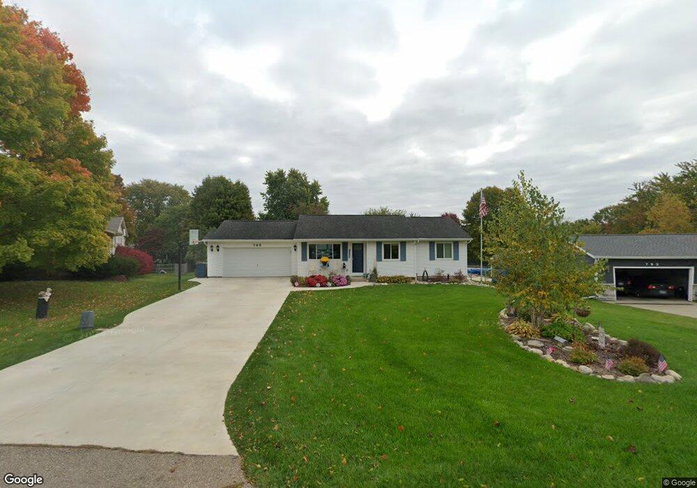
795 Topview Dr Otsego, MI 49078
Estimated Value: $219,906 - $314,000
4
Beds
2
Baths
1,550
Sq Ft
$166/Sq Ft
Est. Value
About This Home
This home is located at 795 Topview Dr, Otsego, MI 49078 and is currently estimated at $257,477, approximately $166 per square foot. 795 Topview Dr is a home located in Allegan County with nearby schools including Plainwell High School, Otsego Christian Academy, and St. Margaret School.
Ownership History
Date
Name
Owned For
Owner Type
Purchase Details
Closed on
Aug 30, 2002
Sold by
Townsend John E and Townsend Kristina S
Bought by
Jackson Scott A and Jackson Julie P
Current Estimated Value
Home Financials for this Owner
Home Financials are based on the most recent Mortgage that was taken out on this home.
Original Mortgage
$128,155
Outstanding Balance
$50,127
Interest Rate
5.37%
Estimated Equity
$207,350
Purchase Details
Closed on
Jan 22, 1999
Sold by
Mead Kurtis M and Mead Deanna L
Bought by
Townsend John E
Create a Home Valuation Report for This Property
The Home Valuation Report is an in-depth analysis detailing your home's value as well as a comparison with similar homes in the area
Home Values in the Area
Average Home Value in this Area
Purchase History
| Date | Buyer | Sale Price | Title Company |
|---|---|---|---|
| Jackson Scott A | $134,900 | -- | |
| Townsend John E | $112,000 | -- |
Source: Public Records
Mortgage History
| Date | Status | Borrower | Loan Amount |
|---|---|---|---|
| Open | Jackson Scott A | $128,155 |
Source: Public Records
Tax History
| Year | Tax Paid | Tax Assessment Tax Assessment Total Assessment is a certain percentage of the fair market value that is determined by local assessors to be the total taxable value of land and additions on the property. | Land | Improvement |
|---|---|---|---|---|
| 2025 | $2,427 | $82,900 | $10,000 | $72,900 |
| 2024 | $2,213 | $79,200 | $9,600 | $69,600 |
| 2023 | $2,249 | $74,000 | $9,500 | $64,500 |
| 2022 | $2,213 | $67,700 | $9,500 | $58,200 |
| 2020 | $2,067 | $76,500 | $5,100 | $71,400 |
| 2019 | $0 | $72,900 | $5,100 | $67,800 |
| 2018 | $0 | $69,500 | $7,100 | $62,400 |
| 2017 | $0 | $69,900 | $7,100 | $62,800 |
| 2016 | $0 | $62,100 | $7,100 | $55,000 |
| 2015 | -- | $62,100 | $7,100 | $55,000 |
| 2014 | -- | $62,100 | $7,100 | $55,000 |
| 2013 | -- | $58,500 | $7,100 | $51,400 |
Source: Public Records
Map
Nearby Homes
- VL 107th Ave
- 716 10th St
- 1038 Allen Ct
- 1036 Sir Knight Rd
- 233 Washington Ave
- 1248 Keith St
- 140 W 1st Ave
- 830 Miller Rd Unit 26.98 Acres
- 355 12th St
- 1431 Michigan 89
- 426 W Bridge St
- 1220 Delaney Dr
- 551 W Bridge St
- 1170 W Bridge St
- 770 Miller Rd
- 301 Helen Ave
- 323 13th St
- 324 S Fair St
- 909 Barton St
- 317 E Chart St
Your Personal Tour Guide
Ask me questions while you tour the home.