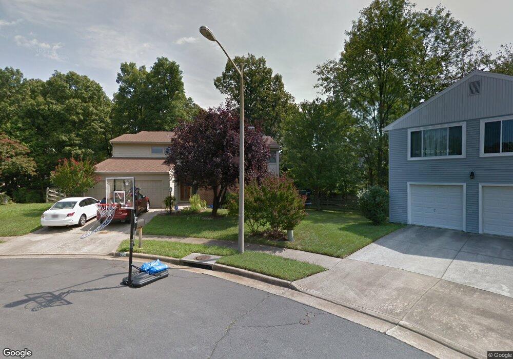
7950 Parsons Grove Ct Dunn Loring, VA 22027
Estimated Value: $1,133,000 - $1,329,000
4
Beds
3
Baths
3,109
Sq Ft
$404/Sq Ft
Est. Value
About This Home
This home is located at 7950 Parsons Grove Ct, Dunn Loring, VA 22027 and is currently estimated at $1,255,672, approximately $403 per square foot. 7950 Parsons Grove Ct is a home located in Fairfax County with nearby schools including Stenwood Elementary School, Kilmer Middle School, and Marshall High School.
Ownership History
Date
Name
Owned For
Owner Type
Purchase Details
Closed on
Mar 19, 2019
Sold by
Silva Carlos A and Soler Irene M
Bought by
Silva Carlos A and Soler Irene M
Current Estimated Value
Purchase Details
Closed on
Jul 11, 2011
Sold by
Southard Michael N
Bought by
Silva Carlos A and Soler Irene M
Home Financials for this Owner
Home Financials are based on the most recent Mortgage that was taken out on this home.
Original Mortgage
$400,000
Interest Rate
4.6%
Mortgage Type
New Conventional
Purchase Details
Closed on
Jul 6, 2001
Sold by
Lacy Larry W
Bought by
Southard Michael N
Home Financials for this Owner
Home Financials are based on the most recent Mortgage that was taken out on this home.
Original Mortgage
$359,600
Interest Rate
7.21%
Create a Home Valuation Report for This Property
The Home Valuation Report is an in-depth analysis detailing your home's value as well as a comparison with similar homes in the area
Home Values in the Area
Average Home Value in this Area
Purchase History
| Date | Buyer | Sale Price | Title Company |
|---|---|---|---|
| Silva Carlos A | -- | None Available | |
| Silva Carlos A | $725,000 | -- | |
| Southard Michael N | $449,500 | -- |
Source: Public Records
Mortgage History
| Date | Status | Borrower | Loan Amount |
|---|---|---|---|
| Previous Owner | Silva Carlos A | $400,000 | |
| Previous Owner | Southard Michael N | $359,600 |
Source: Public Records
Tax History Compared to Growth
Tax History
| Year | Tax Paid | Tax Assessment Tax Assessment Total Assessment is a certain percentage of the fair market value that is determined by local assessors to be the total taxable value of land and additions on the property. | Land | Improvement |
|---|---|---|---|---|
| 2025 | $12,217 | $1,054,530 | $411,000 | $643,530 |
| 2024 | $12,217 | $1,054,530 | $411,000 | $643,530 |
| 2023 | $12,125 | $1,074,430 | $411,000 | $663,430 |
| 2022 | $10,834 | $947,400 | $366,000 | $581,400 |
| 2021 | $9,535 | $812,560 | $336,000 | $476,560 |
| 2020 | $9,617 | $812,560 | $336,000 | $476,560 |
| 2019 | $9,472 | $800,350 | $336,000 | $464,350 |
| 2018 | $8,899 | $773,830 | $321,000 | $452,830 |
| 2017 | $8,984 | $773,830 | $321,000 | $452,830 |
| 2016 | $8,746 | $754,950 | $311,000 | $443,950 |
| 2015 | $8,425 | $754,950 | $311,000 | $443,950 |
| 2014 | $8,184 | $734,950 | $291,000 | $443,950 |
Source: Public Records
Map
Nearby Homes
- 2207 Arden St
- 8027 Tyson Oaks Cir
- 2230 George C Marshall Dr Unit 1111
- 2230 George C Marshall Dr Unit 306
- 2230 George C Marshall Dr Unit 712
- 2230 George C Marshall Dr Unit 516
- 2230 George C Marshall Dr Unit 617
- The Vienna Plan at Vienna Village
- 8010 Merry Oaks Ln
- 2244 Providence St
- 2000 Old Gallows Rd
- 2206 Central Ave
- 2054 Madrillon Rd
- 0 Madrillon Rd
- 2318 Wheystone Ct
- The Evanston Plan at Tysons Ridge
- 7914 Idylwood Rd
- 2014 Edgar Ct
- 2132 Hutchison Grove Ct
- 2020 Nordlie Place
- 7952 Parsons Grove Ct
- 7951 Parsons Grove Ct
- 7956 Robarge Ct
- 7954 Robarge Ct
- 7954 Parsons Grove Ct
- 7953 Parsons Grove Ct
- 7957 Robarge Ct
- 7955 Parsons Grove Ct
- 7951 Arden Ct
- 7956 Parsons Grove Ct
- 7953 Arden Ct
- 7955 Robarge Ct
- 2144 Tysons Executive Ct
- 7957 Parsons Grove Ct
- 2201 Arden St
- 7950 Arden Ct
- 7955 Arden Ct
- 7962 Blitz Ct
- 7953 Robarge Ct
- 7968 Blitz Ct