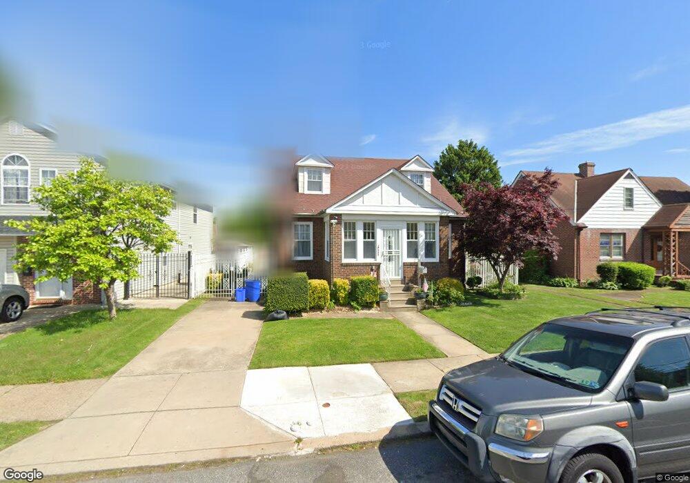
7953 Loretto Ave Philadelphia, PA 19111
Rhawnhurst NeighborhoodEstimated Value: $387,405 - $419,000
--
Bed
--
Bath
1,800
Sq Ft
$226/Sq Ft
Est. Value
About This Home
This home is located at 7953 Loretto Ave, Philadelphia, PA 19111 and is currently estimated at $407,101, approximately $226 per square foot. 7953 Loretto Ave is a home located in Philadelphia County with nearby schools including Rhawnhurst School, Castor Gardens Middle School, and Northeast High School.
Ownership History
Date
Name
Owned For
Owner Type
Purchase Details
Closed on
Dec 11, 2022
Sold by
Vu Kelvin T
Bought by
Le Dung Thi Ngoc
Current Estimated Value
Purchase Details
Closed on
Apr 15, 2002
Sold by
Mertz Jennie M and Fox Margaret A
Bought by
Heljenek Timothy M
Home Financials for this Owner
Home Financials are based on the most recent Mortgage that was taken out on this home.
Original Mortgage
$116,350
Interest Rate
7.05%
Create a Home Valuation Report for This Property
The Home Valuation Report is an in-depth analysis detailing your home's value as well as a comparison with similar homes in the area
Home Values in the Area
Average Home Value in this Area
Purchase History
| Date | Buyer | Sale Price | Title Company |
|---|---|---|---|
| Le Dung Thi Ngoc | -- | -- | |
| Heljenek Timothy M | $122,500 | -- |
Source: Public Records
Mortgage History
| Date | Status | Borrower | Loan Amount |
|---|---|---|---|
| Previous Owner | Heljenek Timothy M | $116,350 |
Source: Public Records
Tax History Compared to Growth
Tax History
| Year | Tax Paid | Tax Assessment Tax Assessment Total Assessment is a certain percentage of the fair market value that is determined by local assessors to be the total taxable value of land and additions on the property. | Land | Improvement |
|---|---|---|---|---|
| 2025 | $4,027 | $365,200 | $73,040 | $292,160 |
| 2024 | $4,027 | $365,200 | $73,040 | $292,160 |
| 2023 | $4,027 | $287,700 | $57,540 | $230,160 |
| 2022 | $2,597 | $242,700 | $57,540 | $185,160 |
| 2021 | $3,227 | $0 | $0 | $0 |
| 2020 | $3,227 | $0 | $0 | $0 |
| 2019 | $3,124 | $0 | $0 | $0 |
| 2018 | $2,882 | $0 | $0 | $0 |
| 2017 | $2,882 | $0 | $0 | $0 |
| 2016 | $2,462 | $0 | $0 | $0 |
| 2015 | $2,357 | $0 | $0 | $0 |
| 2014 | -- | $205,900 | $78,717 | $127,183 |
| 2012 | -- | $36,768 | $16,726 | $20,042 |
Source: Public Records
Map
Nearby Homes
- 1931 33 Rhawn St
- 7912 14 Loretto Ave
- 2013 Fuller St
- 2029 Loney St
- 1718 Rhawn St
- 1719 Loney St
- 1704 Stanwood St
- 1702 Arthur St
- 2123 Loney St
- 7735 Loretto Ave
- 1625 Rhawn St
- 1920 Hartel Ave
- 1826 Hartel Ave
- 2023 Hartel Ave
- 1620 Loney St
- 1919 Lansing St
- 7830 Summerdale Ave
- 1834 Lansing St
- 7950 Algon Ave
- 1807 Napfle Ave
- 7939 Loretto Ave
- 7955 Loretto Ave
- 7957 Loretto Ave
- 1910 Rhawn St
- 1911 Ripley St
- 1914 Rhawn St
- 1915 Ripley St
- 1901 Rhawn St Unit 3
- 7966 Loretto Ave
- 7970 Loretto Ave
- 1918 Rhawn St
- 7960 Loretto Ave
- 7974 Loretto Ave
- 1919 Ripley St
- 7956 Loretto Ave
- 1909 Rhawn St
- 1913 Rhawn St
- 1911 Rhawn St
- 1922 Rhawn St
- 1921 Ripley St Unit 23