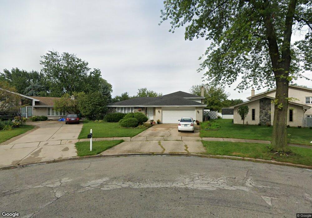
7955 W Sequoia Ct Unit 1 Orland Park, IL 60462
Silver Lake South NeighborhoodEstimated Value: $423,000 - $452,000
4
Beds
3
Baths
1,853
Sq Ft
$235/Sq Ft
Est. Value
About This Home
This home is located at 7955 W Sequoia Ct Unit 1, Orland Park, IL 60462 and is currently estimated at $434,633, approximately $234 per square foot. 7955 W Sequoia Ct Unit 1 is a home located in Cook County with nearby schools including Arnold W Kruse Education Center, Central Middle School, and Victor J Andrew High School.
Ownership History
Date
Name
Owned For
Owner Type
Purchase Details
Closed on
Nov 14, 2003
Sold by
Valderrama Leonard J and Valderrama Christine
Bought by
Palos Bank & Trust Co and Trust #1-5919
Current Estimated Value
Home Financials for this Owner
Home Financials are based on the most recent Mortgage that was taken out on this home.
Original Mortgage
$212,000
Outstanding Balance
$86,227
Interest Rate
4.25%
Mortgage Type
Unknown
Estimated Equity
$348,406
Purchase Details
Closed on
Apr 22, 1996
Sold by
Kamradt Michael J and Kamradt Florence T
Bought by
Valderrama Leonard J and Liebich Christine W
Home Financials for this Owner
Home Financials are based on the most recent Mortgage that was taken out on this home.
Original Mortgage
$146,000
Interest Rate
7.86%
Create a Home Valuation Report for This Property
The Home Valuation Report is an in-depth analysis detailing your home's value as well as a comparison with similar homes in the area
Home Values in the Area
Average Home Value in this Area
Purchase History
| Date | Buyer | Sale Price | Title Company |
|---|---|---|---|
| Palos Bank & Trust Co | -- | Cti | |
| Valderrama Leonard J | $292,500 | First American Title Ins Co |
Source: Public Records
Mortgage History
| Date | Status | Borrower | Loan Amount |
|---|---|---|---|
| Open | Palos Bank & Trust Co | $212,000 | |
| Previous Owner | Valderrama Leonard J | $146,000 |
Source: Public Records
Tax History Compared to Growth
Tax History
| Year | Tax Paid | Tax Assessment Tax Assessment Total Assessment is a certain percentage of the fair market value that is determined by local assessors to be the total taxable value of land and additions on the property. | Land | Improvement |
|---|---|---|---|---|
| 2024 | $9,545 | $36,000 | $8,024 | $27,976 |
| 2023 | $7,536 | $36,000 | $8,024 | $27,976 |
| 2022 | $7,536 | $24,549 | $7,062 | $17,487 |
| 2021 | $7,417 | $24,547 | $7,061 | $17,486 |
| 2020 | $7,457 | $24,547 | $7,061 | $17,486 |
| 2019 | $8,594 | $28,007 | $6,419 | $21,588 |
| 2018 | $8,415 | $28,007 | $6,419 | $21,588 |
| 2017 | $8,248 | $28,007 | $6,419 | $21,588 |
| 2016 | $7,995 | $25,170 | $5,777 | $19,393 |
| 2015 | $7,855 | $25,170 | $5,777 | $19,393 |
| 2014 | $7,767 | $25,170 | $5,777 | $19,393 |
| 2013 | $7,966 | $27,782 | $5,777 | $22,005 |
Source: Public Records
Map
Nearby Homes
- 15229 Bunker Dr
- 7922 Sycamore Dr
- 15024 S 81st Ave
- 7712 Sequoia Ct
- 8215 Saint Andrews Dr
- 14939 S 81st Ct
- 7991 Forestview Dr
- 15426 S 82nd Ave
- 15543 Brassie Dr
- 7825 Braeloch Ct
- 7617 Sycamore Dr
- 7820 Forestview Dr
- 7842 Sea Pines Rd
- 15624 Sunset Ridge Dr
- 15346 Heather Ct
- 15713 Brassie Ct Unit 1S
- 15337 Heather Ct
- 7747 Cashew Dr
- 7911 W 157th St Unit 2W
- 15702 Deerfield Ct Unit 2S
- 7949 W Sequoia Ct Unit 1
- 7960 W Sequoia Ct
- 7943 W Sequoia Ct
- 7950 W Ponderosa Ct
- 7950 W Sequoia Ct
- 15217 Brassie Dr
- 15223 Brassie Dr
- 7935 W Sequoia Ct Unit 1
- 7944 W Ponderosa Ct
- 7944 W Sequoia Ct
- 15211 Brassie Dr
- 15229 Brassie Dr
- 7936 W Ponderosa Ct
- 7936 W Sequoia Ct
- 7955 Sycamore Dr
- 15205 Brassie Dr
- 7927 W Sequoia Ct
- 7949 Sycamore Dr
- 15235 Brassie Dr
- 7943 Sycamore Dr