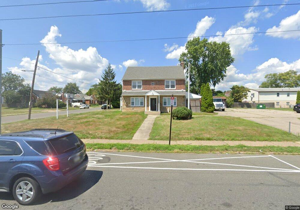
7956 Castor Ave Philadelphia, PA 19152
Rhawnhurst NeighborhoodEstimated Value: $391,000 - $507,000
3
Beds
1
Bath
1,852
Sq Ft
$234/Sq Ft
Est. Value
About This Home
This home is located at 7956 Castor Ave, Philadelphia, PA 19152 and is currently estimated at $432,764, approximately $233 per square foot. 7956 Castor Ave is a home located in Philadelphia County with nearby schools including Rhawnhurst School, Castor Gardens Middle School, and Northeast High School.
Ownership History
Date
Name
Owned For
Owner Type
Purchase Details
Closed on
Apr 29, 2022
Sold by
Patel Manish N
Bought by
Dong Shisong
Current Estimated Value
Home Financials for this Owner
Home Financials are based on the most recent Mortgage that was taken out on this home.
Original Mortgage
$318,750
Outstanding Balance
$300,698
Interest Rate
4.67%
Mortgage Type
New Conventional
Estimated Equity
$132,066
Purchase Details
Closed on
Sep 21, 2017
Sold by
Bernaduo Dominic J
Bought by
Patel Manish
Purchase Details
Closed on
Jun 30, 2000
Sold by
Spinelli Eleanor R and Kramer Esq Mitchell A
Bought by
Bernaudo Dominic J
Home Financials for this Owner
Home Financials are based on the most recent Mortgage that was taken out on this home.
Original Mortgage
$145,000
Interest Rate
8.55%
Mortgage Type
Balloon
Create a Home Valuation Report for This Property
The Home Valuation Report is an in-depth analysis detailing your home's value as well as a comparison with similar homes in the area
Home Values in the Area
Average Home Value in this Area
Purchase History
| Date | Buyer | Sale Price | Title Company |
|---|---|---|---|
| Dong Shisong | $430,000 | None Listed On Document | |
| Patel Manish | $310,000 | None Available | |
| Bernaudo Dominic J | $145,000 | -- |
Source: Public Records
Mortgage History
| Date | Status | Borrower | Loan Amount |
|---|---|---|---|
| Open | Dong Shisong | $318,750 | |
| Previous Owner | Bernaudo Dominic J | $145,000 |
Source: Public Records
Tax History Compared to Growth
Tax History
| Year | Tax Paid | Tax Assessment Tax Assessment Total Assessment is a certain percentage of the fair market value that is determined by local assessors to be the total taxable value of land and additions on the property. | Land | Improvement |
|---|---|---|---|---|
| 2025 | $4,542 | $381,800 | $76,360 | $305,440 |
| 2024 | $4,542 | $381,800 | $76,360 | $305,440 |
| 2023 | $4,542 | $324,500 | $64,900 | $259,600 |
| 2022 | $3,490 | $324,500 | $64,900 | $259,600 |
| 2021 | $3,490 | $0 | $0 | $0 |
| 2020 | $3,490 | $0 | $0 | $0 |
| 2019 | $3,379 | $0 | $0 | $0 |
| 2018 | $3,239 | $0 | $0 | $0 |
| 2017 | $3,239 | $0 | $0 | $0 |
| 2016 | $2,819 | $0 | $0 | $0 |
| 2015 | $2,699 | $0 | $0 | $0 |
| 2014 | -- | $231,400 | $77,250 | $154,150 |
| 2012 | -- | $34,112 | $18,080 | $16,032 |
Source: Public Records
Map
Nearby Homes
- 1931 33 Rhawn St
- 2029 Loney St
- 7912 14 Loretto Ave
- 2013 Fuller St
- 2123 Loney St
- 2023 Hartel Ave
- 7735 Loretto Ave
- 1920 Hartel Ave
- 1719 Loney St
- 1718 Rhawn St
- 1919 Lansing St
- 1826 Hartel Ave
- 1834 Lansing St
- 1704 Stanwood St
- 1702 Arthur St
- 2232 Stanwood St
- 7830 Summerdale Ave
- 1620 Loney St
- 1625 Rhawn St
- 7815 Horrocks St
- 1927 Loney St
- 1925 Loney St
- 7941 Castor Ave
- 1923 Loney St
- 1926 Ripley St
- 1922 Ripley St
- 1921 Loney St
- 1924 Ripley St
- 1916 Loney St
- 1919 Loney St
- 1920 Ripley St
- 1914 Loney St
- 1917 Loney St
- 0 Ripley St
- 7937 Castor Ave
- 7943 Castor Ave
- 7955 Castor Ave
- 1916 Ripley St Unit 18
- 1916-18 Ripley St
- 7935 Castor Ave