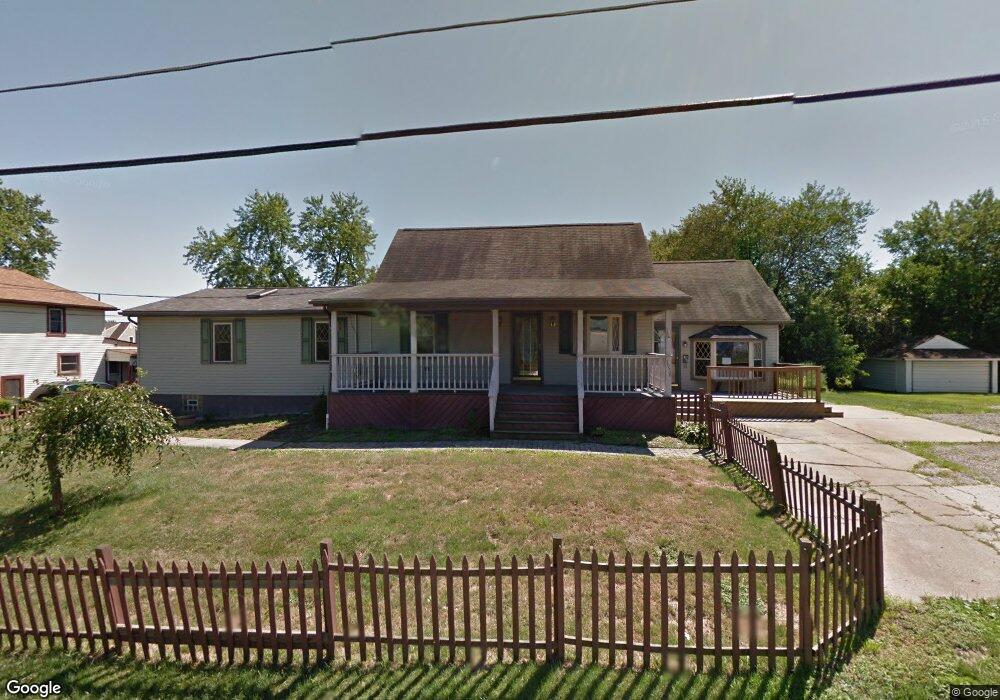
7958 3rd St Masury, OH 44438
Estimated Value: $106,000 - $131,000
4
Beds
2
Baths
2,256
Sq Ft
$55/Sq Ft
Est. Value
About This Home
This home is located at 7958 3rd St, Masury, OH 44438 and is currently estimated at $124,320, approximately $55 per square foot. 7958 3rd St is a home located in Trumbull County with nearby schools including Brookfield Elementary School, Brookfield Middle School, and Brookfield High School.
Ownership History
Date
Name
Owned For
Owner Type
Purchase Details
Closed on
Oct 6, 2021
Sold by
Heinselman Mercedes
Bought by
Martin Michael Mark
Current Estimated Value
Purchase Details
Closed on
Feb 7, 2018
Sold by
Estate Of Eric Heinselman
Bought by
Heinselman Mercedes
Purchase Details
Closed on
Oct 14, 2011
Sold by
Federal Home Loan Mortgage Corporation
Bought by
Heinselman Eric A
Purchase Details
Closed on
Jun 21, 2011
Sold by
Chaney Michael A and Chaney Faith A
Bought by
Federal Home Loan Mortgage Corporation
Purchase Details
Closed on
Jan 1, 1990
Bought by
Doris Mae Mortimer
Create a Home Valuation Report for This Property
The Home Valuation Report is an in-depth analysis detailing your home's value as well as a comparison with similar homes in the area
Home Values in the Area
Average Home Value in this Area
Purchase History
| Date | Buyer | Sale Price | Title Company |
|---|---|---|---|
| Martin Michael Mark | $35,000 | None Available | |
| Heinselman Mercedes | -- | None Available | |
| Heinselman Eric A | $45,000 | None Available | |
| Federal Home Loan Mortgage Corporation | $50,000 | None Available | |
| Doris Mae Mortimer | -- | -- |
Source: Public Records
Tax History Compared to Growth
Tax History
| Year | Tax Paid | Tax Assessment Tax Assessment Total Assessment is a certain percentage of the fair market value that is determined by local assessors to be the total taxable value of land and additions on the property. | Land | Improvement |
|---|---|---|---|---|
| 2024 | $1,488 | $31,540 | $1,890 | $29,650 |
| 2023 | $1,488 | $31,540 | $1,890 | $29,650 |
| 2022 | $1,206 | $20,720 | $1,890 | $18,830 |
| 2021 | $1,131 | $20,720 | $1,890 | $18,830 |
| 2020 | $1,125 | $20,720 | $1,890 | $18,830 |
| 2019 | $1,145 | $19,670 | $1,890 | $17,780 |
| 2018 | $1,135 | $19,670 | $1,890 | $17,780 |
| 2017 | $1,200 | $19,670 | $1,890 | $17,780 |
| 2016 | $1,264 | $21,110 | $1,890 | $19,220 |
| 2015 | $1,266 | $21,110 | $1,890 | $19,220 |
| 2014 | $1,383 | $21,110 | $1,890 | $19,220 |
| 2013 | $1,321 | $22,540 | $1,890 | $20,650 |
Source: Public Records
Map
Nearby Homes
- 1354 Stevenson Rd
- 7440 Stewart Sharon Rd
- 766 S Irvine Ave
- 928 Bedford Rd
- 545 & 625 Davis St
- 691 S Irvine Ave
- 609 Syme St
- 807 Lee Ave
- 306 Federal St
- 7182 Stewart Sharon Rd
- 506 Spearman Ave
- 1952 Hubbard Masury Rd
- 626 Fruit Ave
- 238 Malleable St
- 641 Fruit Ave
- 268 Malleable St
- 365 Brookfield Ave
- 1120 Wallis Ave
- 104 Fruit Ave
- 715 Hamilton Ave