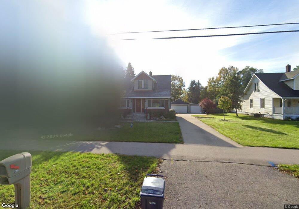
796 Paw Paw Dr Holland, MI 49423
Holland Heights NeighborhoodEstimated Value: $275,000 - $354,000
3
Beds
2
Baths
958
Sq Ft
$323/Sq Ft
Est. Value
About This Home
This home is located at 796 Paw Paw Dr, Holland, MI 49423 and is currently estimated at $309,193, approximately $322 per square foot. 796 Paw Paw Dr is a home located in Ottawa County with nearby schools including Holland Heights Elementary, Maplewood, and Holland High School.
Ownership History
Date
Name
Owned For
Owner Type
Purchase Details
Closed on
Aug 18, 2025
Sold by
Jones Keith A and Jones Amanda
Bought by
Jones Keith A and Jones Amanda
Current Estimated Value
Purchase Details
Closed on
Aug 20, 1998
Sold by
Union Federal Savings
Bought by
Jones Keith A
Purchase Details
Closed on
Sep 11, 1997
Sold by
Mosley Larry J
Bought by
Union Federal Bank]
Purchase Details
Closed on
Sep 27, 1993
Sold by
Mosley Larry J
Create a Home Valuation Report for This Property
The Home Valuation Report is an in-depth analysis detailing your home's value as well as a comparison with similar homes in the area
Home Values in the Area
Average Home Value in this Area
Purchase History
| Date | Buyer | Sale Price | Title Company |
|---|---|---|---|
| Jones Keith A | -- | None Listed On Document | |
| Jones Keith A | $72,600 | -- | |
| Union Federal Bank] | $77,000 | -- | |
| -- | -- | -- |
Source: Public Records
Tax History Compared to Growth
Tax History
| Year | Tax Paid | Tax Assessment Tax Assessment Total Assessment is a certain percentage of the fair market value that is determined by local assessors to be the total taxable value of land and additions on the property. | Land | Improvement |
|---|---|---|---|---|
| 2025 | $2,346 | $110,100 | $0 | $0 |
| 2024 | $2,346 | $101,900 | $0 | $0 |
| 2023 | $4,371 | $83,100 | $0 | $0 |
| 2022 | $2,084 | $80,800 | $0 | $0 |
| 2021 | $2,026 | $78,400 | $0 | $0 |
| 2020 | $2,022 | $69,700 | $0 | $0 |
| 2019 | $2,039 | $60,200 | $0 | $0 |
| 2018 | $1,919 | $53,300 | $0 | $0 |
| 2017 | $1,860 | $53,300 | $0 | $0 |
| 2016 | $1,860 | $53,200 | $0 | $0 |
| 2015 | $1,802 | $49,600 | $0 | $0 |
| 2014 | $1,802 | $47,200 | $0 | $0 |
Source: Public Records
Map
Nearby Homes
- 239 S Waverly Rd
- VL-0 120th Ave
- 499 E 8th St
- 1078 Lynden Rd
- 1101 Lynden Rd
- 403 Stratford Way
- VL 120th Ave
- 1214 Euna Vista Dr
- 160 Sorrento Dr
- 551 Century Ln
- 541 Century Ln
- 561 Century Ln
- 866 E 24th St Unit Parcel A
- 271 E 16th St
- 1391 Quarterline Commons
- 955 Kenwood Dr
- 442 120th Ave
- 451 Lincoln Ave
- 634 Wilshire Ct
- 333 E Lakewood Blvd Unit 209