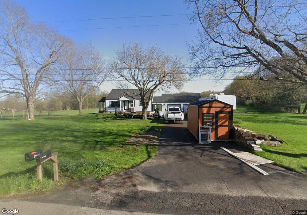
7963 E Liberty St Hubbard, OH 44425
Estimated Value: $202,000 - $313,531
3
Beds
1
Bath
1,080
Sq Ft
$246/Sq Ft
Est. Value
About This Home
This home is located at 7963 E Liberty St, Hubbard, OH 44425 and is currently estimated at $265,883, approximately $246 per square foot. 7963 E Liberty St is a home located in Trumbull County with nearby schools including Hubbard Elementary School, Hubbard Middle School, and Hubbard High School.
Ownership History
Date
Name
Owned For
Owner Type
Purchase Details
Closed on
Apr 1, 2024
Sold by
Bunce Thatcher and Barrett Morgan Mackenzie
Bought by
Bunce Thatcher and Barrett Morgan Mackenzie
Current Estimated Value
Home Financials for this Owner
Home Financials are based on the most recent Mortgage that was taken out on this home.
Original Mortgage
$266,000
Interest Rate
6.9%
Mortgage Type
New Conventional
Purchase Details
Closed on
Dec 20, 2023
Sold by
Patrick William and Easton Janet
Bought by
Easton Robert C and Easton Janet
Purchase Details
Closed on
Feb 23, 2012
Sold by
7963 East Liberty Street Llc
Bought by
Patrick Thomas J
Purchase Details
Closed on
Jun 19, 2008
Sold by
Dubyak Helen
Bought by
7963 East Liberty Street Llc
Purchase Details
Closed on
Jan 1, 1990
Bought by
Helen Dubyak
Create a Home Valuation Report for This Property
The Home Valuation Report is an in-depth analysis detailing your home's value as well as a comparison with similar homes in the area
Home Values in the Area
Average Home Value in this Area
Purchase History
| Date | Buyer | Sale Price | Title Company |
|---|---|---|---|
| Bunce Thatcher | -- | Title Professionals Group | |
| Bunce Thatcher | $280,000 | Title Professionals Group | |
| Easton Robert C | -- | None Listed On Document | |
| Patrick Thomas J | -- | None Available | |
| 7963 East Liberty Street Llc | -- | Erie Title Agency Inc | |
| Helen Dubyak | -- | -- |
Source: Public Records
Mortgage History
| Date | Status | Borrower | Loan Amount |
|---|---|---|---|
| Previous Owner | Bunce Thatcher | $266,000 |
Source: Public Records
Tax History
| Year | Tax Paid | Tax Assessment Tax Assessment Total Assessment is a certain percentage of the fair market value that is determined by local assessors to be the total taxable value of land and additions on the property. | Land | Improvement |
|---|---|---|---|---|
| 2024 | $2,643 | $45,610 | $13,370 | $32,240 |
| 2023 | $2,647 | $45,610 | $13,370 | $32,240 |
| 2022 | $1,728 | $35,700 | $12,460 | $23,240 |
| 2021 | $1,735 | $35,700 | $12,460 | $23,240 |
| 2020 | $1,742 | $35,700 | $12,460 | $23,240 |
| 2019 | $1,571 | $31,750 | $11,550 | $20,200 |
| 2018 | $1,524 | $31,750 | $11,550 | $20,200 |
| 2017 | $1,520 | $31,750 | $11,550 | $20,200 |
| 2016 | $1,473 | $32,130 | $11,550 | $20,580 |
| 2015 | $2,067 | $32,130 | $11,550 | $20,580 |
| 2014 | $2,028 | $32,130 | $11,550 | $20,580 |
| 2013 | $2,025 | $32,130 | $11,550 | $20,580 |
Source: Public Records
Map
Nearby Homes
- 2974 Schotten Rd
- 13 Oak Tree Ct
- 11 Clubhouse Dr
- 1145 Doris Dr
- 868 Saul Dr
- 1 Grandview Dr
- 784 Elmwood Dr
- 1952 Hubbard Masury Rd
- 764 Jones St
- 114 Oakdale Ave
- 27 Hnida Rd
- 132 Drummond Ave
- 228 Stewart St
- 327 W Park Ave
- 7647 Connelly Rd
- 7058 Pine Grove Dr
- 365 Scott St
- 3404 Hubbard-Middlesex Rd
- 940 Wheatland Rd
- 836 School St
- 7963 E East Liberty St
- 7985 E Liberty St
- 7911 E Liberty St
- 7903 E Liberty St
- 8018 E Liberty St
- 8025 E Liberty St
- 8036 E Liberty St
- 7908 E Liberty St
- 8048 E Liberty St
- 8055 E Liberty St
- 8064 E Liberty St
- 7834 E Liberty St
- 8092 E Liberty St
- 2730 S Fox North Rd
- 2750 S Fox Rd N
- 2770 S Fox North Rd
- 2601 S Fox North Rd
- 2750 S Fox North Rd
- 2660 S Fox North Rd
- 2692 S Fox North Rd
Your Personal Tour Guide
Ask me questions while you tour the home.