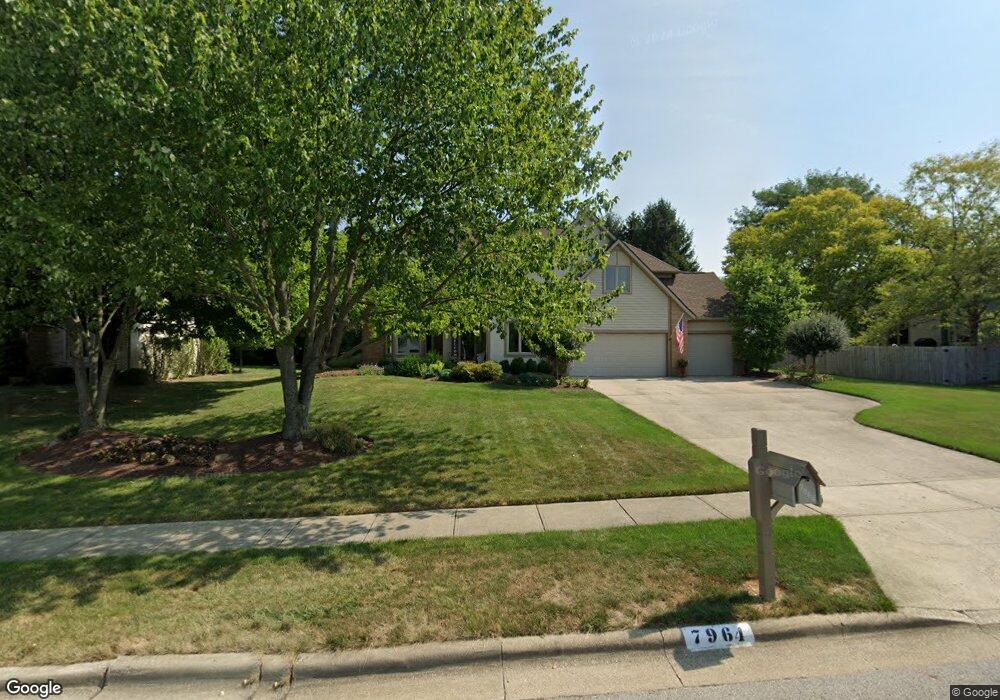
7964 Slate Ridge Blvd Reynoldsburg, OH 43068
Estimated Value: $449,000 - $501,000
4
Beds
3
Baths
3,069
Sq Ft
$153/Sq Ft
Est. Value
About This Home
This home is located at 7964 Slate Ridge Blvd, Reynoldsburg, OH 43068 and is currently estimated at $471,083, approximately $153 per square foot. 7964 Slate Ridge Blvd is a home located in Franklin County with nearby schools including Slate Ridge Elementary School, Hannah J Ashton Middle School, and Baldwin Road Junior High School.
Ownership History
Date
Name
Owned For
Owner Type
Purchase Details
Closed on
Jul 1, 2017
Sold by
Gulling Joseph V and Gulling Lori K
Bought by
Gulling Lori K and Gulling Joseph V
Current Estimated Value
Purchase Details
Closed on
Jan 17, 1996
Sold by
Donley Inc
Bought by
Gulling Joseph V and Gulling Lori K
Home Financials for this Owner
Home Financials are based on the most recent Mortgage that was taken out on this home.
Original Mortgage
$178,500
Outstanding Balance
$4,812
Interest Rate
7.28%
Mortgage Type
New Conventional
Estimated Equity
$466,271
Purchase Details
Closed on
Sep 29, 1995
Sold by
Slate Ridge Dev Co Ltd
Bought by
Donley Inc
Purchase Details
Closed on
May 11, 1994
Create a Home Valuation Report for This Property
The Home Valuation Report is an in-depth analysis detailing your home's value as well as a comparison with similar homes in the area
Home Values in the Area
Average Home Value in this Area
Purchase History
| Date | Buyer | Sale Price | Title Company |
|---|---|---|---|
| Gulling Lori K | -- | None Available | |
| Gulling Joseph V | $233,160 | -- | |
| Donley Inc | $151,000 | -- | |
| -- | -- | -- |
Source: Public Records
Mortgage History
| Date | Status | Borrower | Loan Amount |
|---|---|---|---|
| Open | Gulling Joseph V | $178,500 |
Source: Public Records
Tax History Compared to Growth
Tax History
| Year | Tax Paid | Tax Assessment Tax Assessment Total Assessment is a certain percentage of the fair market value that is determined by local assessors to be the total taxable value of land and additions on the property. | Land | Improvement |
|---|---|---|---|---|
| 2024 | $7,278 | $142,140 | $31,500 | $110,640 |
| 2023 | $6,945 | $142,135 | $31,500 | $110,635 |
| 2022 | $7,003 | $108,430 | $18,060 | $90,370 |
| 2021 | $7,031 | $108,430 | $18,060 | $90,370 |
| 2020 | $7,173 | $108,430 | $18,060 | $90,370 |
| 2019 | $6,598 | $90,410 | $15,050 | $75,360 |
| 2018 | $6,664 | $90,410 | $15,050 | $75,360 |
| 2017 | $6,597 | $90,410 | $15,050 | $75,360 |
| 2016 | $6,945 | $85,090 | $14,740 | $70,350 |
| 2015 | $6,729 | $85,090 | $14,740 | $70,350 |
| 2014 | $6,760 | $85,090 | $14,740 | $70,350 |
| 2013 | $3,289 | $85,085 | $14,735 | $70,350 |
Source: Public Records
Map
Nearby Homes
- 1890 Lockmere Ct
- 7933 Meadowlark Ln S Unit 7933
- 1849 Drugan Ct SW
- 7832 Country Brook Ln
- 7645 Redman Ln
- 1788 Leighton Dr
- 7607 Palmer Rd SW
- 7961 Oak Valley Rd
- 0 Oak Valley Rd Unit 5148458
- 0 Oak Valley Rd Unit Lot 4, 1.088 ac.
- 10039 Taylor Rd SW
- 1744 Graham Rd
- 1545 Alar Ave
- 214 Estates Ln
- 8210 Green Tree Ct
- 210 Estates Ln
- 258 Baron Ct
- 7682 E Main St
- 8055 Eliot Dr
- 53 Estates Ln
- 7954 Slate Ridge Blvd
- 1955 Sherring Ct
- 1949 Sherring Ct
- 1910 Crosswick Ct
- 1910 Crosswick Dr
- 1965 Farmsbury Dr
- 1941 Sherring Ct
- 1974 Farmsbury Dr
- 7935 Slate Ridge Blvd
- 1898 Crosswick Ct
- 1898 Crosswick Dr
- 1909 Crosswick Dr
- 1844 Crosswick Ct
- 1990 Farmsbury Dr
- 1971 Farmsbury Dr
- 1952 Sherring Ct
- 1952 Sherring Ct Unit 133
- 1832 Crosswick Ct
- 1942 Sherring Ct
- 1987 Haverton Dr