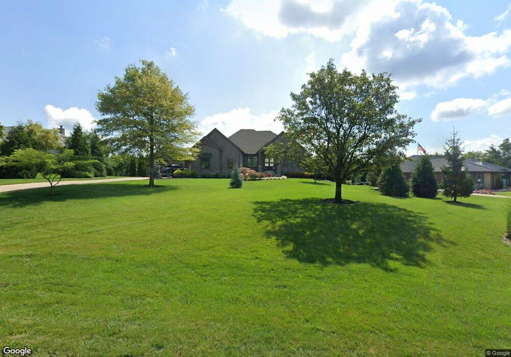
7966 Locust Grove Ct Springboro, OH 45066
Clearcreek Township NeighborhoodEstimated Value: $1,178,000 - $1,329,668
3
Beds
3
Baths
2,903
Sq Ft
$428/Sq Ft
Est. Value
About This Home
This home is located at 7966 Locust Grove Ct, Springboro, OH 45066 and is currently estimated at $1,242,167, approximately $427 per square foot. 7966 Locust Grove Ct is a home with nearby schools including Clearcreek Elementary School, Springboro Intermediate School, and Springboro Junior High School.
Ownership History
Date
Name
Owned For
Owner Type
Purchase Details
Closed on
Dec 11, 2015
Sold by
Gregory Michael and Gregory Kerry
Bought by
Becker Douglas R and Becker Krystyna B
Current Estimated Value
Purchase Details
Closed on
Jun 7, 2006
Sold by
Stoneridge Development Ltd
Bought by
Gregory Michael and Gregory Kerry
Home Financials for this Owner
Home Financials are based on the most recent Mortgage that was taken out on this home.
Original Mortgage
$67,920
Interest Rate
6.73%
Mortgage Type
Purchase Money Mortgage
Create a Home Valuation Report for This Property
The Home Valuation Report is an in-depth analysis detailing your home's value as well as a comparison with similar homes in the area
Home Values in the Area
Average Home Value in this Area
Purchase History
| Date | Buyer | Sale Price | Title Company |
|---|---|---|---|
| Becker Douglas R | $91,333 | Attorney | |
| Gregory Michael | $84,900 | Midwest Abstract |
Source: Public Records
Mortgage History
| Date | Status | Borrower | Loan Amount |
|---|---|---|---|
| Previous Owner | Gregory Michael | $67,920 |
Source: Public Records
Tax History Compared to Growth
Tax History
| Year | Tax Paid | Tax Assessment Tax Assessment Total Assessment is a certain percentage of the fair market value that is determined by local assessors to be the total taxable value of land and additions on the property. | Land | Improvement |
|---|---|---|---|---|
| 2024 | $16,039 | $393,110 | $55,530 | $337,580 |
| 2023 | $13,137 | $295,442 | $34,751 | $260,690 |
| 2022 | $12,850 | $295,442 | $34,752 | $260,691 |
| 2021 | $11,990 | $285,975 | $34,752 | $251,223 |
| 2020 | $11,752 | $242,347 | $29,449 | $212,898 |
| 2019 | $10,914 | $242,347 | $29,449 | $212,898 |
| 2018 | $10,882 | $242,347 | $29,449 | $212,898 |
| 2017 | $1,428 | $27,986 | $27,986 | $0 |
| 2016 | $1,484 | $27,986 | $27,986 | $0 |
| 2015 | $1,456 | $27,986 | $27,986 | $0 |
| 2014 | $1,542 | $27,990 | $27,990 | $0 |
| 2013 | $1,542 | $32,550 | $32,550 | $0 |
Source: Public Records
Map
Nearby Homes
- 710 White Cedar Way
- 0 White Cedar Way Unit 1818661
- 8234 Voltaire Ct
- 0 Voltaire Ct Unit 1863060
- 7510 Country Brook Ct
- 7491 Country Brook Ct
- 8670 Hawthorne Place
- 7940 Bunnell Hill Rd
- 639 Birchcreek Way
- 441 Ohio 73
- 441 E State Route 73
- 8817 Ridgewood Place
- 1744 Harlan Rd
- 7412 Larkspur Ct
- 9229 Bennington Way
- 9195 Glenridge Blvd
- 8301 Red Lion 5 Points Rd
- 1211 Normandy Rue
- 1241 Normandy Rue
- 9079 Bunnell Hill Rd
- 7972 Locust Grove Ct
- 7944 Locust Grove Ct
- 7980 Locust Grove Ct
- 7 Willow Oak Ct
- 7969 Locust Grove Ct
- 7961 Locust Grove Ct
- 7931 Country Brook Ct
- 7939 Country Brook Ct
- 7977 Locust Grove Ct
- 7945 Locust Grove Ct
- 7923 Country Brook Ct
- 7963 Country Brook Ct
- 764 Deer Bend Ct
- 7985 Locust Grove Ct
- Lot Locust Grove Ct
- 87B Locust Grove Ct
- LOT 87B Locust Grove Ct
- 7984 Locust Grove Ct
- 770 Deer Bend Ct
- 7937 Locust Grove Ct