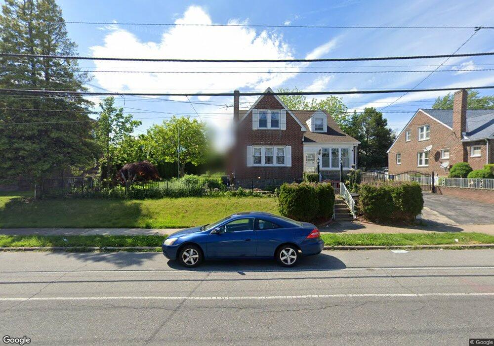
7966 Loretto Ave Philadelphia, PA 19111
Rhawnhurst NeighborhoodEstimated Value: $412,000 - $491,000
--
Bed
--
Bath
2,520
Sq Ft
$185/Sq Ft
Est. Value
About This Home
This home is located at 7966 Loretto Ave, Philadelphia, PA 19111 and is currently estimated at $466,910, approximately $185 per square foot. 7966 Loretto Ave is a home located in Philadelphia County with nearby schools including Rhawnhurst School, Castor Gardens Middle School, and Northeast High School.
Ownership History
Date
Name
Owned For
Owner Type
Purchase Details
Closed on
Sep 26, 2021
Sold by
Laov Met and Estate Of Ouk Laov
Bought by
Laov Mei
Current Estimated Value
Purchase Details
Closed on
Dec 16, 2005
Sold by
Cougle Lillian E
Bought by
Laov Ouk and Laov Mei
Home Financials for this Owner
Home Financials are based on the most recent Mortgage that was taken out on this home.
Original Mortgage
$209,300
Interest Rate
6.36%
Mortgage Type
Fannie Mae Freddie Mac
Create a Home Valuation Report for This Property
The Home Valuation Report is an in-depth analysis detailing your home's value as well as a comparison with similar homes in the area
Home Values in the Area
Average Home Value in this Area
Purchase History
| Date | Buyer | Sale Price | Title Company |
|---|---|---|---|
| Laov Mei | -- | None Available | |
| Laov Ouk | $299,000 | Lawyers Title Insurance Co |
Source: Public Records
Mortgage History
| Date | Status | Borrower | Loan Amount |
|---|---|---|---|
| Closed | Laov Ouk | $209,300 |
Source: Public Records
Tax History Compared to Growth
Tax History
| Year | Tax Paid | Tax Assessment Tax Assessment Total Assessment is a certain percentage of the fair market value that is determined by local assessors to be the total taxable value of land and additions on the property. | Land | Improvement |
|---|---|---|---|---|
| 2025 | -- | $445,000 | $89,000 | $356,000 |
| 2024 | $4,758 | $445,000 | $89,000 | $356,000 |
| 2023 | $4,758 | $339,900 | $67,980 | $271,920 |
| 2022 | $4,758 | $339,900 | $67,980 | $271,920 |
| 2021 | $3,802 | $0 | $0 | $0 |
| 2020 | $3,802 | $271,600 | $51,061 | $220,539 |
| 2019 | $3,421 | $0 | $0 | $0 |
| 2018 | $3,421 | $0 | $0 | $0 |
| 2017 | $3,421 | $0 | $0 | $0 |
| 2016 | $3,421 | $0 | $0 | $0 |
| 2015 | $3,275 | $0 | $0 | $0 |
| 2014 | -- | $244,400 | $166,421 | $77,979 |
| 2012 | -- | $31,904 | $7,529 | $24,375 |
Source: Public Records
Map
Nearby Homes
- 1931 33 Rhawn St
- 7912 14 Loretto Ave
- 1718 Rhawn St
- 2013 Fuller St
- 1719 Loney St
- 2029 Loney St
- 1704 Stanwood St
- 1702 Arthur St
- 1625 Rhawn St
- 1620 Loney St
- 7735 Loretto Ave
- 1826 Hartel Ave
- 2123 Loney St
- 1920 Hartel Ave
- 7830 Summerdale Ave
- 1919 Lansing St
- 2023 Hartel Ave
- 1834 Lansing St
- 7950 Algon Ave
- 1617 Solly Ave
- 7970 Loretto Ave
- 7960 Loretto Ave
- 7956 Loretto Ave
- 1839 Ripley St
- 7974 Loretto Ave
- 1837 Ripley St
- 1835 Ripley St
- 1834 Rhawn St
- 7939 Loretto Ave
- 7953 Loretto Ave
- 7955 Loretto Ave
- 1832 Rhawn St
- 1833 Ripley St
- 7957 Loretto Ave
- 7950 Loretto Ave
- 1830 Rhawn St
- 1826 Rhawn St
- 1901 Rhawn St Unit 3
- 1831 Ripley St
- 1840 Ripley St