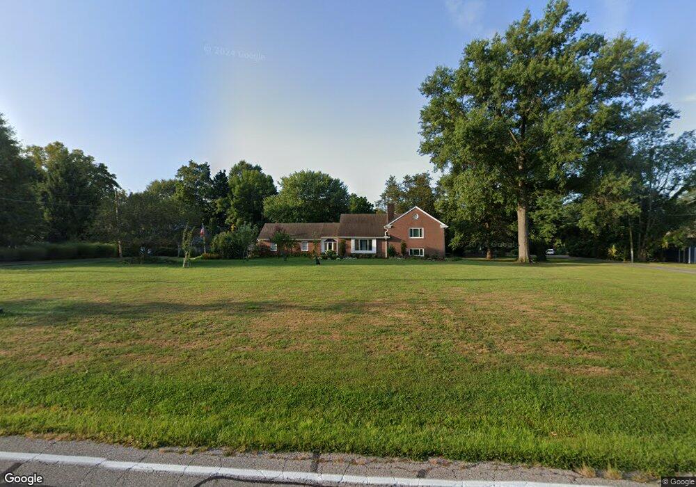
7969 Woodruff Rd Cincinnati, OH 45255
Estimated Value: $390,000 - $449,000
3
Beds
2
Baths
2,858
Sq Ft
$146/Sq Ft
Est. Value
About This Home
This home is located at 7969 Woodruff Rd, Cincinnati, OH 45255 and is currently estimated at $418,234, approximately $146 per square foot. 7969 Woodruff Rd is a home located in Hamilton County with nearby schools including Ayer Elementary School, Nagel Middle School, and Anderson High School.
Ownership History
Date
Name
Owned For
Owner Type
Purchase Details
Closed on
Aug 13, 2007
Sold by
Hunter Shawn and Hunter Tisha
Bought by
Dwolf James F and Dwolf Colette M
Current Estimated Value
Home Financials for this Owner
Home Financials are based on the most recent Mortgage that was taken out on this home.
Original Mortgage
$206,610
Outstanding Balance
$129,259
Interest Rate
6.79%
Mortgage Type
Second Mortgage Made To Cover Down Payment
Estimated Equity
$288,975
Purchase Details
Closed on
Jan 24, 2003
Sold by
Conner Sally Anne and Baumgardner Jane Lynn
Bought by
Hunter Shawn and Hunter Tisha
Purchase Details
Closed on
Mar 27, 1997
Sold by
Conner Sally Ann
Bought by
Conner Sally Ann and Conner Curtis W
Purchase Details
Closed on
Jan 16, 1997
Sold by
Elston Anne O
Bought by
Elston Anne O and Elston Lawrence M
Create a Home Valuation Report for This Property
The Home Valuation Report is an in-depth analysis detailing your home's value as well as a comparison with similar homes in the area
Home Values in the Area
Average Home Value in this Area
Purchase History
| Date | Buyer | Sale Price | Title Company |
|---|---|---|---|
| Dwolf James F | $213,000 | Lawyers Title Of Cincinnati | |
| Hunter Shawn | $186,000 | -- | |
| Conner Sally Ann | -- | -- | |
| Elston Anne O | -- | -- |
Source: Public Records
Mortgage History
| Date | Status | Borrower | Loan Amount |
|---|---|---|---|
| Open | Dwolf James F | $206,610 |
Source: Public Records
Tax History
| Year | Tax Paid | Tax Assessment Tax Assessment Total Assessment is a certain percentage of the fair market value that is determined by local assessors to be the total taxable value of land and additions on the property. | Land | Improvement |
|---|---|---|---|---|
| 2025 | $7,268 | $116,232 | $30,758 | $85,474 |
| 2024 | $7,064 | $116,232 | $30,758 | $85,474 |
| 2023 | $6,719 | $116,232 | $30,758 | $85,474 |
| 2022 | $5,206 | $80,157 | $21,721 | $58,436 |
| 2021 | $5,083 | $80,157 | $21,721 | $58,436 |
| 2020 | $5,142 | $80,157 | $21,721 | $58,436 |
| 2019 | $5,011 | $70,935 | $19,222 | $51,713 |
| 2018 | $4,695 | $70,935 | $19,222 | $51,713 |
| 2017 | $4,428 | $70,935 | $19,222 | $51,713 |
| 2016 | $4,159 | $65,079 | $19,607 | $45,472 |
| 2015 | $4,039 | $65,079 | $19,607 | $45,472 |
| 2014 | $4,042 | $65,079 | $19,607 | $45,472 |
| 2013 | $3,747 | $63,802 | $19,222 | $44,580 |
Source: Public Records
Map
Nearby Homes
- 7988 Woodruff Rd
- 8016 Hignite Ct
- 7978 Nagel Village Dr
- 881 Asbury Rd
- 684 Balbriggan Ct
- 559 Asbury Rd
- 792 Farmsworth Ct
- 849 Shawnee Trace Ct
- 7754 Forest Rd
- 1125 Wittshire Ln Unit 130
- 854 Woodlyn Dr S
- 906 Woodlyn Dr N Unit 4
- 8303 Tidewater Ct
- 965 Woodlyn Dr N
- 807 Nordyke Rd
- 136 Coldstream Villa Dr
- 1357 Oak Ct
- 8512 Prilla Ln
- 1363 Oak Ct
- 8345 Cherry Ln
- 7975 Woodruff Rd
- 7967 Woodruff Rd
- 8009 Woodruff Rd
- 8009 Woodruff Rd Unit 1
- 8009 Woodruff Rd Unit 2
- 7991 Woodruff Rd
- 7960 Woodruff Rd
- 7970 Woodruff Rd
- 7950 Woodruff Rd
- 7939 Woodruff Rd
- 7993 Woodruff Rd
- 8099 Woodruff Rd
- 7944 Woodruff Rd
- 7929 Woodruff Rd
- 759 Ackley Rd
- 760 Kipp Dr
- 7920 Woodruff Rd
- 761 Kipp Dr
- 8015 Woodruff Rd
- 8011 Woodruff Rd
Your Personal Tour Guide
Ask me questions while you tour the home.