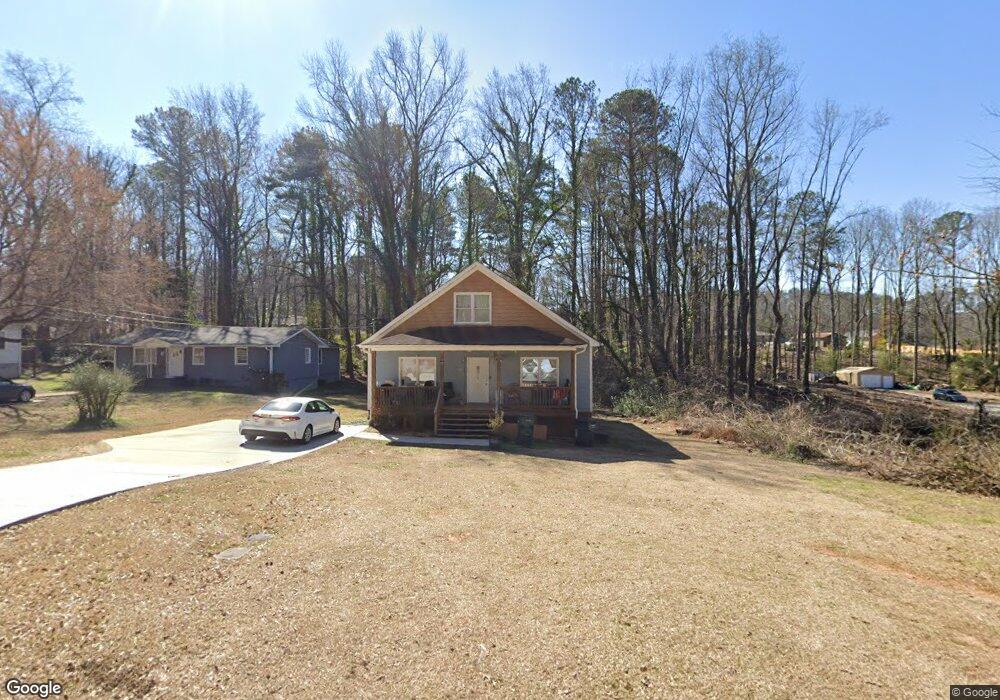
797 Britt Rd Austell, GA 30168
Estimated Value: $200,000 - $313,000
3
Beds
3
Baths
1,714
Sq Ft
$159/Sq Ft
Est. Value
About This Home
This home is located at 797 Britt Rd, Austell, GA 30168 and is currently estimated at $272,333, approximately $158 per square foot. 797 Britt Rd is a home with nearby schools including Bryant Elementary School, Lindley Middle School, and Pebblebrook High School.
Ownership History
Date
Name
Owned For
Owner Type
Purchase Details
Closed on
Jun 6, 2017
Sold by
Ashley
Bought by
Bank Of America
Current Estimated Value
Purchase Details
Closed on
Sep 6, 2016
Sold by
Ashley
Bought by
Laurmark Investments Llc
Purchase Details
Closed on
Jul 7, 2015
Sold by
Sec Of Housing & U
Bought by
Mtg Electronic Registration Sy and O Carl Mcrae Exec C
Create a Home Valuation Report for This Property
The Home Valuation Report is an in-depth analysis detailing your home's value as well as a comparison with similar homes in the area
Home Values in the Area
Average Home Value in this Area
Purchase History
| Date | Buyer | Sale Price | Title Company |
|---|---|---|---|
| Bank Of America | $45,600 | -- | |
| Laurmark Investments Llc | $27,000 | -- | |
| Mtg Electronic Registration Sy | -- | -- |
Source: Public Records
Tax History
| Year | Tax Paid | Tax Assessment Tax Assessment Total Assessment is a certain percentage of the fair market value that is determined by local assessors to be the total taxable value of land and additions on the property. | Land | Improvement |
|---|---|---|---|---|
| 2025 | $2,982 | $98,964 | $31,132 | $67,832 |
| 2024 | $2,984 | $98,964 | $31,132 | $67,832 |
| 2023 | $2,984 | $98,964 | $31,132 | $67,832 |
Source: Public Records
Map
Nearby Homes
- 760 W Starling Dr SW
- 739 Gardner St
- 846 Orris Ln SW
- 6355 Sweetbriar Dr SW
- 6281 Denny Ln SW
- 6276 Vera Ln SW
- 6266 Britt Rd SW
- 687 Alburgh Aly
- 373 Waterbluff Dr SW
- 00 Pisgah Rd
- 368 Waterbluff Dr SW
- 985 Timber Trail
- 365 Waterbluff Dr SW
- 364 Waterbluff Dr SW
- 496 Elizabeth Ln SW
- 760 Wade Farm Dr
- 1202 Pisgah Rd SW
- 420 Nash Cir SW
- 6365 Susan Dr SW
- Harbor Plan at Mableton Station
- 795 Britt Rd SW
- 791 Britt Rd SW
- 0 Britt Rd Unit 3154077
- 0 Britt Rd Unit 20011772
- 890 Britt Rd SW
- 799 Britt Rd SW
- 6435 Jane Dr SW Unit 3
- 0 Gardner Ct Unit Lot 6 8979157
- 6540 Gardner Ct
- 6520 Gardner Ct Unit 5
- 6520 Gardner Ct
- 6425 Jane Dr SW
- 761 Britt Rd SW
- 782 Britt Rd SW
- 800 Gardner St
- 6411 Jane Dr SW
- 816 Gardner St
- 6444 Jane Dr SW
- 790 Gardner St
- 6434 Jane Dr SW
Your Personal Tour Guide
Ask me questions while you tour the home.