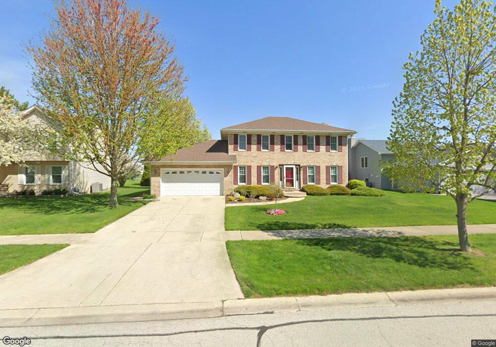
797 Butternut Dr North Aurora, IL 60542
Estimated Value: $379,153 - $456,000
3
Beds
--
Bath
2,154
Sq Ft
$194/Sq Ft
Est. Value
About This Home
This home is located at 797 Butternut Dr, North Aurora, IL 60542 and is currently estimated at $417,538, approximately $193 per square foot. 797 Butternut Dr is a home located in Kane County with nearby schools including Goodwin Elementary School, Jewel Middle School, and West Aurora High School.
Ownership History
Date
Name
Owned For
Owner Type
Purchase Details
Closed on
Apr 1, 2005
Sold by
Voss Don L and Voss Cassandra
Bought by
Parke Edward J and Sisco Monica A
Current Estimated Value
Home Financials for this Owner
Home Financials are based on the most recent Mortgage that was taken out on this home.
Original Mortgage
$162,000
Outstanding Balance
$82,125
Interest Rate
5.71%
Mortgage Type
Purchase Money Mortgage
Estimated Equity
$335,413
Create a Home Valuation Report for This Property
The Home Valuation Report is an in-depth analysis detailing your home's value as well as a comparison with similar homes in the area
Home Values in the Area
Average Home Value in this Area
Purchase History
| Date | Buyer | Sale Price | Title Company |
|---|---|---|---|
| Parke Edward J | $265,500 | Multiple |
Source: Public Records
Mortgage History
| Date | Status | Borrower | Loan Amount |
|---|---|---|---|
| Open | Parke Edward J | $162,000 | |
| Closed | Parke Edward J | $34,675 |
Source: Public Records
Tax History
| Year | Tax Paid | Tax Assessment Tax Assessment Total Assessment is a certain percentage of the fair market value that is determined by local assessors to be the total taxable value of land and additions on the property. | Land | Improvement |
|---|---|---|---|---|
| 2024 | $7,204 | $112,341 | $15,287 | $97,054 |
| 2023 | $6,957 | $101,962 | $13,875 | $88,087 |
| 2022 | $6,920 | $95,163 | $12,839 | $82,324 |
| 2021 | $6,703 | $90,254 | $12,177 | $78,077 |
| 2020 | $6,671 | $88,119 | $11,943 | $76,176 |
| 2019 | $6,727 | $84,999 | $11,520 | $73,479 |
| 2018 | $6,651 | $81,761 | $11,081 | $70,680 |
| 2017 | $6,587 | $79,065 | $10,716 | $68,349 |
| 2016 | $6,557 | $76,762 | $10,404 | $66,358 |
| 2015 | -- | $75,014 | $10,167 | $64,847 |
| 2014 | -- | $72,653 | $9,847 | $62,806 |
| 2013 | -- | $74,807 | $13,226 | $61,581 |
Source: Public Records
Map
Nearby Homes
- 406 Juniper Dr
- 413 N Sycamore Ln
- 523 Mallard Point Dr Unit 1
- 357 Pheasant Hill Dr
- 448 Prairie Ridge Ln
- 444 Prairie Ridge Ln
- 459 Prairie Ridge Ln
- 537 Moose Lake Ave
- 509 Moorfield Ave
- 344 Timber Oaks Dr
- 451 Pheasant Hill Dr
- 346 Timber Oaks Dr
- 516 E Victoria Cir Unit 162
- 310 Oak St
- 81 Parkside Ct Unit 2
- 307 Hill Ave
- 10 N Adams St
- 208 W State St
- 28 S Willow Way
- 1504 Hearthstone Ln
- 799 Butternut Dr
- 795 Butternut Dr
- 304 Juniper Dr
- 801 Butternut Dr
- 792 Butternut Dr
- 794 Butternut Dr
- 803 Butternut Dr
- 796 Butternut Dr
- 208 Juniper Dr Unit 2
- 798 Butternut Dr
- 805 Butternut Dr
- 305 Juniper Dr
- 303 Juniper Dr
- 793 Cottonwood Dr
- 795 Cottonwood Dr
- 800 Butternut Dr
- 307 Juniper Dr
- 797 Cottonwood Dr
- 309 Juniper Dr
- 209 Juniper Dr
Your Personal Tour Guide
Ask me questions while you tour the home.