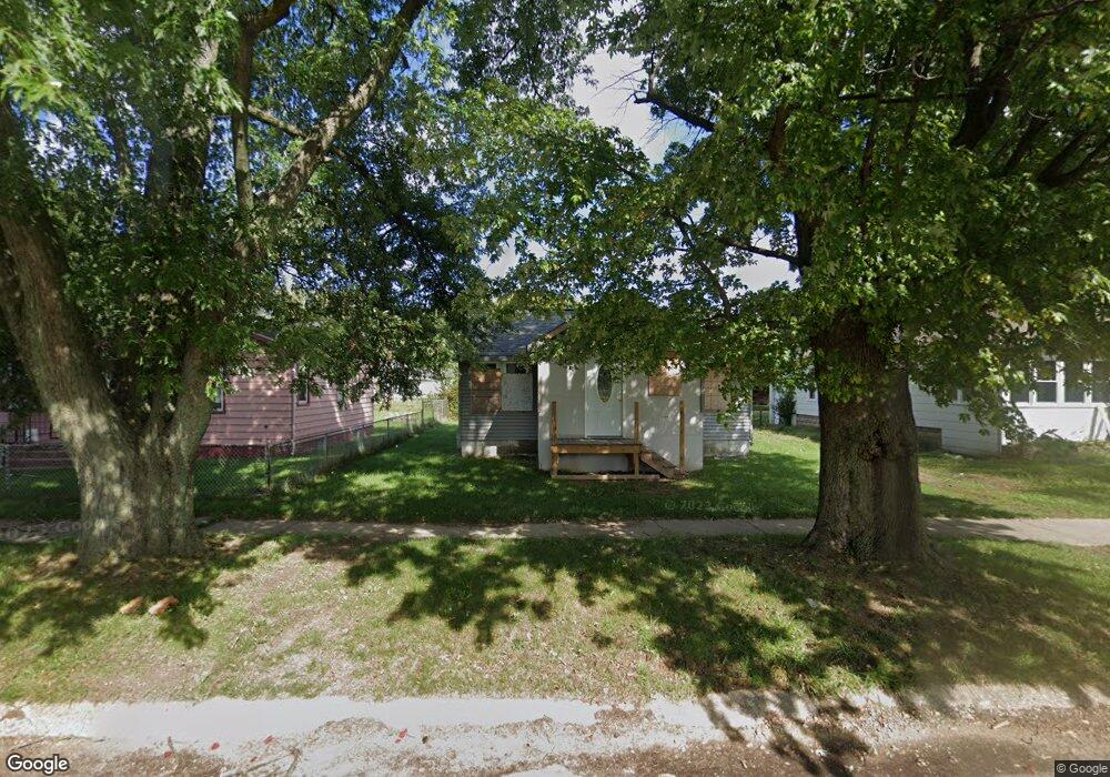
797 Mcguigan Ave Benton Harbor, MI 49022
Estimated Value: $61,000 - $104,000
2
Beds
1
Bath
665
Sq Ft
$114/Sq Ft
Est. Value
About This Home
This home is located at 797 Mcguigan Ave, Benton Harbor, MI 49022 and is currently estimated at $75,953, approximately $114 per square foot. 797 Mcguigan Ave is a home located in Berrien County with nearby schools including Fair Plain Middle School, Benton Harbor High School, and Benton Harbor Charter School Academy.
Ownership History
Date
Name
Owned For
Owner Type
Purchase Details
Closed on
Feb 24, 2014
Sold by
Egewater Bank
Bought by
Taylor J C
Current Estimated Value
Purchase Details
Closed on
Mar 6, 2013
Sold by
Grace Property Investments Llc
Bought by
Edgewater Bank
Purchase Details
Closed on
Nov 1, 2005
Sold by
Edgewater Bank
Bought by
Grace Property Investments Llc
Purchase Details
Closed on
Dec 9, 2004
Sold by
Brown Willie and Brown Francis M
Bought by
Lasalle Fsb
Purchase Details
Closed on
Apr 18, 1996
Create a Home Valuation Report for This Property
The Home Valuation Report is an in-depth analysis detailing your home's value as well as a comparison with similar homes in the area
Home Values in the Area
Average Home Value in this Area
Purchase History
| Date | Buyer | Sale Price | Title Company |
|---|---|---|---|
| Taylor J C | $200 | None Available | |
| Edgewater Bank | -- | None Available | |
| Grace Property Investments Llc | $1,500 | -- | |
| Lasalle Fsb | $7,166 | -- | |
| -- | $100 | -- |
Source: Public Records
Tax History Compared to Growth
Tax History
| Year | Tax Paid | Tax Assessment Tax Assessment Total Assessment is a certain percentage of the fair market value that is determined by local assessors to be the total taxable value of land and additions on the property. | Land | Improvement |
|---|---|---|---|---|
| 2025 | $499 | $27,400 | $0 | $0 |
| 2024 | $480 | $23,700 | $0 | $0 |
| 2023 | $384 | $16,200 | $0 | $0 |
| 2022 | $436 | $11,700 | $0 | $0 |
| 2021 | $439 | $11,500 | $700 | $10,800 |
| 2020 | $433 | $11,500 | $0 | $0 |
| 2019 | $426 | $10,000 | $0 | $0 |
| 2018 | $415 | $10,500 | $0 | $0 |
| 2017 | $407 | $6,500 | $0 | $0 |
| 2016 | $400 | $6,600 | $0 | $0 |
| 2015 | $400 | $6,400 | $0 | $0 |
| 2014 | $427 | $7,700 | $0 | $0 |
Source: Public Records
Map
Nearby Homes
- 419 Packard St
- 710 Buss Ave
- 806 Pitkins Ave
- 696 Highland Ave
- 992 Highland Ave
- 137 Cornelia St
- 688 S Fair Ave
- 238 Pine St
- 416 E Britain Ave
- 1069 E Main St
- 391 Pipestone St
- 6525 Territorial Rd
- 378 Pipestone St
- 363 Brunson Ave
- 234 Walnut St
- 309 High St
- 730 Superior St
- 0 V/L E Empire Ave
- 1226 Chicago Ave
- 255 High St
- 785 Mcguigan Ave
- 805 Mcguigan Ave
- 811 Mcguigan Ave
- 781 Mcguigan Ave
- 794 E Vineyard Ave
- 773 Mcguigan Ave
- 798 E Vineyard Ave
- 802 E Vineyard Ave
- 814 E Vineyard Ave
- 765 Mcguigan Ave
- 780 E Vineyard Ave
- 818 E Vineyard Ave
- 772 E Vineyard Ave
- 757 Mcguigan Ave
- 830 E Vineyard Ave
- 795 E Vineyard Ave
- 803 E Vineyard Ave
- 787 E Vineyard Ave
- 754 E Vineyard Ave
- 828 Mcguigan Ave