Estimated Value: $370,098 - $667,000
Studio
--
Bath
1,528
Sq Ft
$356/Sq Ft
Est. Value
About This Home
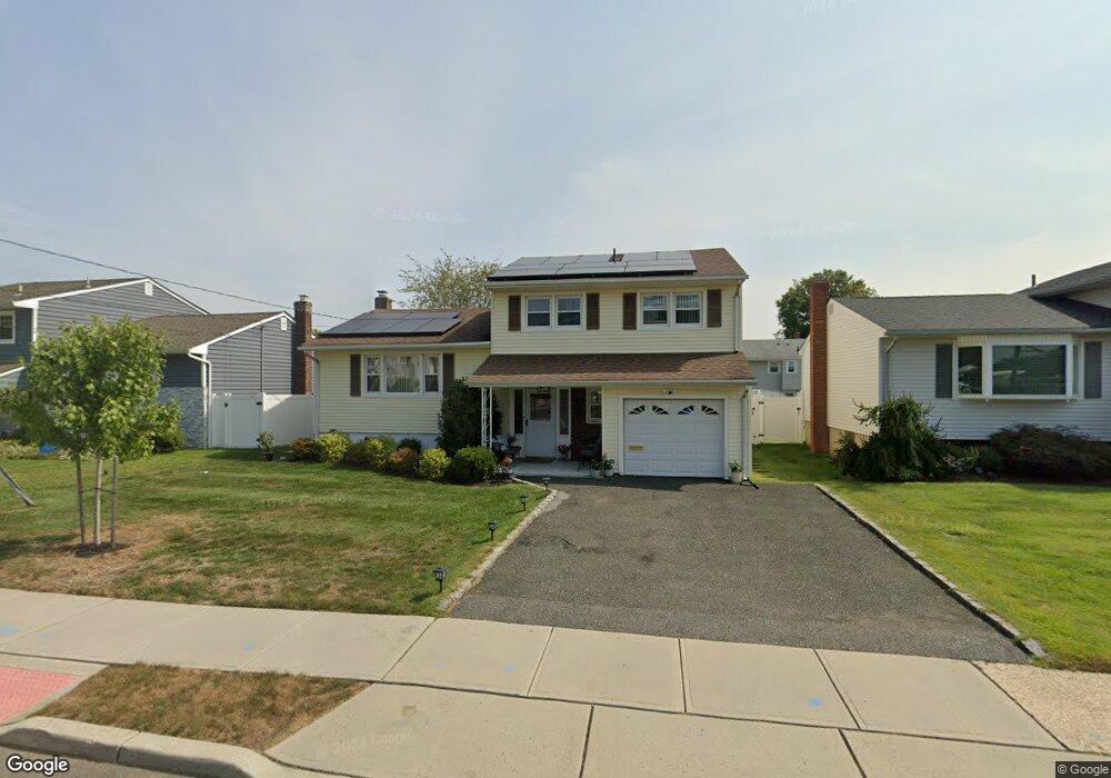
This home is located at 797 Mitchell Ave, Union, NJ 07083 and is currently estimated at $544,275, approximately $356 per square foot. 797 Mitchell Ave is a home located in Union County with nearby schools including Battle Hill Elementary School, Burnet Middle School, and Union High School.
Ownership History
Date
Name
Owned For
Owner Type
Purchase Details
Closed on
Jul 20, 2022
Sold by
Lawson Sandra F
Bought by
Mendoza Juan Carlos
Current Estimated Value
Home Financials for this Owner
Home Financials are based on the most recent Mortgage that was taken out on this home.
Original Mortgage
$323,000
Outstanding Balance
$309,127
Interest Rate
5.81%
Mortgage Type
New Conventional
Estimated Equity
$235,148
Purchase Details
Closed on
Jul 7, 2016
Sold by
Davis Bernice
Bought by
Lawson Sandra - Schlemovitz, Rina
Create a Home Valuation Report for This Property
The Home Valuation Report is an in-depth analysis detailing your home's value as well as a comparison with similar homes in the area
Home Values in the Area
Average Home Value in this Area
Purchase History
| Date | Buyer | Sale Price | Title Company |
|---|---|---|---|
| Mendoza Juan Carlos | $340,000 | Shapiro Jeffrey L | |
| Lawson Sandra - Schlemovitz, Rina | -- | -- |
Source: Public Records
Mortgage History
| Date | Status | Borrower | Loan Amount |
|---|---|---|---|
| Open | Mendoza Juan Carlos | $323,000 |
Source: Public Records
Tax History
| Year | Tax Paid | Tax Assessment Tax Assessment Total Assessment is a certain percentage of the fair market value that is determined by local assessors to be the total taxable value of land and additions on the property. | Land | Improvement |
|---|---|---|---|---|
| 2025 | $11,131 | $49,800 | $20,400 | $29,400 |
| 2024 | $10,791 | $49,800 | $20,400 | $29,400 |
| 2023 | $10,791 | $49,800 | $20,400 | $29,400 |
| 2022 | $10,416 | $49,800 | $20,400 | $29,400 |
| 2021 | $10,164 | $49,800 | $20,400 | $29,400 |
| 2020 | $9,961 | $49,800 | $20,400 | $29,400 |
| 2019 | $9,827 | $49,800 | $20,400 | $29,400 |
| 2018 | $9,660 | $49,800 | $20,400 | $29,400 |
| 2017 | $9,517 | $49,800 | $20,400 | $29,400 |
| 2016 | $9,285 | $49,800 | $20,400 | $29,400 |
| 2015 | $8,881 | $49,800 | $20,400 | $29,400 |
| 2014 | $8,676 | $49,800 | $20,400 | $29,400 |
Source: Public Records
Map
Nearby Homes
- 2670 Bancroft Ave
- 2469 Macarthur Dr
- 787 Liberty Ave
- 2442 Terrill Rd
- 2705 Andrea Rd
- 933 Douglas Terrace
- 735 Garden St
- 960 Moessner Ave
- 750 Andover Rd
- 909 Garden St
- 798 Pinewood Rd
- 6 Bashford Ave Unit 6
- 1065 Liberty Ave
- 5 Bashford Ave Unit 5
- 14 Bashford Ave Unit 14
- 2785 Larchmont Rd
- 1042 Battle Hill Terrace
- 105 Battle Hill Ave
- 148 Locust Dr
- 67 Battle Hill Ave
- 801 Mitchell Ave
- 793 Mitchell Ave
- 798 Maxwell St
- 805 Mitchell Ave
- 804 Maxwell St
- 789 Mitchell Ave
- 794 Maxwell St
- 808 Maxwell St
- 790 Maxwell St
- 2625 Killian Place
- 809 Mitchell Ave
- 785 Mitchell Ave
- 812 Maxwell St
- 786 Maxwell St
- 2631 Killian Place
- 815 Mitchell Ave
- 810 Mitchell Ave
- 2508 Jay Place
- 816 Maxwell St
- 2635 Killian Place
Your Personal Tour Guide
Ask me questions while you tour the home.