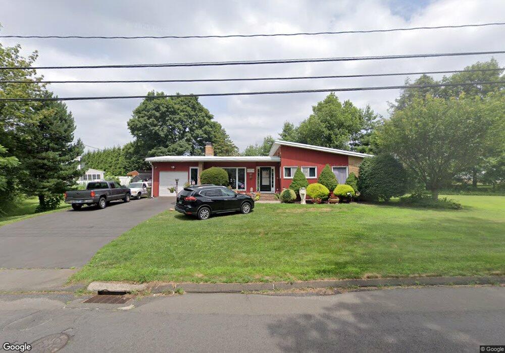
797 N Farms Rd Wallingford, CT 06492
Estimated Value: $447,000 - $484,000
1
Bed
2
Baths
1,664
Sq Ft
$279/Sq Ft
Est. Value
About This Home
This home is located at 797 N Farms Rd, Wallingford, CT 06492 and is currently estimated at $464,858, approximately $279 per square foot. 797 N Farms Rd is a home located in New Haven County with nearby schools including Moses Y Beach Elementary School, Rock Hill Elementary School, and Dag Hammarskjold Middle School.
Ownership History
Date
Name
Owned For
Owner Type
Purchase Details
Closed on
Aug 18, 2011
Sold by
Paluconis Helen Est
Bought by
Fox Paul and Nicolai Lauren J
Current Estimated Value
Home Financials for this Owner
Home Financials are based on the most recent Mortgage that was taken out on this home.
Original Mortgage
$165,690
Interest Rate
4.62%
Mortgage Type
Purchase Money Mortgage
Create a Home Valuation Report for This Property
The Home Valuation Report is an in-depth analysis detailing your home's value as well as a comparison with similar homes in the area
Home Values in the Area
Average Home Value in this Area
Purchase History
| Date | Buyer | Sale Price | Title Company |
|---|---|---|---|
| Fox Paul | $170,000 | -- | |
| Fox Paul | $170,000 | -- |
Source: Public Records
Mortgage History
| Date | Status | Borrower | Loan Amount |
|---|---|---|---|
| Open | Fox Paul | $167,500 | |
| Closed | Fox Paul | $165,690 |
Source: Public Records
Tax History Compared to Growth
Tax History
| Year | Tax Paid | Tax Assessment Tax Assessment Total Assessment is a certain percentage of the fair market value that is determined by local assessors to be the total taxable value of land and additions on the property. | Land | Improvement |
|---|---|---|---|---|
| 2025 | $7,275 | $301,600 | $115,500 | $186,100 |
| 2024 | $6,497 | $211,900 | $96,300 | $115,600 |
| 2023 | $6,217 | $211,900 | $96,300 | $115,600 |
| 2022 | $6,154 | $211,900 | $96,300 | $115,600 |
| 2021 | $7,296 | $211,900 | $96,300 | $115,600 |
| 2020 | $5,587 | $191,400 | $95,400 | $96,000 |
| 2019 | $6,179 | $191,400 | $95,400 | $96,000 |
| 2018 | $5,482 | $191,400 | $95,400 | $96,000 |
| 2017 | $5,464 | $191,400 | $95,400 | $96,000 |
| 2016 | $5,338 | $191,400 | $95,400 | $96,000 |
| 2015 | $5,134 | $186,900 | $95,400 | $91,500 |
| 2014 | $5,026 | $186,900 | $95,400 | $91,500 |
Source: Public Records
Map
Nearby Homes
- 5 Stegos Dr
- 37 Laurelwood Dr
- 4 Sunset Dr
- 1 Pine Glen Terrace
- 670 Williams Rd
- 940 Durham Rd
- 96 Rockledge Dr
- 28 Morgan Dr
- 147 Pinehurst Dr
- 380 Main St Unit 3
- 380 Main St Unit 7
- 380 Main St Unit 4
- 380 Main St Unit 16
- 380 Main St Unit 13
- 380 Main St Unit 14
- 400 Williams Rd
- 1323 Barnes Rd
- 49 High St
- 31 Carriage Dr
- 350 Williams Rd