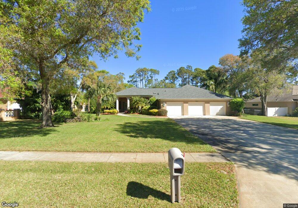
797 Pheasant Run Ct Port Orange, FL 32127
Port Orange West NeighborhoodEstimated Value: $879,000 - $1,152,996
3
Beds
5
Baths
4,645
Sq Ft
$219/Sq Ft
Est. Value
About This Home
This home is located at 797 Pheasant Run Ct, Port Orange, FL 32127 and is currently estimated at $1,015,499, approximately $218 per square foot. 797 Pheasant Run Ct is a home located in Volusia County with nearby schools including Spruce Creek Elementary School, Creekside Middle School, and Spruce Creek High School.
Ownership History
Date
Name
Owned For
Owner Type
Purchase Details
Closed on
Apr 21, 2025
Sold by
Gray Christopher and Gray Christine
Bought by
Christopher A Gray And Christine S Gray Joint and Gray
Current Estimated Value
Purchase Details
Closed on
Mar 29, 2021
Sold by
Dunham Bruce Wayne and Dunham Barbara
Bought by
Dunham Bruce Wayne and Dunham Barbara
Create a Home Valuation Report for This Property
The Home Valuation Report is an in-depth analysis detailing your home's value as well as a comparison with similar homes in the area
Home Values in the Area
Average Home Value in this Area
Purchase History
| Date | Buyer | Sale Price | Title Company |
|---|---|---|---|
| Christopher A Gray And Christine S Gray Joint | $100 | None Listed On Document | |
| Christopher A Gray And Christine S Gray Joint | $100 | None Listed On Document | |
| Dunham Bruce Wayne | -- | Attorney |
Source: Public Records
Tax History Compared to Growth
Tax History
| Year | Tax Paid | Tax Assessment Tax Assessment Total Assessment is a certain percentage of the fair market value that is determined by local assessors to be the total taxable value of land and additions on the property. | Land | Improvement |
|---|---|---|---|---|
| 2025 | $6,835 | $450,600 | -- | -- |
| 2024 | $6,835 | $437,901 | -- | -- |
| 2023 | $6,835 | $425,147 | $0 | $0 |
| 2022 | $6,641 | $412,764 | $0 | $0 |
| 2021 | $6,820 | $400,742 | $0 | $0 |
| 2020 | $6,644 | $395,209 | $0 | $0 |
| 2019 | $6,432 | $386,324 | $0 | $0 |
| 2018 | $6,450 | $379,121 | $0 | $0 |
| 2017 | $6,493 | $371,323 | $0 | $0 |
| 2016 | $6,561 | $363,686 | $0 | $0 |
| 2015 | $6,771 | $361,158 | $0 | $0 |
| 2014 | $6,806 | $358,292 | $0 | $0 |
Source: Public Records
Map
Nearby Homes
- 747 Taylor Rd
- 732 English Oaks Dr
- 725 English Oaks Dr
- 722 English Oaks Dr
- 5808 Westport Dr
- 720 English Oaks Dr
- 739 English Oaks Dr
- 783 Highgarden Dr
- 740 English Oaks Dr
- 936 Countryside Blvd W
- 840 Pine Forest Trail W
- 823 Bayridge Ln
- 804 Wildwood Cir
- 981 Countryside Blvd W
- 5800 Spruce Creek Woods Dr
- 5822 Spruce Creek Woods Dr
- 749 Tumblebrook Dr
- 5836 Spruce Creek Woods Dr
- 644 Hamlet Dr
- 204 Devon St
- 795 Pheasant Run Ct
- 799 Pheasant Run Ct
- 811 Pheasant Dr
- 793 Pheasant Run Ct
- 801 Pheasant Run Ct
- 977 Smokerise Blvd
- 979 Smokerise Blvd
- 975 Smokerise Blvd
- 796 Pheasant Run Ct
- 798 Pheasant Run Ct
- 794 Pheasant Run Ct
- 973 Smokerise Blvd
- 983 Smokerise Blvd
- 791 Pheasant Run Ct
- 800 Pheasant Run Ct
- 792 Pheasant Run Ct
- 811 Pheasant Run Ct W
- 985 Smokerise Blvd
- 978 Smokerise Blvd
- 971 Smokerise Blvd