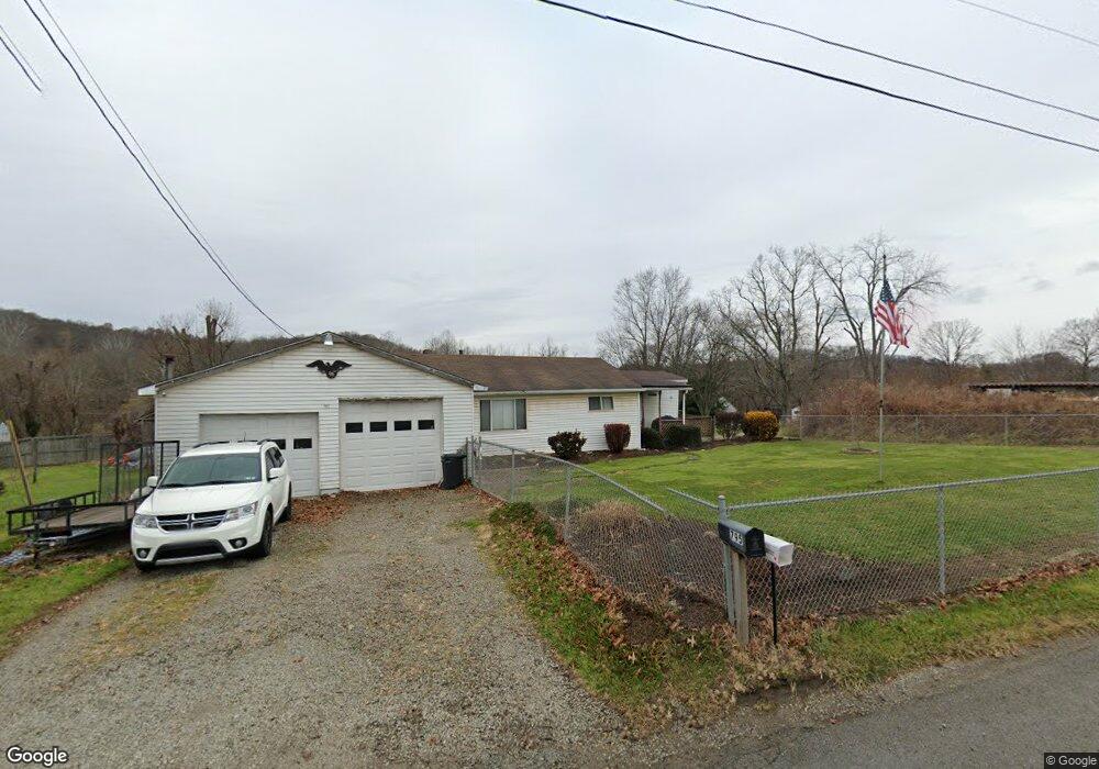
797 Route 519 Eighty Four, PA 15330
Estimated Value: $203,873 - $231,000
2
Beds
1
Bath
1,390
Sq Ft
$157/Sq Ft
Est. Value
About This Home
This home is located at 797 Route 519, Eighty Four, PA 15330 and is currently estimated at $217,968, approximately $156 per square foot. 797 Route 519 is a home with nearby schools including Bentworth Middle School and Bentworth Senior High School.
Ownership History
Date
Name
Owned For
Owner Type
Purchase Details
Closed on
Dec 8, 2018
Sold by
Lane Don S
Bought by
Lane Donald S and Donald S Lane Revocable Trust
Current Estimated Value
Purchase Details
Closed on
Dec 7, 2018
Sold by
Lane Don S
Bought by
Lane Don S
Create a Home Valuation Report for This Property
The Home Valuation Report is an in-depth analysis detailing your home's value as well as a comparison with similar homes in the area
Home Values in the Area
Average Home Value in this Area
Purchase History
| Date | Buyer | Sale Price | Title Company |
|---|---|---|---|
| Lane Donald S | -- | None Available | |
| Lane Don S | -- | None Available |
Source: Public Records
Tax History
| Year | Tax Paid | Tax Assessment Tax Assessment Total Assessment is a certain percentage of the fair market value that is determined by local assessors to be the total taxable value of land and additions on the property. | Land | Improvement |
|---|---|---|---|---|
| 2025 | $2,055 | $102,100 | $40,600 | $61,500 |
| 2024 | $1,777 | $102,100 | $40,600 | $61,500 |
| 2023 | $1,777 | $102,100 | $40,600 | $61,500 |
| 2022 | $1,714 | $102,100 | $40,600 | $61,500 |
| 2021 | $1,661 | $102,100 | $40,600 | $61,500 |
| 2020 | $1,617 | $102,100 | $40,600 | $61,500 |
| 2019 | $1,579 | $102,100 | $40,600 | $61,500 |
| 2018 | $1,541 | $102,100 | $40,600 | $61,500 |
| 2017 | $190 | $102,100 | $40,600 | $61,500 |
| 2016 | $190 | $7,646 | $1,680 | $5,966 |
| 2015 | -- | $7,646 | $1,680 | $5,966 |
| 2014 | $190 | $7,646 | $1,680 | $5,966 |
| 2013 | $190 | $7,646 | $1,680 | $5,966 |
Source: Public Records
Map
Nearby Homes
- 19 Old Monongahela Pike
- 190 Linnwood Rd
- 124 Dyersstone Dr
- 60 Carl Ave
- 216 Kopper Kettle Rd
- Lot 355 & 356 Floral Hill Dr
- LOT 8 Thomas Eighty Four Rd
- 0 Route 519 Unit 1728830
- 0 Route 519 Unit 1706095
- 338 Quarry Rd
- 1645 Route 519
- Bieda Lot Davis School Rd
- 1075 E National Pike
- 373 Lakeview Dr
- 22 Belen Hill Cir
- 4 Koa Rd
- 49 Woodside Dr
- 22 Belen Cir
- 350 Cedar Dr
- 332 Red Bud Ln
Your Personal Tour Guide
Ask me questions while you tour the home.