7975 Route 487 Unit LR177 Dushore, PA 18614
Estimated Value: $129,000 - $187,300
3
Beds
1
Bath
1,196
Sq Ft
$139/Sq Ft
Est. Value
About This Home
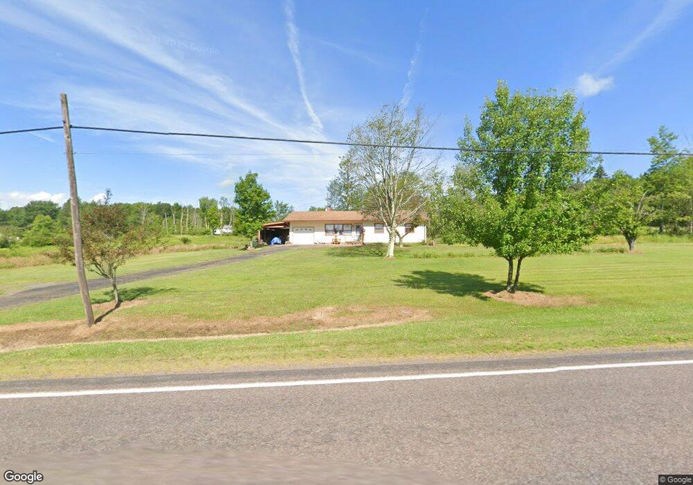
This home is located at 7975 Route 487 Unit LR177, Dushore, PA 18614 and is currently estimated at $166,325, approximately $139 per square foot. 7975 Route 487 Unit LR177 is a home located in Sullivan County with nearby schools including Sullivan County Elementary School and Sullivan County High School.
Ownership History
Date
Name
Owned For
Owner Type
Purchase Details
Closed on
Jul 31, 2015
Sold by
Dodson Gregory A
Bought by
Baran Andrew P
Current Estimated Value
Home Financials for this Owner
Home Financials are based on the most recent Mortgage that was taken out on this home.
Original Mortgage
$72,000
Outstanding Balance
$56,628
Interest Rate
4.03%
Mortgage Type
New Conventional
Estimated Equity
$109,697
Create a Home Valuation Report for This Property
The Home Valuation Report is an in-depth analysis detailing your home's value as well as a comparison with similar homes in the area
Home Values in the Area
Average Home Value in this Area
Purchase History
| Date | Buyer | Sale Price | Title Company |
|---|---|---|---|
| Baran Andrew P | $90,000 | None Available |
Source: Public Records
Mortgage History
| Date | Status | Borrower | Loan Amount |
|---|---|---|---|
| Open | Baran Andrew P | $72,000 |
Source: Public Records
Tax History Compared to Growth
Tax History
| Year | Tax Paid | Tax Assessment Tax Assessment Total Assessment is a certain percentage of the fair market value that is determined by local assessors to be the total taxable value of land and additions on the property. | Land | Improvement |
|---|---|---|---|---|
| 2025 | $1,602 | $67,400 | $13,600 | $53,800 |
| 2024 | $1,551 | $67,400 | $13,600 | $53,800 |
| 2023 | $1,449 | $67,400 | $13,600 | $53,800 |
| 2022 | $550 | $67,400 | $13,600 | $53,800 |
| 2021 | $550 | $67,400 | $13,600 | $53,800 |
| 2020 | $1,431 | $67,400 | $13,600 | $53,800 |
| 2019 | $1,406 | $67,400 | $13,600 | $53,800 |
| 2017 | $1,369 | $67,400 | $13,600 | $53,800 |
| 2015 | $662 | $67,400 | $13,600 | $53,800 |
| 2014 | $662 | $67,400 | $13,600 | $53,800 |
| 2012 | $662 | $67,400 | $13,600 | $53,800 |
Source: Public Records
Map
Nearby Homes
- 1050 Old Bernice Rd
- 0 Old Bernice Rd Unit 31721825
- 167 Payne Run Ln
- 1070 Hayes Rd
- 595 Old Bernice Rd
- 181 E Cherry St
- 244 S Turnpike St
- 242 S Turnpike St Unit LR895
- PARCEL 0017 Route 220 Hwy
- 4526 Pennsylvania 487
- 5751 Pennsylvania 487
- 113 Swamp Rd
- 1164 Rosenberry Hill Rd
- 0 Cummiskey Rd
- 4529 Route 487
- 108 Stansfield Rd
- 33 Walton Way Rd
- 272 Crawford Rd
- 0 Snyder Rd
- Snyder Rd Lot Unit WP001
- 218 Schlock Rd
- 0 Schlock Rd
- 244 Schlock Rd
- 229 Schlock Rd
- 106 Schlock Rd
- 197 Schlock Rd
- 154 Schlock Rd
- 145 Schlock Rd
- 165 Schlock Rd
- 103 Schlock Rd
- 64 Schlock Rd
- 86 Schlock Rd Unit SR1006
- 48 Schlock Rd
- 8068 Route 487 Unit LR177
- 61 Schlock Rd
- 56 Schlock Rd
- 17 Potuck Rd
- 712 Shinerville Rd
- 47 Schlock Rd
- 41 Schlock Rd