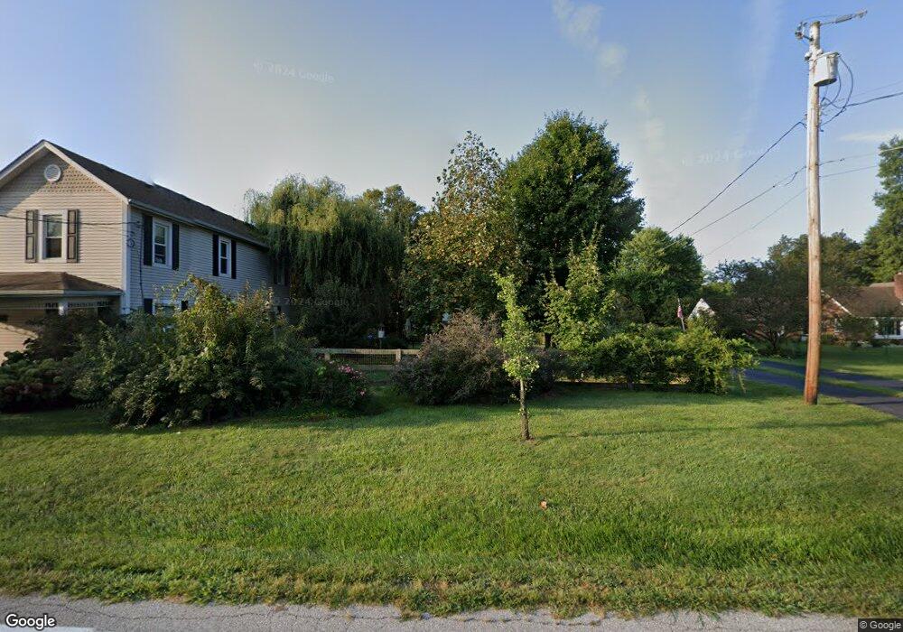
7975 Woodruff Rd Cincinnati, OH 45255
Estimated Value: $304,000 - $375,000
3
Beds
3
Baths
1,934
Sq Ft
$175/Sq Ft
Est. Value
About This Home
This home is located at 7975 Woodruff Rd, Cincinnati, OH 45255 and is currently estimated at $337,954, approximately $174 per square foot. 7975 Woodruff Rd is a home located in Hamilton County with nearby schools including Ayer Elementary School, Nagel Middle School, and Anderson High School.
Ownership History
Date
Name
Owned For
Owner Type
Purchase Details
Closed on
May 6, 2025
Sold by
Ball Craig L and Ball Julie A
Bought by
Phillips John Paul and Ball Chloe Lynn
Current Estimated Value
Home Financials for this Owner
Home Financials are based on the most recent Mortgage that was taken out on this home.
Original Mortgage
$307,000
Outstanding Balance
$304,797
Interest Rate
6.64%
Mortgage Type
VA
Estimated Equity
$33,157
Create a Home Valuation Report for This Property
The Home Valuation Report is an in-depth analysis detailing your home's value as well as a comparison with similar homes in the area
Home Values in the Area
Average Home Value in this Area
Purchase History
| Date | Buyer | Sale Price | Title Company |
|---|---|---|---|
| Phillips John Paul | $307,000 | None Listed On Document | |
| Phillips John Paul | $307,000 | None Listed On Document |
Source: Public Records
Mortgage History
| Date | Status | Borrower | Loan Amount |
|---|---|---|---|
| Open | Phillips John Paul | $307,000 | |
| Closed | Phillips John Paul | $307,000 |
Source: Public Records
Tax History
| Year | Tax Paid | Tax Assessment Tax Assessment Total Assessment is a certain percentage of the fair market value that is determined by local assessors to be the total taxable value of land and additions on the property. | Land | Improvement |
|---|---|---|---|---|
| 2025 | $6,845 | $109,449 | $20,482 | $88,967 |
| 2024 | $6,652 | $109,449 | $20,482 | $88,967 |
| 2023 | $6,328 | $109,449 | $20,482 | $88,967 |
| 2022 | $5,071 | $78,064 | $14,469 | $63,595 |
| 2021 | $4,951 | $78,064 | $14,469 | $63,595 |
| 2020 | $5,008 | $78,064 | $14,469 | $63,595 |
| 2019 | $4,881 | $69,083 | $12,803 | $56,280 |
| 2018 | $4,572 | $69,083 | $12,803 | $56,280 |
| 2017 | $4,312 | $69,083 | $12,803 | $56,280 |
| 2016 | $4,327 | $67,733 | $13,059 | $54,674 |
| 2015 | $4,203 | $67,733 | $13,059 | $54,674 |
| 2014 | $4,206 | $67,733 | $13,059 | $54,674 |
| 2013 | $3,899 | $66,406 | $12,803 | $53,603 |
Source: Public Records
Map
Nearby Homes
- 8016 Hignite Ct
- 7978 Nagel Village Dr
- 881 Asbury Rd
- 7926 Causeway Ln
- 937 Merritt Grove Ln
- 559 Asbury Rd
- 7754 Forest Rd
- 1013 Wittshire Ln
- 1073 Wittshire Cir Unit 113
- 1125 Wittshire Ln Unit 130
- 8372 Benton Ridge Ln
- 844 Woodlyn Dr S Unit 135
- 854 Woodlyn Dr S
- 8303 Tidewater Ct
- 906 Woodlyn Dr N Unit 4
- 1054 Eight Mile Rd
- 771 Woodlyn Dr S Unit 190
- 965 Woodlyn Dr N
- 1357 Oak Ct
- 136 Coldstream Villa Dr
- 7991 Woodruff Rd
- 8009 Woodruff Rd
- 8009 Woodruff Rd Unit 1
- 8009 Woodruff Rd Unit 2
- 7967 Woodruff Rd
- 7969 Woodruff Rd
- 7993 Woodruff Rd
- 8099 Woodruff Rd
- 8011 Woodruff Rd
- 8011 Woodruff Rd Unit 8099
- 8015 Woodruff Rd
- 7970 Woodruff Rd
- 7960 Woodruff Rd
- 8017 Woodruff Rd
- 759 Ackley Rd
- 7939 Woodruff Rd
- 8012 Woodruff Rd
- 7950 Woodruff Rd
- 7944 Woodruff Rd
- 7929 Woodruff Rd
Your Personal Tour Guide
Ask me questions while you tour the home.