Estimated Value: $404,000 - $501,000
3
Beds
1
Bath
1,200
Sq Ft
$379/Sq Ft
Est. Value
About This Home
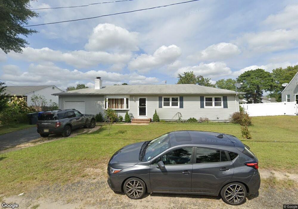
This home is located at 798 Burnt Tavern Rd, Brick, NJ 08724 and is currently estimated at $455,019, approximately $379 per square foot. 798 Burnt Tavern Rd is a home located in Ocean County with nearby schools including Veterans Memorial Elementary School, Veterans Memorial Middle School, and Brick Township Memorial High School.
Ownership History
Date
Name
Owned For
Owner Type
Purchase Details
Closed on
Mar 30, 1998
Sold by
Amejka Michael and Amejka Virginia
Bought by
Digenio Mark and Digenio Linda
Current Estimated Value
Home Financials for this Owner
Home Financials are based on the most recent Mortgage that was taken out on this home.
Original Mortgage
$101,850
Outstanding Balance
$18,980
Interest Rate
6.89%
Estimated Equity
$436,039
Create a Home Valuation Report for This Property
The Home Valuation Report is an in-depth analysis detailing your home's value as well as a comparison with similar homes in the area
Home Values in the Area
Average Home Value in this Area
Purchase History
| Date | Buyer | Sale Price | Title Company |
|---|---|---|---|
| Digenio Mark | $10,500 | -- |
Source: Public Records
Mortgage History
| Date | Status | Borrower | Loan Amount |
|---|---|---|---|
| Open | Digenio Mark | $101,850 |
Source: Public Records
Tax History Compared to Growth
Tax History
| Year | Tax Paid | Tax Assessment Tax Assessment Total Assessment is a certain percentage of the fair market value that is determined by local assessors to be the total taxable value of land and additions on the property. | Land | Improvement |
|---|---|---|---|---|
| 2025 | $5,447 | $208,300 | $104,500 | $103,800 |
| 2024 | $5,178 | $208,300 | $104,500 | $103,800 |
| 2023 | $5,110 | $208,300 | $104,500 | $103,800 |
| 2022 | $5,110 | $208,300 | $104,500 | $103,800 |
| 2021 | $4,650 | $208,300 | $104,500 | $103,800 |
| 2020 | $4,937 | $208,300 | $104,500 | $103,800 |
| 2019 | $4,841 | $208,300 | $104,500 | $103,800 |
| 2018 | $4,730 | $208,300 | $104,500 | $103,800 |
| 2017 | $4,603 | $208,300 | $104,500 | $103,800 |
| 2016 | $4,570 | $208,300 | $104,500 | $103,800 |
| 2015 | $4,449 | $208,300 | $104,500 | $103,800 |
| 2014 | $4,406 | $208,300 | $104,500 | $103,800 |
Source: Public Records
Map
Nearby Homes
- 302 Maxwell Ct
- 853 Stengel Ave
- 861 Wraight Ave
- 291 Prospect Dr
- 462 Austin Ave
- 775 Maple Ave
- 456 Rose Ave
- 432 18th Ave
- 411 Hulse Ave
- 405 17th Ave
- 384 18th Ave
- 445 Vista Ct
- 16 English Ln
- 10 Foxwood Ct Unit 93
- 270 Westwood Place
- 626-632 Summit Ave
- 47 Newport Ct Unit 6
- 658 Summit Ave
- 107 Brandywine Ct Unit 307
- 404 Driscol Dr
- 796 Burnt Tavern Rd
- 802 Burnt Tavern Rd
- 803 Marbro Ave Unit 46
- 794 Burnt Tavern Rd
- 799 Marbro Ave Unit 48
- 811 Marbro Ave Unit 38
- 806 Burnt Tavern Rd
- 795 Marbro Ave Unit 52
- 792 Burnt Tavern Rd
- 425 Harris Ave
- 38 Marbro Ave
- 804 Marbro Ave Unit 41
- 424 Harris Ave
- 39 Marbro Ave
- 424 Carole Ave
- 841 Marbro Ave
- 841 Marbro Ave Unit 4
- 791 Marbro Ave
- 786 Burnt Tavern Rd
- 416 Sweeney Ave