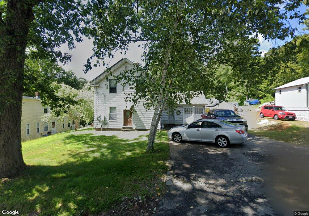
798 Franklin St Belchertown, MA 01007
Estimated Value: $237,000 - $285,530
3
Beds
2
Baths
1,081
Sq Ft
$242/Sq Ft
Est. Value
About This Home
This home is located at 798 Franklin St, Belchertown, MA 01007 and is currently estimated at $261,383, approximately $241 per square foot. 798 Franklin St is a home located in Hampshire County with nearby schools including Swift River Elementary School, Chestnut Hill Community School, and Jabish Middle School.
Ownership History
Date
Name
Owned For
Owner Type
Purchase Details
Closed on
Jul 31, 1998
Sold by
Kulig Anna and Kulig Gd Stanley
Bought by
Richard Michael
Current Estimated Value
Home Financials for this Owner
Home Financials are based on the most recent Mortgage that was taken out on this home.
Original Mortgage
$72,200
Interest Rate
6.92%
Mortgage Type
Purchase Money Mortgage
Create a Home Valuation Report for This Property
The Home Valuation Report is an in-depth analysis detailing your home's value as well as a comparison with similar homes in the area
Home Values in the Area
Average Home Value in this Area
Purchase History
| Date | Buyer | Sale Price | Title Company |
|---|---|---|---|
| Richard Michael | $76,000 | -- |
Source: Public Records
Mortgage History
| Date | Status | Borrower | Loan Amount |
|---|---|---|---|
| Open | Richard Michael | $37,000 | |
| Closed | Richard Michael | $57,168 | |
| Closed | Richard Michael | $29,000 | |
| Closed | Richard Michael | $72,200 |
Source: Public Records
Tax History
| Year | Tax Paid | Tax Assessment Tax Assessment Total Assessment is a certain percentage of the fair market value that is determined by local assessors to be the total taxable value of land and additions on the property. | Land | Improvement |
|---|---|---|---|---|
| 2025 | $2,757 | $190,000 | $61,600 | $128,400 |
| 2024 | $2,666 | $174,000 | $55,700 | $118,300 |
| 2023 | $2,747 | $168,300 | $52,000 | $116,300 |
| 2022 | $2,914 | $165,000 | $52,000 | $113,000 |
| 2021 | $2,692 | $148,500 | $48,200 | $100,300 |
| 2020 | $2,500 | $137,600 | $48,200 | $89,400 |
| 2019 | $2,385 | $130,200 | $46,400 | $83,800 |
| 2018 | $2,336 | $128,400 | $47,500 | $80,900 |
| 2017 | $2,295 | $126,100 | $47,500 | $78,600 |
| 2016 | $2,239 | $124,600 | $46,400 | $78,200 |
| 2015 | $2,363 | $132,100 | $48,200 | $83,900 |
Source: Public Records
Map
Nearby Homes
- 87-12 State St
- 3102 S Main St
- 3072 Main St Unit 3072
- 45 River St
- 61 Fuller Rd
- 0 South St
- 4 Sunny Crest Ln
- 31 High Bluff Rd
- 15 High Bluff Rd
- 7 High Bluff Rd
- Lot 87-12 State St
- 8 Summit Dr
- 70 Summer St
- 105 Railroad St
- Lot 38 Michael Sears Rd
- 0 Michael Sears Rd
- 3057 Foster St
- 4188 Main St
- 213 River St
- 268 N Liberty St
- 800 Franklin St
- 794 Franklin St
- 155 River St
- 792 Franklin St
- 791 Franklin St
- 801 Franklin St
- 801 Franklin St Unit 1
- 786 Franklin St
- 147 River St
- 785 Franklin St
- 180 River St
- 143 River St
- 182 River St
- 182 River St Unit A
- 780 Franklin St
- 19 Bridge St
- 781 Franklin St
- Lot A River St
- 10 Depot St
- 10 Depot St
Your Personal Tour Guide
Ask me questions while you tour the home.