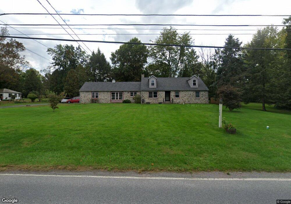
798 Pughtown Rd Spring City, PA 19475
Estimated Value: $413,000 - $456,000
2
Beds
1
Bath
1,858
Sq Ft
$233/Sq Ft
Est. Value
About This Home
This home is located at 798 Pughtown Rd, Spring City, PA 19475 and is currently estimated at $433,664, approximately $233 per square foot. 798 Pughtown Rd is a home located in Chester County with nearby schools including West Vincent Elementary School, Owen J Roberts Middle School, and Owen J Roberts High School.
Ownership History
Date
Name
Owned For
Owner Type
Purchase Details
Closed on
Aug 8, 2011
Sold by
Gle Philip M and Estate Of Helen D Keim
Bought by
Weber Michael J and Weber Samantha D
Current Estimated Value
Home Financials for this Owner
Home Financials are based on the most recent Mortgage that was taken out on this home.
Original Mortgage
$180,000
Outstanding Balance
$124,281
Interest Rate
4.51%
Mortgage Type
New Conventional
Estimated Equity
$309,383
Create a Home Valuation Report for This Property
The Home Valuation Report is an in-depth analysis detailing your home's value as well as a comparison with similar homes in the area
Home Values in the Area
Average Home Value in this Area
Purchase History
| Date | Buyer | Sale Price | Title Company |
|---|---|---|---|
| Weber Michael J | $226,400 | None Available |
Source: Public Records
Mortgage History
| Date | Status | Borrower | Loan Amount |
|---|---|---|---|
| Open | Weber Michael J | $180,000 |
Source: Public Records
Tax History Compared to Growth
Tax History
| Year | Tax Paid | Tax Assessment Tax Assessment Total Assessment is a certain percentage of the fair market value that is determined by local assessors to be the total taxable value of land and additions on the property. | Land | Improvement |
|---|---|---|---|---|
| 2025 | $5,990 | $151,350 | $33,390 | $117,960 |
| 2024 | $5,990 | $151,350 | $33,390 | $117,960 |
| 2023 | $5,900 | $151,350 | $33,390 | $117,960 |
| 2022 | $5,800 | $151,350 | $33,390 | $117,960 |
| 2021 | $5,727 | $151,350 | $33,390 | $117,960 |
| 2020 | $5,573 | $151,350 | $33,390 | $117,960 |
| 2019 | $5,465 | $151,350 | $33,390 | $117,960 |
| 2018 | $5,354 | $151,350 | $33,390 | $117,960 |
| 2017 | $5,222 | $151,350 | $33,390 | $117,960 |
| 2016 | $4,577 | $151,350 | $33,390 | $117,960 |
| 2015 | $4,577 | $151,350 | $33,390 | $117,960 |
| 2014 | $4,577 | $151,350 | $33,390 | $117,960 |
Source: Public Records
Map
Nearby Homes
- 108 Hartman Rd
- 176 Bucktown Crossing Unit 42C
- 3381 Coventryville Rd
- 3251 Coventryville Rd
- 3221 Coventryville Rd
- 1623 Hilltop Rd
- 1630 Sheeder Mill Rd
- 3896 Coventryville Rd
- 1547 Pottstown Pike
- 1672 Hollow Rd
- 1255 Hollow Rd
- 1420 Hollow Rd
- 1381 School House Ln
- 150 Horseshoe Ln
- 746 W Hoffecker Rd
- 1284 School House Ln
- 121 Warwick Chase
- 1378 S Hanover St
- 287 Kulp Rd
- 1940 Ridge Rd
- 794 Pughtown Rd
- 806 Pughtown Rd
- 803 Pughtown Rd
- 803 Pughtown Rd Unit 2301331-59417
- 799 Pughtown Rd
- 790 Pughtown Rd
- 815 Pughtown Rd
- 795 Pughtown Rd
- 816 Pughtown Rd
- 816 Pughtown Rd
- 786 Pughtown Rd
- 791 Pughtown Rd
- 787 Pughtown Rd
- 820 Pughtown Rd
- 820 Pughtown Rd
- 820 Pottstown Park
- 819 Pughtown Rd
- 783 Pughtown Rd
- 780 Pughtown Rd
- 779 Pughtown Rd