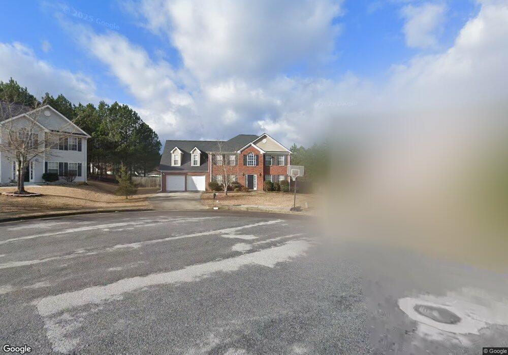
7981 Browning Dr Lithonia, GA 30058
Estimated Value: $361,000 - $406,000
4
Beds
3
Baths
3,136
Sq Ft
$121/Sq Ft
Est. Value
About This Home
This home is located at 7981 Browning Dr, Lithonia, GA 30058 and is currently estimated at $379,405, approximately $120 per square foot. 7981 Browning Dr is a home located in DeKalb County with nearby schools including Rock Chapel Elementary School, Lithonia Middle School, and Lithonia High School.
Ownership History
Date
Name
Owned For
Owner Type
Purchase Details
Closed on
Jul 28, 2003
Sold by
Wayne Thomas Group Inc
Bought by
Ngum Haddy M
Current Estimated Value
Home Financials for this Owner
Home Financials are based on the most recent Mortgage that was taken out on this home.
Original Mortgage
$35,300
Interest Rate
5.17%
Mortgage Type
New Conventional
Create a Home Valuation Report for This Property
The Home Valuation Report is an in-depth analysis detailing your home's value as well as a comparison with similar homes in the area
Home Values in the Area
Average Home Value in this Area
Purchase History
| Date | Buyer | Sale Price | Title Company |
|---|---|---|---|
| Ngum Haddy M | -- | -- | |
| Ngum Haddyy M | $176,400 | -- |
Source: Public Records
Mortgage History
| Date | Status | Borrower | Loan Amount |
|---|---|---|---|
| Previous Owner | Ngum Haddyy M | $35,300 |
Source: Public Records
Tax History Compared to Growth
Tax History
| Year | Tax Paid | Tax Assessment Tax Assessment Total Assessment is a certain percentage of the fair market value that is determined by local assessors to be the total taxable value of land and additions on the property. | Land | Improvement |
|---|---|---|---|---|
| 2025 | $4,453 | $137,560 | $20,000 | $117,560 |
| 2024 | $4,577 | $134,040 | $20,000 | $114,040 |
| 2023 | $4,577 | $117,520 | $20,000 | $97,520 |
| 2022 | $3,487 | $102,920 | $20,000 | $82,920 |
| 2021 | $2,928 | $86,680 | $15,000 | $71,680 |
| 2020 | $2,553 | $75,640 | $15,000 | $60,640 |
| 2019 | $2,438 | $73,080 | $15,000 | $58,080 |
| 2018 | $1,987 | $66,040 | $15,000 | $51,040 |
| 2017 | $2,162 | $62,800 | $15,000 | $47,800 |
| 2016 | $2,037 | $60,720 | $5,840 | $54,880 |
| 2014 | $1,521 | $45,920 | $5,840 | $40,080 |
Source: Public Records
Map
Nearby Homes
- 7992 Browning Dr
- 2442 Harmony Ridge Ct
- 2391 Harmony Ridge Ct
- 8332 Union Grove Rd
- 2231 Mason Point
- 7786 Providence Point Way
- 7808 Providence Point Way
- 2289 Overlook Ave
- 8359 Union Grove Rd Unit 1
- 2477 Osceola Rd
- 8347 Union Grove Rd
- 2467 Overlook Ave
- 2496 Osceola Rd
- 8218 Mahogany Ln
- 2330 Haliard Way
- 2934 Union Grove Rd
- 2325 Haliard Way
- 7977 Union Grove Rd
- 2565 Bear Mountain St
- 2369 Bear Mountain St
- 2277 Benson Ridge
- 7985 Browning Dr
- 7978 Browning Dr
- 2271 Benson Ridge Unit 3A
- 2283 Benson Ridge
- 2293 Benson Ridge Unit 6
- 2293 Benson Ridge
- 2293 Benson Ridge Unit 3A/36
- 2407 Emma Ct
- 2265 Benson Ridge
- 7982 Browning Dr
- 2299 Benson Ridge
- 7986 Browning Dr
- 2259 Benson Ridge
- 2413 Emma Ct
- 2305 Benson Ridge
- 2276 Benson Ridge
- 0 Browning Dr Unit 7011889
- 0 Browning Dr Unit 8453913
- 0 Browning Dr Unit 3281052