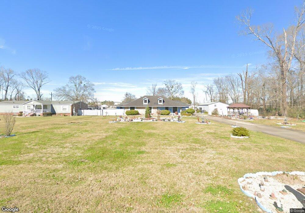
7982 George Cain Rd Baton Rouge, LA 70809
Airline/Jefferson NeighborhoodEstimated Value: $235,301 - $410,000
--
Bed
--
Bath
1,800
Sq Ft
$168/Sq Ft
Est. Value
About This Home
This home is located at 7982 George Cain Rd, Baton Rouge, LA 70809 and is currently estimated at $302,325, approximately $167 per square foot. 7982 George Cain Rd is a home located in East Baton Rouge Parish with nearby schools including Woodlawn Elementary School, Woodlawn Middle School, and Woodlawn High School.
Ownership History
Date
Name
Owned For
Owner Type
Purchase Details
Closed on
Dec 18, 2023
Sold by
Lrk Llc
Bought by
Ekg Holdings Llc and Honor Properties I-10 Investments Llc
Current Estimated Value
Purchase Details
Closed on
May 27, 2004
Sold by
Davis Derrick
Bought by
Landry Phillip
Home Financials for this Owner
Home Financials are based on the most recent Mortgage that was taken out on this home.
Original Mortgage
$151,750
Interest Rate
5.93%
Mortgage Type
New Conventional
Create a Home Valuation Report for This Property
The Home Valuation Report is an in-depth analysis detailing your home's value as well as a comparison with similar homes in the area
Home Values in the Area
Average Home Value in this Area
Purchase History
| Date | Buyer | Sale Price | Title Company |
|---|---|---|---|
| Ekg Holdings Llc | -- | None Listed On Document | |
| Landry Phillip | $17,500 | -- |
Source: Public Records
Mortgage History
| Date | Status | Borrower | Loan Amount |
|---|---|---|---|
| Previous Owner | Landry Phillip | $151,750 |
Source: Public Records
Tax History Compared to Growth
Tax History
| Year | Tax Paid | Tax Assessment Tax Assessment Total Assessment is a certain percentage of the fair market value that is determined by local assessors to be the total taxable value of land and additions on the property. | Land | Improvement |
|---|---|---|---|---|
| 2024 | $937 | $15,400 | $4,400 | $11,000 |
| 2023 | $937 | $15,400 | $4,400 | $11,000 |
| 2022 | $1,760 | $15,400 | $4,400 | $11,000 |
| 2021 | $1,726 | $15,400 | $4,400 | $11,000 |
| 2020 | $1,714 | $15,400 | $4,400 | $11,000 |
| 2019 | $1,623 | $14,000 | $4,000 | $10,000 |
| 2018 | $1,602 | $14,000 | $4,000 | $10,000 |
| 2017 | $1,602 | $14,000 | $4,000 | $10,000 |
| 2016 | $741 | $14,000 | $4,000 | $10,000 |
| 2015 | $348 | $10,400 | $400 | $10,000 |
| 2014 | $341 | $10,400 | $400 | $10,000 |
| 2013 | -- | $10,400 | $400 | $10,000 |
Source: Public Records
Map
Nearby Homes
- 8601 Foxfield Dr
- 7111 Village Charmant Dr Unit 94
- 7111 Village Charmant Dr Unit 55
- 8525 Glenfield Dr
- 13938 Mullins Dr
- 13944 Mullins Way
- 7111 Village Maison Ct Unit 17
- 14013 Spalding Way
- 8730 Pecue Ln
- 8730-8760 Pecue Ln
- 7514 Mcmahon Dr
- 8926 Foxgate Dr
- 7529 Mcmahon Dr
- 7517 Mcmahon Dr
- 8523 Briarwood Place
- 8946 Foxgate Dr
- 7635 Griffon Dr
- 13968 Pinehurst Ave
- 14241 Spalding Way
- 7526 Griffon Dr
- 7992 George Cain Rd
- 7929 George Cain Rd
- 8011 George Cain Rd
- 8008 W Pecue Ln
- 7550 Pecue Ln
- 8031 George Cain Rd
- 7850 Pecue Ln
- 8028 Pecue Ln
- 8014 W Pecue Ln
- 7930 Pecue Ln
- 8102 George Cain Rd
- 8012 George Cain Rd
- 7958 Pecue Ln
- 8112 George Cain Rd
- 8222 W Pecue Ln
- 7987 Pecue Ln
- 8232 W Pecue Ln
- 8207 George Cain Rd
- 8140 Pecue Ln
- 8041 Pecue Ln