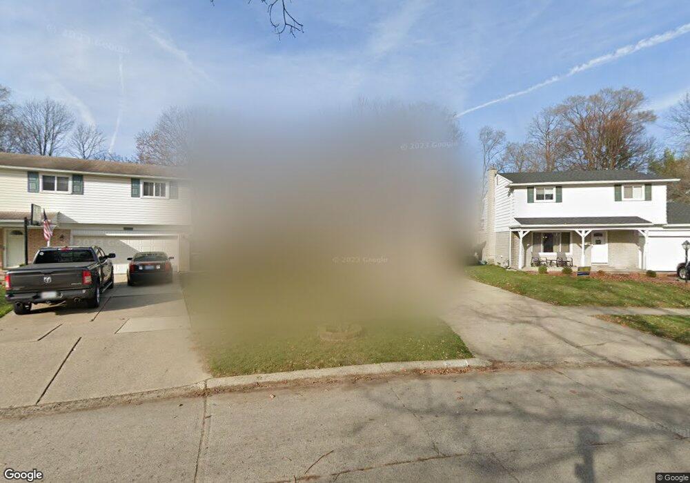
7989 Kaiser St Canton, MI 48187
Estimated Value: $299,000 - $385,000
3
Beds
2
Baths
1,464
Sq Ft
$233/Sq Ft
Est. Value
About This Home
This home is located at 7989 Kaiser St, Canton, MI 48187 and is currently estimated at $341,410, approximately $233 per square foot. 7989 Kaiser St is a home located in Wayne County with nearby schools including Canton High School, East Middle School, and Salem High School.
Ownership History
Date
Name
Owned For
Owner Type
Purchase Details
Closed on
Jun 15, 2010
Sold by
Donovan Shaun
Bought by
Russell Ryan and Russell Krystal
Current Estimated Value
Purchase Details
Closed on
Oct 2, 2009
Sold by
Wells Fargo Bank Na
Bought by
The Secretary Of Housing & Urban Develop
Purchase Details
Closed on
Apr 1, 2009
Sold by
Barshaw Douglas C and Barshaw Deborah K
Bought by
Wells Fargo Bank Na
Create a Home Valuation Report for This Property
The Home Valuation Report is an in-depth analysis detailing your home's value as well as a comparison with similar homes in the area
Home Values in the Area
Average Home Value in this Area
Purchase History
| Date | Buyer | Sale Price | Title Company |
|---|---|---|---|
| Russell Ryan | $85,000 | None Available | |
| The Secretary Of Housing & Urban Develop | -- | None Available | |
| Wells Fargo Bank Na | $164,551 | None Available |
Source: Public Records
Tax History
| Year | Tax Paid | Tax Assessment Tax Assessment Total Assessment is a certain percentage of the fair market value that is determined by local assessors to be the total taxable value of land and additions on the property. | Land | Improvement |
|---|---|---|---|---|
| 2025 | $2,268 | $193,700 | $0 | $0 |
| 2024 | $2,204 | $171,500 | $0 | $0 |
| 2023 | $2,101 | $163,400 | $0 | $0 |
| 2022 | $4,602 | $148,800 | $0 | $0 |
| 2021 | $4,321 | $133,700 | $0 | $0 |
| 2020 | $4,270 | $131,300 | $0 | $0 |
| 2019 | $4,191 | $113,540 | $0 | $0 |
| 2018 | $1,727 | $112,900 | $0 | $0 |
| 2017 | $2,892 | $80,100 | $0 | $0 |
| 2016 | $2,608 | $79,300 | $0 | $0 |
| 2015 | $6,363 | $70,470 | $0 | $0 |
| 2013 | $6,184 | $64,260 | $0 | $0 |
| 2010 | -- | $73,190 | $36,873 | $36,317 |
Source: Public Records
Map
Nearby Homes
- 39857 Edmundton St
- 00 Commerce Blvd
- 000 Commerce Blvd
- 39618 Bart St
- 219 W Fern
- 40504 Newport Dr
- 39500 Warren Rd Unit 242
- 39500 Warren Rd Unit 144
- 39500 Warren Rd Unit 154
- 39500 Warren Rd Unit 115
- 39500 Warren Rd Unit 174
- 39500 Warren Rd Unit 208
- 40584 Newport Ct
- 40548 Newport Dr
- 41430 Warren Rd
- 41415 Copper Creek Dr Unit 17
- 38508 Alma Ln
- 8821 Knolson Ave
- 8895 Knolson Ave
- 42209 Saratoga Cir Unit 16
- 7977 Kaiser St
- 7999 Kaiser St
- 7965 Kaiser St
- 39994 Hillary Dr
- 7953 Kaiser St
- 39980 Hillary Dr
- 39975 Hillary Dr
- 7950 Kaiser St
- 7941 Kaiser St
- 39966 Hillary Dr
- 7929 Kaiser St
- 7928 Kaiser St
- 39952 Hillary Dr
- 39951 Hillary Dr
- 7917 Kaiser St
- 39938 Hillary Dr
- 7914 Kaiser St
- 39937 Hillary Dr
- 39926 Edmunton St
- 7905 Kaiser St
Your Personal Tour Guide
Ask me questions while you tour the home.
