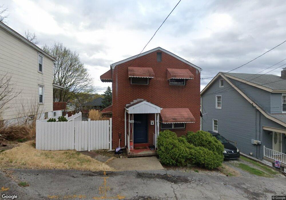
799 12th St Mc Kees Rocks, PA 15136
Stowe Township NeighborhoodEstimated Value: $68,000 - $147,000
3
Beds
2
Baths
1,056
Sq Ft
$116/Sq Ft
Est. Value
About This Home
This home is located at 799 12th St, Mc Kees Rocks, PA 15136 and is currently estimated at $122,516, approximately $116 per square foot. 799 12th St is a home located in Allegheny County with nearby schools including Sto-Rox Upper Elementary School, Sto-Rox Primary Center, and Sto-Rox Junior/Senior High School.
Ownership History
Date
Name
Owned For
Owner Type
Purchase Details
Closed on
Apr 12, 2002
Sold by
Vattimo Terrence R and Vattimo Suzanne I
Bought by
Shaw John
Current Estimated Value
Purchase Details
Closed on
Oct 19, 1995
Sold by
Kodrich Frank R and Kodrich Patricia A
Bought by
Vattimo Terrence R and Vattimo Suzanne I
Purchase Details
Closed on
May 12, 1994
Sold by
Kodrich Frank R and Kodrich Patricia A
Bought by
Kodrich Frank R and Kodrich Patricia A
Create a Home Valuation Report for This Property
The Home Valuation Report is an in-depth analysis detailing your home's value as well as a comparison with similar homes in the area
Home Values in the Area
Average Home Value in this Area
Purchase History
| Date | Buyer | Sale Price | Title Company |
|---|---|---|---|
| Shaw John | $63,500 | -- | |
| Vattimo Terrence R | $54,000 | -- | |
| Kodrich Frank R | -- | -- |
Source: Public Records
Tax History Compared to Growth
Tax History
| Year | Tax Paid | Tax Assessment Tax Assessment Total Assessment is a certain percentage of the fair market value that is determined by local assessors to be the total taxable value of land and additions on the property. | Land | Improvement |
|---|---|---|---|---|
| 2025 | $1,806 | $41,800 | $12,000 | $29,800 |
| 2024 | $1,736 | $41,800 | $12,000 | $29,800 |
| 2023 | $1,736 | $41,800 | $12,000 | $29,800 |
| 2022 | $1,681 | $41,800 | $12,000 | $29,800 |
| 2021 | $1,643 | $41,800 | $12,000 | $29,800 |
| 2020 | $1,643 | $41,800 | $12,000 | $29,800 |
| 2019 | $1,643 | $41,800 | $12,000 | $29,800 |
| 2018 | $198 | $41,800 | $12,000 | $29,800 |
| 2017 | $1,605 | $41,800 | $12,000 | $29,800 |
| 2016 | $198 | $41,800 | $12,000 | $29,800 |
| 2015 | $198 | $41,800 | $12,000 | $29,800 |
| 2014 | $1,605 | $41,800 | $12,000 | $29,800 |
Source: Public Records
Map
Nearby Homes
- 1212 Woodward Ave
- 809 11th St
- 932 Ridge Ave
- 810 10th St
- 802 10th St
- 813 10th St
- 815 10th St
- 1406 Broadway Ave
- 1408 Broadway Ave
- 1131 13th St
- 837 Benwood Ave
- 908 Russellwood Ave
- 1140 12th St
- 813 8th St
- 810 Woodward Ave
- 815 Broadway Ave
- 1128 9th St
- 543 Elizabeth Ave
- 124 Pleasant Ridge Rd
- 1144 1/2 Race St