Estimated Value: $316,515 - $690,000
Studio
--
Bath
--
Sq Ft
6,578
Sq Ft
About This Home
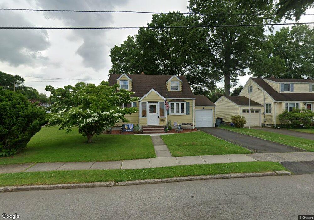
This home is located at 799 Hemlock Rd, Union, NJ 07083 and is currently estimated at $560,379. 799 Hemlock Rd is a home located in Union County with nearby schools including Battle Hill Elementary School, Burnet Middle School, and Union High School.
Ownership History
Date
Name
Owned For
Owner Type
Purchase Details
Closed on
May 15, 2001
Sold by
Mcmanus Joan
Bought by
Tyra Pascal J and Tyra Colleen B
Current Estimated Value
Home Financials for this Owner
Home Financials are based on the most recent Mortgage that was taken out on this home.
Original Mortgage
$177,422
Outstanding Balance
$66,249
Interest Rate
7.03%
Mortgage Type
FHA
Estimated Equity
$494,130
Create a Home Valuation Report for This Property
The Home Valuation Report is an in-depth analysis detailing your home's value as well as a comparison with similar homes in the area
Home Values in the Area
Average Home Value in this Area
Purchase History
| Date | Buyer | Sale Price | Title Company |
|---|---|---|---|
| Tyra Pascal J | $184,000 | -- |
Source: Public Records
Mortgage History
| Date | Status | Borrower | Loan Amount |
|---|---|---|---|
| Open | Tyra Pascal J | $177,422 |
Source: Public Records
Tax History
| Year | Tax Paid | Tax Assessment Tax Assessment Total Assessment is a certain percentage of the fair market value that is determined by local assessors to be the total taxable value of land and additions on the property. | Land | Improvement |
|---|---|---|---|---|
| 2025 | $10,281 | $46,000 | $21,800 | $24,200 |
| 2024 | $9,968 | $46,000 | $21,800 | $24,200 |
Source: Public Records
Map
Nearby Homes
- 750 Andover Rd
- 2705 Andrea Rd
- 798 Pinewood Rd
- 787 Liberty Ave
- 2670 Bancroft Ave
- 960 Moessner Ave
- 105 Battle Hill Ave
- 148 Locust Dr
- 67 Battle Hill Ave
- 238 Riverside Dr
- 2785 Larchmont Rd
- 2469 Macarthur Dr
- 1042 Battle Hill Terrace
- 933 Douglas Terrace
- 1065 Liberty Ave
- 2442 Terrill Rd
- 735 Garden St
- 17 Alvin Terrace
- 5 Bashford Ave Unit 5
- 14 Bashford Ave Unit 14
- 795 Hemlock Rd
- 2752 Killian Place
- 791 Hemlock Rd
- 809 Hemlock Rd
- 2748 Killian Place
- 780 Andover Rd
- 796 Hemlock Rd
- 787 Hemlock Rd
- 2749 Killian Place
- 813 Hemlock Rd
- 792 Hemlock Rd
- 804 Hemlock Rd
- 784 Andover Rd
- 2744 Killian Place
- 776 Andover Rd
- 2745 Killian Place
- 786 Hemlock Rd
- 810 Hemlock Rd
- 783 Hemlock Rd
- 817 Hemlock Rd
Your Personal Tour Guide
Ask me questions while you tour the home.