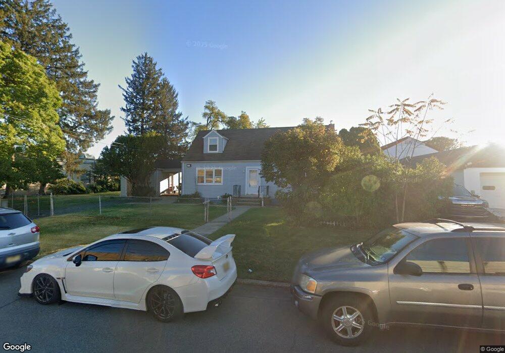
799 Martin St Rahway, NJ 07065
Estimated Value: $360,000 - $474,000
--
Bed
--
Bath
1,459
Sq Ft
$296/Sq Ft
Est. Value
About This Home
This home is located at 799 Martin St, Rahway, NJ 07065 and is currently estimated at $431,187, approximately $295 per square foot. 799 Martin St is a home located in Union County with nearby schools including Rahway High School.
Ownership History
Date
Name
Owned For
Owner Type
Purchase Details
Closed on
Feb 15, 2022
Sold by
Alfonso Smaldone
Bought by
799 Martin Street Llc
Current Estimated Value
Purchase Details
Closed on
Apr 9, 2021
Sold by
Diversified Residential Properties Llc
Bought by
Smaldone Alfonso and Smaldone James
Purchase Details
Closed on
May 10, 2010
Sold by
Selective Development Co Llc
Bought by
Diversified Residential Prop Llc
Purchase Details
Closed on
Dec 22, 2000
Sold by
Grubbs William J and Rather Deborah L
Bought by
Selective Development Company Llc
Purchase Details
Closed on
Jan 25, 1996
Sold by
Hall Joseph and Skipper Maleather
Bought by
Grubbs William J and Rather Deborah L
Create a Home Valuation Report for This Property
The Home Valuation Report is an in-depth analysis detailing your home's value as well as a comparison with similar homes in the area
Home Values in the Area
Average Home Value in this Area
Purchase History
| Date | Buyer | Sale Price | Title Company |
|---|---|---|---|
| 799 Martin Street Llc | -- | Kappock Brian H | |
| Smaldone Alfonso | $335,000 | Main Street Title | |
| Smaldone Alfonso | $335,000 | Main Street Title | |
| Diversified Residential Prop Llc | -- | -- | |
| Selective Development Company Llc | -- | -- | |
| Grubbs William J | $60,000 | -- |
Source: Public Records
Tax History Compared to Growth
Tax History
| Year | Tax Paid | Tax Assessment Tax Assessment Total Assessment is a certain percentage of the fair market value that is determined by local assessors to be the total taxable value of land and additions on the property. | Land | Improvement |
|---|---|---|---|---|
| 2025 | $7,101 | $95,900 | $52,700 | $43,200 |
| 2024 | $3,787 | $95,900 | $52,700 | $43,200 |
| 2023 | $3,787 | $52,800 | $52,700 | $100 |
| 2022 | $9,761 | $139,000 | $52,700 | $86,300 |
| 2021 | $6,666 | $95,900 | $52,700 | $43,200 |
| 2020 | $6,641 | $95,900 | $52,700 | $43,200 |
| 2019 | $6,557 | $95,900 | $52,700 | $43,200 |
| 2018 | $6,419 | $95,900 | $52,700 | $43,200 |
| 2017 | $6,260 | $95,900 | $52,700 | $43,200 |
| 2016 | $6,127 | $95,900 | $52,700 | $43,200 |
| 2015 | $6,058 | $95,900 | $52,700 | $43,200 |
| 2014 | $5,950 | $95,900 | $52,700 | $43,200 |
Source: Public Records
Map
Nearby Homes
- 276 E Stearns St
- 935 Thorn St
- 197 Iva St
- 280 E Hazelwood Ave
- 245 William St
- 1025 New Brunswick Ave
- 735 E Hazelwood Ave
- 653 New Brunswick Ave
- 1427 Barnhardt Ln Unit 502
- 1435 Barnhardt Ln Unit 604
- 1330 Stockton St
- 48 W Hazelwood Ave
- 59 Minna St
- 1016 Jaques Ave
- 180 W Stearns St
- 181 W Stearns St
- 182 W Lake Ave
- 445 Prospect Ave
- 8 3rd St
- 9 2nd St
- 810 Martin St
- 868 Elston St
- 838 Leesville Ave
- 848 Leesville Ave
- 862 Leesville Ave
- 872 Leesville Ave
- 896 Leesville Ave
- 906 Leesville Ave
- 916 Leesville Ave
- 835 Main St
- 877 Main St
- 687 Leesville Ave
- 855 Main St
- 930 Leesville Ave
- 889 Main St
- 671 Leesville Ave
- 891 Main St
- 390 Regina Ave
- 901 Main St Unit 3
- 794 Main St