Estimated Value: $595,000 - $669,044
Studio
1
Bath
1,300
Sq Ft
$485/Sq Ft
Est. Value
About This Home
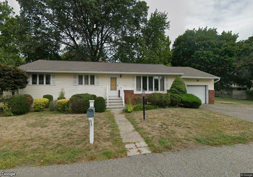
This home is located at 7A Tosch Ave Unit A, Wayne, NJ 07470 and is currently estimated at $630,761, approximately $485 per square foot. 7A Tosch Ave Unit A is a home located in Passaic County with nearby schools including Lafayette Elementary School, Anthony Wayne Middle School, and Wayne Valley High School.
Ownership History
Date
Name
Owned For
Owner Type
Purchase Details
Closed on
Feb 25, 2025
Sold by
Corrao Robert T and Corrao Joseph T
Bought by
Krakower Sean and Krakower Pranvera
Current Estimated Value
Home Financials for this Owner
Home Financials are based on the most recent Mortgage that was taken out on this home.
Original Mortgage
$527,000
Outstanding Balance
$524,349
Interest Rate
6.96%
Mortgage Type
New Conventional
Estimated Equity
$106,412
Purchase Details
Closed on
May 11, 2020
Sold by
Corrao Family Trust
Bought by
Corrao Robert T and Corrao Joseph T
Purchase Details
Closed on
Jan 3, 2008
Sold by
Corrao Joseph and Corrao Kathleen
Bought by
Corrao Family Trust
Create a Home Valuation Report for This Property
The Home Valuation Report is an in-depth analysis detailing your home's value as well as a comparison with similar homes in the area
Home Values in the Area
Average Home Value in this Area
Purchase History
| Date | Buyer | Sale Price | Title Company |
|---|---|---|---|
| Krakower Sean | $577,000 | Insight Title Services | |
| Krakower Sean | $577,000 | Insight Title Services | |
| Corrao Robert T | -- | None Available | |
| Corrao Family Trust | -- | -- |
Source: Public Records
Mortgage History
| Date | Status | Borrower | Loan Amount |
|---|---|---|---|
| Open | Krakower Sean | $527,000 | |
| Closed | Krakower Sean | $527,000 |
Source: Public Records
Tax History
| Year | Tax Paid | Tax Assessment Tax Assessment Total Assessment is a certain percentage of the fair market value that is determined by local assessors to be the total taxable value of land and additions on the property. | Land | Improvement |
|---|---|---|---|---|
| 2025 | $10,578 | $177,900 | $96,000 | $81,900 |
| 2024 | $10,172 | $177,900 | $96,000 | $81,900 |
| 2022 | $10,058 | $177,900 | $96,000 | $81,900 |
| 2021 | $10,048 | $177,900 | $96,000 | $81,900 |
| 2020 | $10,003 | $177,900 | $96,000 | $81,900 |
| 2019 | $9,809 | $177,900 | $96,000 | $81,900 |
| 2018 | $9,722 | $177,900 | $96,000 | $81,900 |
| 2017 | $9,633 | $177,900 | $96,000 | $81,900 |
| 2016 | $9,498 | $177,900 | $96,000 | $81,900 |
| 2015 | $9,384 | $177,900 | $96,000 | $81,900 |
| 2014 | $9,119 | $177,900 | $96,000 | $81,900 |
Source: Public Records
Map
Nearby Homes
- 14 Louisa Ct
- 24 Holmes Ln
- 70 Weinmanns Blvd
- 35 Darlington Dr
- 51 Harmer Terrace
- 4 Highfield Ct
- 18 Stonycroft Rd
- 61 Carlisle Rd
- 2 White Oak Ln
- 14 Weinmanns Blvd
- 69 Colonial Rd
- 22 Woodlot Rd
- 20 Maljim Ct
- 92 Independence Trail
- 92 Independence Trail Unit 1004
- 16 Lawrence Rd
- 28 Battle Ridge Trail
- 4 Generals Ln
- 7 Lookout Point Trail
- 125 Hamilton Trail
Your Personal Tour Guide
Ask me questions while you tour the home.