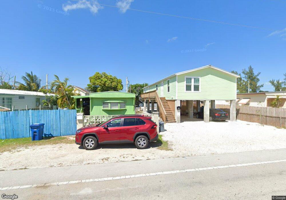
7F Cross St Unit F Stock Island, FL 33040
Estimated Value: $688,290 - $867,000
2
Beds
2
Baths
840
Sq Ft
$919/Sq Ft
Est. Value
About This Home
This home is located at 7F Cross St Unit F, Stock Island, FL 33040 and is currently estimated at $772,323, approximately $919 per square foot. 7F Cross St Unit F is a home located in Monroe County with nearby schools including Gerald Adams Elementary School, Key West High School, and The College Of The Florida Keys Academy.
Ownership History
Date
Name
Owned For
Owner Type
Purchase Details
Closed on
Dec 30, 2016
Sold by
Alfred and Roxanne
Bought by
Rahming Alfred and Rahming Roxanne
Current Estimated Value
Purchase Details
Closed on
Apr 23, 2010
Sold by
Moore Bevette and Moore Kyle
Bought by
Alfred & Roxanne At 201 Julia Heights Ll
Purchase Details
Closed on
Oct 1, 1985
Bought by
Alfred And Roxanne @ 201 Julia Heights Llc
Purchase Details
Closed on
Jan 1, 1978
Bought by
Alfred And Roxanne @ 201 Julia Heights Llc
Create a Home Valuation Report for This Property
The Home Valuation Report is an in-depth analysis detailing your home's value as well as a comparison with similar homes in the area
Home Values in the Area
Average Home Value in this Area
Purchase History
| Date | Buyer | Sale Price | Title Company |
|---|---|---|---|
| Rahming Alfred | -- | None Available | |
| Alfred & Roxanne At 201 Julia Heights Ll | $99,000 | None Available | |
| Alfred And Roxanne @ 201 Julia Heights Llc | $40,000 | -- | |
| Alfred And Roxanne @ 201 Julia Heights Llc | $17,200 | -- |
Source: Public Records
Tax History Compared to Growth
Tax History
| Year | Tax Paid | Tax Assessment Tax Assessment Total Assessment is a certain percentage of the fair market value that is determined by local assessors to be the total taxable value of land and additions on the property. | Land | Improvement |
|---|---|---|---|---|
| 2025 | $5,011 | $572,313 | $302,032 | $270,281 |
| 2024 | $4,574 | $567,749 | $302,032 | $265,717 |
| 2023 | $4,574 | $530,770 | $280,458 | $250,312 |
| 2022 | $4,255 | $500,157 | $240,907 | $259,250 |
| 2021 | $3,907 | $383,086 | $158,207 | $224,879 |
| 2020 | $3,826 | $370,895 | $156,409 | $214,486 |
| 2019 | $3,770 | $367,669 | $151,016 | $216,653 |
| 2018 | $1,467 | $153,744 | $151,016 | $2,728 |
| 2017 | $1,659 | $175,319 | $0 | $0 |
| 2016 | $634 | $107,268 | $0 | $0 |
| 2015 | $569 | $90,705 | $0 | $0 |
| 2014 | $566 | $90,501 | $0 | $0 |
Source: Public Records
Map
Nearby Homes
- G59 Miriam St
- 317 Cross St
- C1 9th Ave
- 41G Miriam St
- B50 9th Ave
- B38 9th Ave
- 33D 11th Ave
- G34 Miriam St
- E14 11th Ave
- 30F Cross St
- 6460 Sunshine St
- 7000 5th St
- 7200 5th St
- 25D 10th Ave
- 5435 5th Ave
- 1445 S Roosevelt Blvd Unit 412
- 1445 S 1445 Roosevelt Blvd Unit 411
- 243 Golf Club Dr
- 247 Golf Club Dr
- 44 Spoonbill Way Unit 1
- G6 Roberta St
- 7 Cross St Unit F
- 9F Cross St
- 8G Roberta St
- 0 Roberta St Unit 94437
- 0 Roberta St Unit 91647
- 0 Roberta St Unit 91255
- 0 Roberta St Unit 102853
- 0 8th Ave
- 26A 8th Ave
- G7 Roberta St
- 6 Roberta St
- 6G Roberta St
- 10F Cross St
- 9 Cross St
- 10 Cross St
- 11G Roberta St
- 4 7th Ave
- 1 8th Ave
- G9 Roberta St