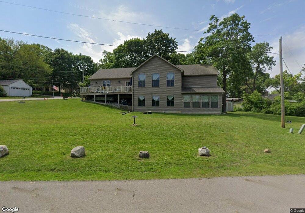
7N085 Riverside Dr Saint Charles, IL 60174
Fox River Heights NeighborhoodEstimated Value: $332,000 - $401,441
3
Beds
1
Bath
720
Sq Ft
$528/Sq Ft
Est. Value
About This Home
This home is located at 7N085 Riverside Dr, Saint Charles, IL 60174 and is currently estimated at $379,860, approximately $527 per square foot. 7N085 Riverside Dr is a home located in Kane County with nearby schools including Anderson Elementary School, Wredling Middle School, and St Charles North High School.
Ownership History
Date
Name
Owned For
Owner Type
Purchase Details
Closed on
Sep 12, 2016
Sold by
Cox Johnie O and Cox Laurie Ann
Bought by
Cox Johnie O and Cox Laurie Ann
Current Estimated Value
Purchase Details
Closed on
Jun 19, 2014
Sold by
Cox Johnie O and Cox Laurie Ann
Bought by
Cox Johnie O and Cox Laurie Ann
Create a Home Valuation Report for This Property
The Home Valuation Report is an in-depth analysis detailing your home's value as well as a comparison with similar homes in the area
Home Values in the Area
Average Home Value in this Area
Purchase History
| Date | Buyer | Sale Price | Title Company |
|---|---|---|---|
| Cox Johnie O | -- | None Available | |
| Cox Johnie O | -- | None Available | |
| Jonnie O Cox Family Trust | -- | None Available |
Source: Public Records
Tax History Compared to Growth
Tax History
| Year | Tax Paid | Tax Assessment Tax Assessment Total Assessment is a certain percentage of the fair market value that is determined by local assessors to be the total taxable value of land and additions on the property. | Land | Improvement |
|---|---|---|---|---|
| 2024 | $8,874 | $141,351 | $34,148 | $107,203 |
| 2023 | $8,376 | $126,511 | $30,563 | $95,948 |
| 2022 | $8,245 | $118,783 | $33,829 | $84,954 |
| 2021 | $7,629 | $111,612 | $30,634 | $80,978 |
| 2020 | $7,186 | $104,559 | $30,063 | $74,496 |
| 2019 | $3,025 | $50,279 | $29,468 | $20,811 |
| 2018 | $1,838 | $34,815 | $29,839 | $4,976 |
| 2017 | $2,035 | $37,091 | $28,819 | $8,272 |
| 2016 | $2,013 | $34,618 | $27,807 | $6,811 |
| 2015 | -- | $30,349 | $27,507 | $2,842 |
| 2014 | -- | $30,789 | $27,507 | $3,282 |
| 2013 | -- | $35,209 | $27,782 | $7,427 |
Source: Public Records
Map
Nearby Homes
- 7N230 Sims Ln
- 6N779 State Route 31
- 36W172 Silver Glen Ct
- 6N705 State Route 31
- 633 Endicott Rd
- 35W343 Riverside Dr
- Lot 103 Oak Pointe Dr
- 552 Endicott Rd
- 4009 Faith Ln
- 4032 Faith Ln
- 4016 Faith Ln
- 629 Endicott Rd
- 532 Endicott Rd
- 528 Endicott Rd
- 6N362 Riverside Dr
- 524 Endicott Rd
- 517 Endicott Rd
- 516 Endicott Rd
- 512 Endicott Rd
- 508 Endicott Rd
- 7N081 Riverside Dr
- 7N061 Riverside Dr
- 35W837 Oak Dr
- 35W825 Oak Dr
- 7N047 Riverside Dr
- 7N042 Jackson Ave
- 7N039 Jackson Ave
- 7N037 Riverside Dr
- 35W801 Oak Dr
- 7N029 Riverside Dr
- 7N025 Jackson Ave
- 7N011 Jackson Ave
- 35W777 Riverside Dr
- 7N018 Irving Ave
- 7N018 Irving Ave
- 7N005 Riverside Dr
- 35W746 Oak Dr
- 6N997 Jackson Ave
- 7N025 Irving Ave
- 7N060 Maple Ave