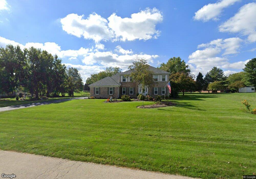
7N904 Cloverfield Dr Unit 3 Saint Charles, IL 60175
Cranston Meadows Park NeighborhoodEstimated Value: $607,767 - $662,000
--
Bed
1
Bath
2,814
Sq Ft
$228/Sq Ft
Est. Value
About This Home
This home is located at 7N904 Cloverfield Dr Unit 3, Saint Charles, IL 60175 and is currently estimated at $640,192, approximately $227 per square foot. 7N904 Cloverfield Dr Unit 3 is a home located in Kane County with nearby schools including Ferson Creek Elementary School, Thompson Middle School, and St Charles North High School.
Ownership History
Date
Name
Owned For
Owner Type
Purchase Details
Closed on
Feb 23, 2004
Sold by
Nicklaus Robert E and Berton Nicklaus Antonietta
Bought by
Nicklaus Robert E and Berton Nicklaus Antonietta
Current Estimated Value
Purchase Details
Closed on
Nov 7, 2002
Sold by
Berton Nicklaus Antonietta G and Nicklaus Robert E
Bought by
Nicklaus Robert E and Berton Nicklaus Antonietta G
Purchase Details
Closed on
Jul 8, 2002
Sold by
Hyser Christopher W and Hyser Barbara M
Bought by
Berton Antonietta G and Nicklaus Robert E
Home Financials for this Owner
Home Financials are based on the most recent Mortgage that was taken out on this home.
Original Mortgage
$229,000
Interest Rate
5.62%
Create a Home Valuation Report for This Property
The Home Valuation Report is an in-depth analysis detailing your home's value as well as a comparison with similar homes in the area
Home Values in the Area
Average Home Value in this Area
Purchase History
| Date | Buyer | Sale Price | Title Company |
|---|---|---|---|
| Nicklaus Robert E | -- | -- | |
| Nicklaus Robert E | -- | -- | |
| Berton Antonietta G | $378,000 | -- |
Source: Public Records
Mortgage History
| Date | Status | Borrower | Loan Amount |
|---|---|---|---|
| Previous Owner | Berton Antonietta G | $229,000 |
Source: Public Records
Tax History Compared to Growth
Tax History
| Year | Tax Paid | Tax Assessment Tax Assessment Total Assessment is a certain percentage of the fair market value that is determined by local assessors to be the total taxable value of land and additions on the property. | Land | Improvement |
|---|---|---|---|---|
| 2024 | $10,759 | $169,614 | $26,845 | $142,769 |
| 2023 | $10,465 | $151,644 | $24,001 | $127,643 |
| 2022 | $10,124 | $138,172 | $21,869 | $116,303 |
| 2021 | $9,666 | $130,462 | $20,649 | $109,813 |
| 2020 | $9,661 | $128,585 | $20,352 | $108,233 |
| 2019 | $9,550 | $126,697 | $20,053 | $106,644 |
| 2018 | $9,553 | $126,697 | $20,053 | $106,644 |
| 2017 | $9,255 | $124,837 | $19,759 | $105,078 |
| 2016 | $9,729 | $121,685 | $19,260 | $102,425 |
| 2015 | -- | $118,324 | $18,728 | $99,596 |
| 2014 | -- | $120,138 | $19,015 | $101,123 |
| 2013 | -- | $122,154 | $19,334 | $102,820 |
Source: Public Records
Map
Nearby Homes
- 38W725 Cloverfield Dr
- 7N610 Cloverfield Cir
- 3591 Sandstone Cir
- 3588 Sandstone Cir
- 3590 Sandstone Cir
- 1848 Chandolin Ln
- 1846 Chandolin Ln
- 1850 Chandolin Ln
- 1851 Diamond Dr
- 1847 Diamond Dr
- 1858 Chandolin Ln
- 1854 Chandolin Ln
- 1867 Chandolin Ln
- 1865 Chandolin Ln
- 1863 Chandolin Ln
- 1857 Chandolin Ln
- 3620 Sahara Rd
- 7N919 Cloverfield Rd
- Newcastle Plan at Ponds of Stony Creek - Phase II
- Windsor Plan at Ponds of Stony Creek - Phase II
- 7N888 Cloverfield Dr Unit 3
- 7N903 Cloverfield Cir
- 7N861 Cloverfield Cir
- 7N908 Brittany Ct Unit 3
- 7N866 Cloverfield Dr
- 7N831 Cloverfield Cir
- 7N927 Cloverfield Dr
- 7N935 Cloverfield Dr
- 7N905 Brittany Ct
- 7N834 Cloverfield Dr Unit 3
- 7N940 Cloverfield Dr
- 7N930 Brittany Ct
- 7N900 Cloverfield Cir
- 7N872 Cloverfield Cir Unit 1
- 7N969 Cloverfield Dr Unit 2
- 7N812 Cloverfield Dr Unit 3
- 7N960 Cloverfield Dr
- 7N765 Cloverfield Cir Unit 1
- 7N929 Brittany Ct Unit 3
- 7N942 Brittany Ct