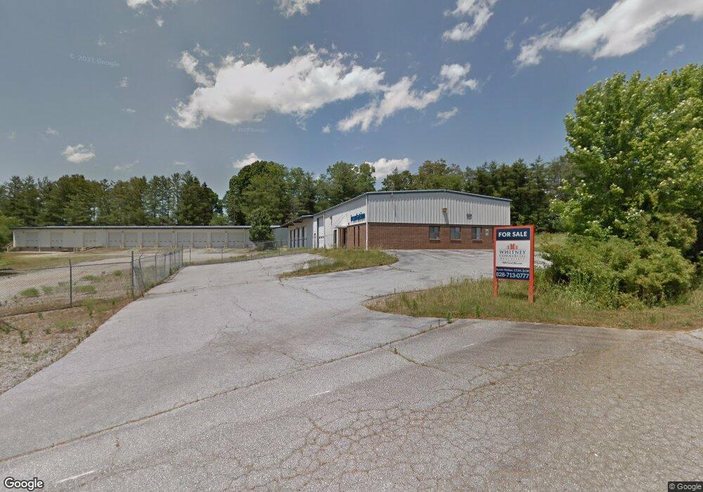
8 & 10 Brandy Branch Rd Mills River, NC 28759
Estimated Value: $1,962,024
--
Bed
--
Bath
9,254
Sq Ft
$212/Sq Ft
Est. Value
About This Home
This home is located at 8 & 10 Brandy Branch Rd, Mills River, NC 28759 and is currently estimated at $1,962,024, approximately $212 per square foot. 8 & 10 Brandy Branch Rd is a home located in Henderson County with nearby schools including Mills River Elementary School, Rugby Middle School, and West Henderson High School.
Ownership History
Date
Name
Owned For
Owner Type
Purchase Details
Closed on
May 17, 2019
Sold by
Builder Svcs Grp Inc
Bought by
Dlv Investments Llc
Current Estimated Value
Home Financials for this Owner
Home Financials are based on the most recent Mortgage that was taken out on this home.
Original Mortgage
$956,250
Outstanding Balance
$840,737
Interest Rate
4.2%
Mortgage Type
Commercial
Estimated Equity
$1,121,287
Create a Home Valuation Report for This Property
The Home Valuation Report is an in-depth analysis detailing your home's value as well as a comparison with similar homes in the area
Home Values in the Area
Average Home Value in this Area
Purchase History
| Date | Buyer | Sale Price | Title Company |
|---|---|---|---|
| Dlv Investments Llc | $1,125,000 | -- |
Source: Public Records
Mortgage History
| Date | Status | Borrower | Loan Amount |
|---|---|---|---|
| Open | Dlv Investments Llc | $956,250 |
Source: Public Records
Tax History Compared to Growth
Tax History
| Year | Tax Paid | Tax Assessment Tax Assessment Total Assessment is a certain percentage of the fair market value that is determined by local assessors to be the total taxable value of land and additions on the property. | Land | Improvement |
|---|---|---|---|---|
| 2025 | $5,644 | $1,514,900 | $477,000 | $1,037,900 |
| 2024 | $5,644 | $1,309,600 | $477,000 | $832,600 |
| 2023 | $5,644 | $1,309,600 | $477,000 | $832,600 |
| 2022 | $5,580 | $994,700 | $219,400 | $775,300 |
| 2021 | $5,180 | $994,700 | $219,400 | $775,300 |
| 2020 | $5,580 | $994,700 | $0 | $0 |
| 2019 | $5,491 | $978,700 | $0 | $0 |
| 2018 | $5,180 | $916,800 | $0 | $0 |
| 2017 | $5,180 | $916,800 | $0 | $0 |
| 2016 | $5,180 | $916,800 | $0 | $0 |
| 2015 | -- | $916,800 | $0 | $0 |
| 2014 | -- | $910,000 | $0 | $0 |
Source: Public Records
Map
Nearby Homes
- 4165 Haywood Rd
- 21 Presbyterian Church Rd
- 174 W Chippendale Dr
- 106 Beaver Dam Dr
- 415 Kingfisher Ln
- 372 Kingfisher Ln
- 26 Cook Ln
- 230 Blue Heron Dr Unit 57
- 10 Greenwood Acres Dr
- 354 River Oak Cir
- 456 Samuel Dr
- 320 Turnpike Rd
- 163 Samuel Dr
- 128 Cook Ln
- 16 School House Rd
- 301 Rockbridge Rd
- 162 Mavrick Dr
- 27 Shep Dr
- 274 Daniel Circle Dr
- 271 Greenstone Ln
- 8 Brandy Branch Rd
- 10 Brandy Branch Rd
- 10 Brandy Branch Rd Unit 10
- 6 Brandy Branch Rd
- 16 Lookout Ln
- 15 Lookout Ln
- 111 Clement Dr
- 7 Brandy Branch Rd
- 89 Clement Dr
- 11 Lookout Ln
- 4 Brandy Branch
- 4 Brandy Branch Rd Unit 5
- 4891 Boylston Hwy Unit 1
- 4891 Boylston Hwy
- 120 Parsonage Dr
- 4891 & 492 Boylston Hwy
- 4891 & 4929 Boylston Hwy
- 5 Lookout Ln
- 4929 Boyleston Highway (Hwy 280)
- 4929 Boylston Hwy Unit 2