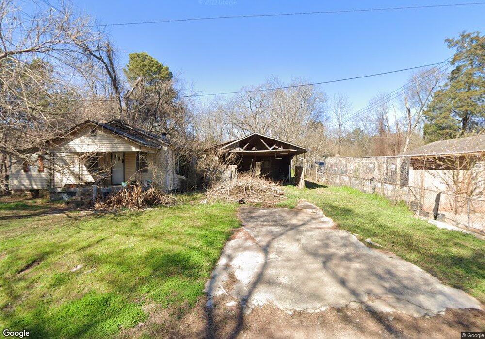
8 11th St Birmingham, AL 35217
Estimated Value: $60,000 - $131,000
3
Beds
1
Bath
1,000
Sq Ft
$82/Sq Ft
Est. Value
About This Home
This home is located at 8 11th St, Birmingham, AL 35217 and is currently estimated at $82,396, approximately $82 per square foot. 8 11th St is a home located in Jefferson County with nearby schools including Fultondale Elementary School and Fultondale High School.
Ownership History
Date
Name
Owned For
Owner Type
Purchase Details
Closed on
Nov 22, 2023
Sold by
Jefferson Cnty Fin'L Svcs Inc
Bought by
Aguilar Joel Armando and Diaz Yeni Yaneth
Current Estimated Value
Purchase Details
Closed on
Mar 14, 2016
Sold by
Ryan Tianna
Bought by
Ray Henry
Purchase Details
Closed on
Apr 18, 2007
Sold by
Thompson Robert Harold and Thompson Gloria Jean
Bought by
Thompson Robert Harold and Thompson Gloria Jean
Purchase Details
Closed on
Jun 28, 2000
Sold by
Jr Smith Margret Alline
Bought by
Thompson Robert Harold and Thompson Gloria Jean
Purchase Details
Closed on
Oct 15, 1997
Sold by
Gloria Jean Thompson Robert Harold
Bought by
Smith Margret Alline and Mccown Joseph H
Home Financials for this Owner
Home Financials are based on the most recent Mortgage that was taken out on this home.
Original Mortgage
$24,000
Interest Rate
7.55%
Mortgage Type
Seller Take Back
Create a Home Valuation Report for This Property
The Home Valuation Report is an in-depth analysis detailing your home's value as well as a comparison with similar homes in the area
Home Values in the Area
Average Home Value in this Area
Purchase History
| Date | Buyer | Sale Price | Title Company |
|---|---|---|---|
| Aguilar Joel Armando | $2,000 | None Listed On Document | |
| Ray Henry | $4,000 | -- | |
| Thompson Robert Harold | -- | Jefferson Title Corporation | |
| Thompson Robert Harold | $28,891 | -- | |
| Smith Margret Alline | $24,000 | Jefferson Title Corporation |
Source: Public Records
Mortgage History
| Date | Status | Borrower | Loan Amount |
|---|---|---|---|
| Previous Owner | Smith Margret Alline | $24,000 |
Source: Public Records
Tax History Compared to Growth
Tax History
| Year | Tax Paid | Tax Assessment Tax Assessment Total Assessment is a certain percentage of the fair market value that is determined by local assessors to be the total taxable value of land and additions on the property. | Land | Improvement |
|---|---|---|---|---|
| 2024 | $568 | $11,340 | -- | -- |
| 2022 | $428 | $8,540 | $1,320 | $7,220 |
| 2021 | $131 | $8,540 | $1,320 | $7,220 |
| 2020 | $131 | $8,540 | $1,320 | $7,220 |
| 2019 | $131 | $4,280 | $0 | $0 |
| 2018 | $131 | $3,620 | $0 | $0 |
| 2017 | $0 | $3,620 | $0 | $0 |
| 2016 | $131 | $3,620 | $0 | $0 |
| 2015 | -- | $3,620 | $0 | $0 |
| 2014 | $233 | $3,560 | $0 | $0 |
| 2013 | $233 | $3,560 | $0 | $0 |
Source: Public Records
Map
Nearby Homes
- 17 5th St
- 2417 Pine Cone Cir
- 2438 Cedar Hill Dr
- 2059 Chenoor Rd
- 646 Valley Crest Dr
- 1024 Timberline Trail
- 1005 Timberline Trail
- 555 Eastbrook Dr
- 4391 Ottawa Dr
- 551 Eastbrook Dr
- 1100 Vail Cir
- 601 Rushing Springs Dr Unit 1
- 517 Eastbrook Dr
- 4535 Shepherd Ln
- 1105 Eastbrook Ln
- 1109 Eastbrook Ln
- 1101 Eastbrook Ln
- 2024 Cedar St
- 2016 Cedar St
- 223 Black Creek Rd