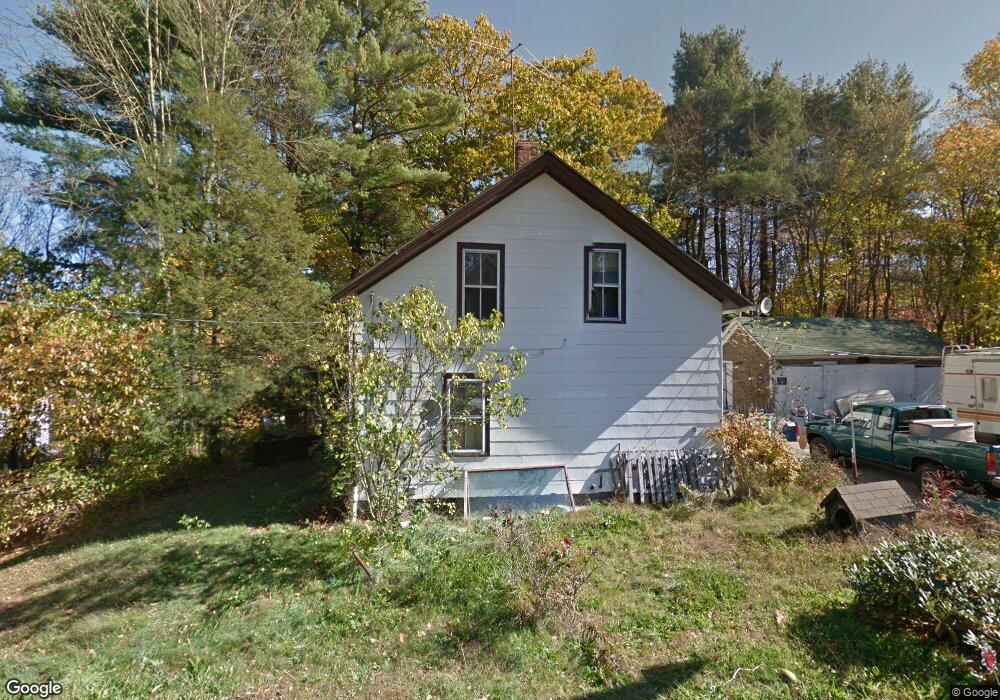
8 1st St Sutton, MA 01590
Estimated Value: $274,000 - $406,000
6
Beds
3
Baths
1,830
Sq Ft
$186/Sq Ft
Est. Value
About This Home
This home is located at 8 1st St, Sutton, MA 01590 and is currently estimated at $340,000, approximately $185 per square foot. 8 1st St is a home located in Worcester County with nearby schools including Sutton Elementary School, Sutton Middle School, and Sutton High School.
Ownership History
Date
Name
Owned For
Owner Type
Purchase Details
Closed on
Jun 27, 2017
Sold by
Holmes Bruce and Holmes Margaret
Bought by
Lavallee Craig and Lavallee Jaclyn
Current Estimated Value
Purchase Details
Closed on
Jun 18, 2001
Sold by
Roaf Mary E Est and Roaf
Bought by
Holmes Bruce and Holmes Margaret
Home Financials for this Owner
Home Financials are based on the most recent Mortgage that was taken out on this home.
Original Mortgage
$107,285
Interest Rate
7.15%
Mortgage Type
Purchase Money Mortgage
Create a Home Valuation Report for This Property
The Home Valuation Report is an in-depth analysis detailing your home's value as well as a comparison with similar homes in the area
Home Values in the Area
Average Home Value in this Area
Purchase History
| Date | Buyer | Sale Price | Title Company |
|---|---|---|---|
| Lavallee Craig | $2,500 | -- | |
| Holmes Bruce | $109,000 | -- |
Source: Public Records
Mortgage History
| Date | Status | Borrower | Loan Amount |
|---|---|---|---|
| Previous Owner | Holmes Bruce | $107,285 |
Source: Public Records
Tax History
| Year | Tax Paid | Tax Assessment Tax Assessment Total Assessment is a certain percentage of the fair market value that is determined by local assessors to be the total taxable value of land and additions on the property. | Land | Improvement |
|---|---|---|---|---|
| 2025 | $2,264 | $170,200 | $170,200 | $0 |
| 2024 | $2,254 | $163,100 | $163,100 | $0 |
| 2023 | $2,236 | $148,400 | $147,500 | $900 |
| 2022 | $2,084 | $118,900 | $118,000 | $900 |
| 2021 | $2,084 | $118,900 | $118,000 | $900 |
| 2020 | $9,128 | $118,900 | $118,000 | $900 |
| 2019 | $2,118 | $120,000 | $118,000 | $2,000 |
| 2018 | $1,815 | $102,300 | $100,300 | $2,000 |
| 2017 | $1,605 | $90,300 | $88,300 | $2,000 |
| 2016 | $1,619 | $90,300 | $88,300 | $2,000 |
| 2015 | $3,271 | $182,100 | $88,300 | $93,800 |
| 2014 | $3,267 | $179,500 | $87,300 | $92,200 |
Source: Public Records
Map
Nearby Homes
- 348 Manchaug Rd
- 6 1st St
- 5 1st St
- 5 B W Second St Unit B
- 5 E 2nd St Unit 5B
- 5 E 2nd St Unit B
- 5 2nd St Unit B
- 4 1st St Unit B
- 8 Second St
- 6 Second St
- 6 Second St
- 6 Second St Unit A
- 10 E 2nd St
- 349 Manchaug Rd
- 4 Second St
- 2 1st St
- 352 Manchaug Rd
- 352 Manchaug Rd Unit 1
- 352 Manchaug Rd Unit 2
- 352 Manchaug Rd Unit C
Your Personal Tour Guide
Ask me questions while you tour the home.