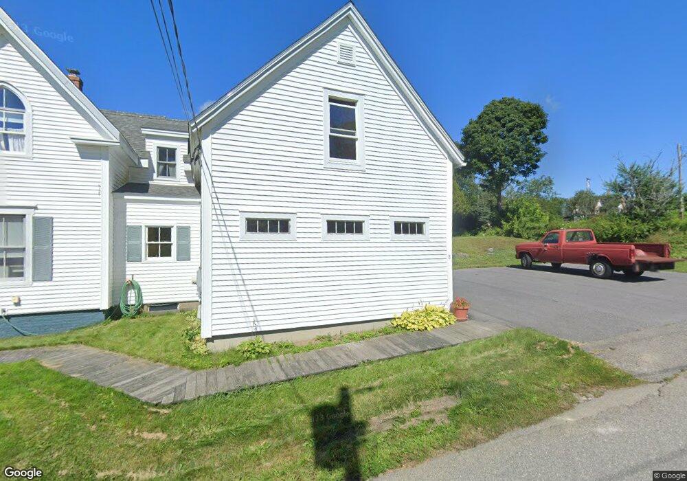
8 Andersen Rd Boothbay, ME 04537
Estimated Value: $597,000 - $728,000
4
Beds
3
Baths
1,105
Sq Ft
$588/Sq Ft
Est. Value
About This Home
This home is located at 8 Andersen Rd, Boothbay, ME 04537 and is currently estimated at $649,783, approximately $588 per square foot. 8 Andersen Rd is a home with nearby schools including Boothbay Region Elementary School and Boothbay Region High School.
Ownership History
Date
Name
Owned For
Owner Type
Purchase Details
Closed on
May 6, 2021
Sold by
Suzanne L Keene 1992 T L and Suzanne Keene
Bought by
Litterio Patrick J
Current Estimated Value
Home Financials for this Owner
Home Financials are based on the most recent Mortgage that was taken out on this home.
Original Mortgage
$384,000
Outstanding Balance
$345,025
Interest Rate
3.1%
Mortgage Type
Purchase Money Mortgage
Estimated Equity
$304,758
Purchase Details
Closed on
Jun 1, 2006
Sold by
Sozanski Stephen R
Bought by
Sozanski Stephen R and Sozanski Alice
Create a Home Valuation Report for This Property
The Home Valuation Report is an in-depth analysis detailing your home's value as well as a comparison with similar homes in the area
Home Values in the Area
Average Home Value in this Area
Purchase History
| Date | Buyer | Sale Price | Title Company |
|---|---|---|---|
| Litterio Patrick J | -- | None Available | |
| Litterio Patrick J | -- | None Available | |
| Sozanski Stephen R | -- | -- | |
| Sozanski Stephen R | -- | -- |
Source: Public Records
Mortgage History
| Date | Status | Borrower | Loan Amount |
|---|---|---|---|
| Open | Litterio Patrick J | $384,000 | |
| Closed | Litterio Patrick J | $384,000 |
Source: Public Records
Tax History
| Year | Tax Paid | Tax Assessment Tax Assessment Total Assessment is a certain percentage of the fair market value that is determined by local assessors to be the total taxable value of land and additions on the property. | Land | Improvement |
|---|---|---|---|---|
| 2025 | $3,653 | $301,879 | $114,765 | $187,114 |
| 2024 | $3,426 | $301,879 | $114,765 | $187,114 |
| 2023 | $3,034 | $301,879 | $114,765 | $187,114 |
| 2022 | $2,807 | $301,879 | $114,765 | $187,114 |
| 2021 | $2,883 | $301,879 | $114,765 | $187,114 |
| 2020 | $2,898 | $301,879 | $114,765 | $187,114 |
| 2019 | $2,853 | $301,879 | $114,765 | $187,114 |
| 2018 | $2,807 | $301,879 | $114,765 | $187,114 |
| 2017 | $2,986 | $324,600 | $150,700 | $173,900 |
| 2016 | $2,856 | $324,600 | $150,700 | $173,900 |
| 2015 | $2,840 | $324,600 | $150,700 | $173,900 |
| 2014 | $2,759 | $324,600 | $150,700 | $173,900 |
Source: Public Records
Map
Nearby Homes
- 210 Ocean Point Rd
- 239 Ocean Point Rd
- 6 Abenaki Rd
- 74 & 76 Bay St
- 62 Murphy Rd
- 642 Ocean Point Rd
- 63 Townsend Ave
- 40 Atlantic Ave
- 43 Oak St
- 37 Townsend Ave
- 21 Lobster Cove Rd
- 34 Townsend Ave
- 27 Townsend Ave
- 17 Fire Road 5
- 137 Miles Rd
- 8 Country Club Rd
- 53 Commercial St
- 26 Sea St
- 30 Village Ct Unit 36
- 133 Atlantic Ave Unit 81A
- 5 Andersen Rd
- 8 Andersen St
- 164 Ocean Point Rd
- 7 Andersen Rd
- 9 Andersen Rd
- 5 Anderson St
- 0 Barlow Hill Rd Unit 262314
- 0 Barlow Hill Rd Unit 247773
- 0 Barlow Hill Rd Unit 182379
- 0 Barlow Hill Rd Unit 1268759
- 162 Ocean Point Rd
- 15 Anderson St
- 15 Andersen Rd
- 159/161 Ocean Point Rd
- 159 Ocean Point Rd
- 1 Barlow Hill Rd
- 11 Andersen Rd
- 19 Andersen Rd
- 171 Ocean Point Rd
- 182 Ocean Point Rd
Your Personal Tour Guide
Ask me questions while you tour the home.