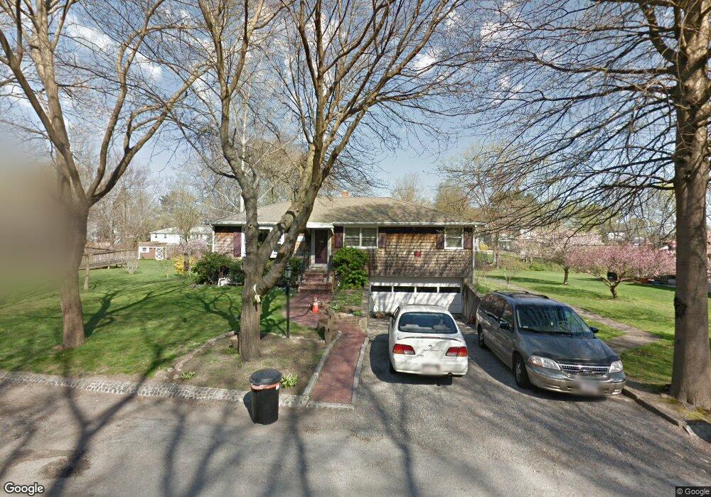
8 Ashland Place Taunton, MA 02780
City Center NeighborhoodEstimated Value: $299,000 - $487,000
4
Beds
1
Bath
1,444
Sq Ft
$287/Sq Ft
Est. Value
About This Home
This home is located at 8 Ashland Place, Taunton, MA 02780 and is currently estimated at $414,928, approximately $287 per square foot. 8 Ashland Place is a home located in Bristol County with nearby schools including Elizabeth Pole School, Taunton High School, and John F. Parker Middle School.
Ownership History
Date
Name
Owned For
Owner Type
Purchase Details
Closed on
Jun 28, 2016
Sold by
Clark James A and Clark Rhonsa
Bought by
8 Ashland Place T
Current Estimated Value
Purchase Details
Closed on
May 29, 1998
Sold by
North Susan E and North John J
Bought by
Clark James and Clark Rhonda
Home Financials for this Owner
Home Financials are based on the most recent Mortgage that was taken out on this home.
Original Mortgage
$127,100
Interest Rate
7.12%
Mortgage Type
Purchase Money Mortgage
Purchase Details
Closed on
May 27, 1992
Sold by
Robinson Wm and Robinson Patricia
Bought by
Mccaffrey Susan and North John J
Home Financials for this Owner
Home Financials are based on the most recent Mortgage that was taken out on this home.
Original Mortgage
$92,000
Interest Rate
8.7%
Mortgage Type
Purchase Money Mortgage
Create a Home Valuation Report for This Property
The Home Valuation Report is an in-depth analysis detailing your home's value as well as a comparison with similar homes in the area
Home Values in the Area
Average Home Value in this Area
Purchase History
| Date | Buyer | Sale Price | Title Company |
|---|---|---|---|
| 8 Ashland Place T | -- | -- | |
| Clark James | $128,000 | -- | |
| Mccaffrey Susan | $115,000 | -- |
Source: Public Records
Mortgage History
| Date | Status | Borrower | Loan Amount |
|---|---|---|---|
| Previous Owner | Mccaffrey Susan | $164,000 | |
| Previous Owner | Mccaffrey Susan | $127,100 | |
| Previous Owner | Mccaffrey Susan | $92,000 |
Source: Public Records
Tax History Compared to Growth
Tax History
| Year | Tax Paid | Tax Assessment Tax Assessment Total Assessment is a certain percentage of the fair market value that is determined by local assessors to be the total taxable value of land and additions on the property. | Land | Improvement |
|---|---|---|---|---|
| 2025 | $3,815 | $348,700 | $97,100 | $251,600 |
| 2024 | $3,545 | $316,800 | $97,100 | $219,700 |
| 2023 | $3,526 | $292,600 | $97,100 | $195,500 |
| 2022 | $3,374 | $256,000 | $80,900 | $175,100 |
| 2021 | $3,030 | $213,400 | $73,500 | $139,900 |
| 2020 | $3,014 | $202,800 | $73,500 | $129,300 |
| 2019 | $3,051 | $193,600 | $73,500 | $120,100 |
| 2018 | $2,847 | $181,100 | $74,300 | $106,800 |
| 2017 | $3,139 | $199,800 | $88,000 | $111,800 |
| 2016 | $3,025 | $192,900 | $85,500 | $107,400 |
| 2015 | $2,984 | $198,800 | $83,900 | $114,900 |
| 2014 | $2,888 | $197,700 | $83,900 | $113,800 |
Source: Public Records
Map
Nearby Homes
- 125 Belmont St
- 80 Arlington St
- 58 Ashland St
- 30 Buffington St
- 2 Elmhurst St
- 68 Dean St
- 34 Grant St
- 12 Chestnut St Unit A
- 29 Grant St
- 25 Fayette Place
- 90 School St
- 1 Benefit St
- 176 School St
- 38 Trescott St
- 215 Longmeadow Rd Unit 604
- 215 Longmeadow Rd Unit 403
- 5 Dean Ave
- 14 Presbrey Ave
- 14 Wilbur St
- 0 M64 L39 Knapp St
- 6 Ashland Place
- 10 Ashland Place
- 119 Belmont St
- 105 Belmont St
- 4 Ashland Place
- 95 Arlington St
- 101 Belmont St
- 93 Arlington St
- 131 Belmont St
- 87 Arlington St
- 99 Arlington St
- 29 Ashland St
- 25 Ashland St
- 35 Ashland St
- 27 Ashland St
- 135 Belmont St
- 37 Ashland St
- 126 Belmont St
- 126 Belmont St Unit 1
- 118 Belmont St