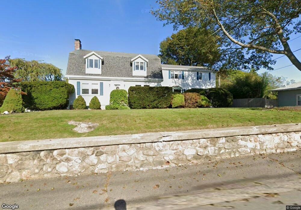
8 Atlantic Rd Gloucester, MA 01930
East Gloucester NeighborhoodEstimated Value: $1,403,000 - $2,121,000
Studio
3
Baths
--
Sq Ft
18,861
Sq Ft Lot
About This Home
This home is located at 8 Atlantic Rd, Gloucester, MA 01930 and is currently estimated at $1,798,135. 8 Atlantic Rd is a home located in Essex County with nearby schools including East Gloucester Elementary School, Ralph B O'maley Middle School, and Gloucester High School.
Ownership History
Date
Name
Owned For
Owner Type
Purchase Details
Closed on
Nov 21, 2022
Sold by
Greely Helen M
Bought by
Greely Rt
Current Estimated Value
Purchase Details
Closed on
Jan 7, 2008
Sold by
Greely Helen M and Greely James C
Bought by
Greely Helen M
Create a Home Valuation Report for This Property
The Home Valuation Report is an in-depth analysis detailing your home's value as well as a comparison with similar homes in the area
Home Values in the Area
Average Home Value in this Area
Purchase History
| Date | Buyer | Sale Price | Title Company |
|---|---|---|---|
| Greely Rt | -- | None Available | |
| Greely Helen M | -- | -- | |
| Greely Helen M | -- | -- |
Source: Public Records
Tax History
| Year | Tax Paid | Tax Assessment Tax Assessment Total Assessment is a certain percentage of the fair market value that is determined by local assessors to be the total taxable value of land and additions on the property. | Land | Improvement |
|---|---|---|---|---|
| 2025 | $15,046 | $1,547,900 | $542,200 | $1,005,700 |
| 2024 | $14,156 | $1,454,900 | $409,700 | $1,045,200 |
| 2023 | $13,678 | $1,291,600 | $365,800 | $925,800 |
| 2022 | $13,211 | $1,126,300 | $318,200 | $808,100 |
| 2021 | $12,858 | $1,033,600 | $289,100 | $744,500 |
| 2020 | $11,892 | $964,500 | $237,000 | $727,500 |
| 2019 | $11,322 | $892,200 | $237,000 | $655,200 |
| 2018 | $11,325 | $875,900 | $237,000 | $638,900 |
| 2017 | $10,991 | $833,300 | $225,700 | $607,600 |
| 2016 | $10,161 | $746,600 | $214,000 | $532,600 |
| 2015 | $9,711 | $711,400 | $214,000 | $497,400 |
Source: Public Records
Map
Nearby Homes
- 70 Bass Ave
- 26 Marina Dr
- 3 Mondello Square
- 11 Wall St Unit R
- 36 Eastern Ave
- 78 Thatcher Rd Unit 6
- 25 Salt Island Rd
- 32 Witham St Unit B
- 197 E Main St Unit 1
- 21 Marble Rd
- 14R Spring St Unit 3
- 23 Mount Vernon St
- 60 Rocky Neck Ave Unit 202
- 73 Rocky Neck Ave Unit 2
- 10 Seaview Rd
- 50 Warner St
- 191 Main St Unit 3
- 191 Main St Unit 2A
- 113 Pleasant St
- 1 Wonson St
- 6 Atlantic Rd
- 9 Beach Rd
- 11 Beach Rd
- 1 Mallard Way
- 7 Beach Rd
- 4 Atlantic Rd
- 9 Atlantic Rd
- 9 Atlantic Rd Unit 2
- 5 Beach Rd
- 2 Mallard Way
- 14 Atlantic Rd Unit 5
- 14 Atlantic Rd Unit 4
- 14 Atlantic Rd Unit 3
- 14 Atlantic Rd Unit 2
- 14 Atlantic Rd Unit 1
- 14 Atlantic Rd
- 14 Atlantic Rd Unit 5
- 107 Bass Ave
- 109 Bass Ave
- 111 Bass Ave
Your Personal Tour Guide
Ask me questions while you tour the home.