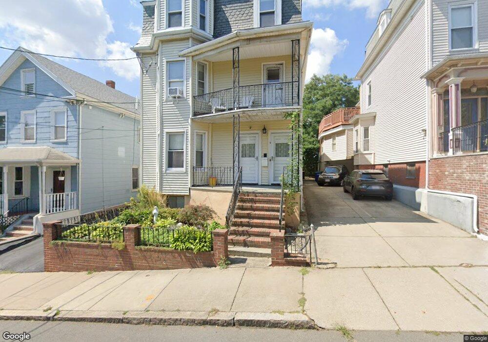
8 Austin St Somerville, MA 02145
East Somerville NeighborhoodEstimated Value: $1,277,000 - $1,481,000
7
Beds
4
Baths
3,866
Sq Ft
$364/Sq Ft
Est. Value
About This Home
This home is located at 8 Austin St, Somerville, MA 02145 and is currently estimated at $1,405,333, approximately $363 per square foot. 8 Austin St is a home located in Middlesex County with nearby schools including Somerville High School, Prospect Hill Academy Upper Elementary Campus, and Bright Future Educare Center.
Ownership History
Date
Name
Owned For
Owner Type
Purchase Details
Closed on
May 25, 2023
Sold by
Aluia Vito S
Bought by
Aluia Family Joint T
Current Estimated Value
Purchase Details
Closed on
Sep 9, 2022
Sold by
Meirowitz Randy E and Meirowitz Agnes A
Bought by
Aluia Vito S
Purchase Details
Closed on
Sep 7, 2022
Sold by
Aluia Anthony F
Bought by
Aluia Vito S
Purchase Details
Closed on
Sep 6, 2022
Sold by
Aluia Joseph
Bought by
Aluia Vito S
Purchase Details
Closed on
Jan 19, 1968
Bought by
Aluia Antonio and Aluia Rosalia
Create a Home Valuation Report for This Property
The Home Valuation Report is an in-depth analysis detailing your home's value as well as a comparison with similar homes in the area
Home Values in the Area
Average Home Value in this Area
Purchase History
| Date | Buyer | Sale Price | Title Company |
|---|---|---|---|
| Aluia Family Joint T | -- | None Available | |
| Aluia Vito S | -- | None Available | |
| Aluia Vito S | -- | None Available | |
| Aluia Vito S | -- | None Available | |
| Aluia Antonio | $18,000 | -- |
Source: Public Records
Tax History
| Year | Tax Paid | Tax Assessment Tax Assessment Total Assessment is a certain percentage of the fair market value that is determined by local assessors to be the total taxable value of land and additions on the property. | Land | Improvement |
|---|---|---|---|---|
| 2025 | $13,735 | $1,258,900 | $402,700 | $856,200 |
| 2024 | $12,852 | $1,221,700 | $402,700 | $819,000 |
| 2023 | $12,552 | $1,213,900 | $402,700 | $811,200 |
| 2022 | $12,011 | $1,179,900 | $383,500 | $796,400 |
| 2021 | $11,176 | $1,096,800 | $378,400 | $718,400 |
| 2020 | $10,432 | $1,033,900 | $363,800 | $670,100 |
| 2019 | $9,039 | $840,100 | $301,800 | $538,300 |
| 2018 | $7,838 | $693,000 | $241,300 | $451,700 |
| 2017 | $7,766 | $665,500 | $227,600 | $437,900 |
| 2016 | $7,180 | $573,000 | $159,900 | $413,100 |
| 2015 | $7,084 | $561,800 | $159,100 | $402,700 |
Source: Public Records
Map
Nearby Homes
- 4 George St Unit 1
- 3 Franklin St Unit C
- 31 Wisconsin Ave Unit 1
- 5 Brook St
- 32 Pinckney St
- 4 Cross St
- 2 Hillside Ave
- 78 Mount Vernon St
- 43 Cross St
- 7 Washington St
- 14 Bonair St Unit 14
- 17 Kensington Ave
- 34 Franklin Ave
- 19 Everett Ave
- 84 Cross St
- 11 Macarthur St Unit B
- 11 Macarthur St Unit A
- 76 Franklin St
- 129 Glen St Unit B
- 36 Everett Ave
- 6 Austin St
- 10 Austin St Unit 3
- 10 Austin St Unit 1
- 10 Austin St
- 10 Austin St Unit 2
- 10 Austin Ln
- 4 Austin St
- 4 Austin St Unit 1
- 4 Austin St Unit 2
- 12 Austin St
- 9 Pennsylvania Ave
- 67 Broadway Unit 2&3
- 67 Broadway Unit 3
- 67 Broadway Unit 2
- 67 Broadway
- 2 Austin St
- 14 Austin St
- 11 Pennsylvania Ave Unit 3
- 7 Austin St Unit 7B
- 7 Austin St Unit 7A
Your Personal Tour Guide
Ask me questions while you tour the home.