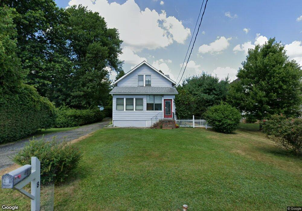
8 Baird Place Whippany, NJ 07981
Estimated Value: $461,277 - $694,000
--
Bed
--
Bath
1,172
Sq Ft
$482/Sq Ft
Est. Value
About This Home
This home is located at 8 Baird Place, Whippany, NJ 07981 and is currently estimated at $564,319, approximately $481 per square foot. 8 Baird Place is a home located in Morris County with nearby schools including Whippany Park High School, Arrow Academy, and The Morristown-Beard School.
Ownership History
Date
Name
Owned For
Owner Type
Purchase Details
Closed on
Mar 28, 2001
Sold by
Briggs Miller Stacy and Miller Michael E
Bought by
Kupper Harry J
Current Estimated Value
Home Financials for this Owner
Home Financials are based on the most recent Mortgage that was taken out on this home.
Original Mortgage
$176,700
Outstanding Balance
$64,847
Interest Rate
6.96%
Estimated Equity
$499,472
Create a Home Valuation Report for This Property
The Home Valuation Report is an in-depth analysis detailing your home's value as well as a comparison with similar homes in the area
Home Values in the Area
Average Home Value in this Area
Purchase History
| Date | Buyer | Sale Price | Title Company |
|---|---|---|---|
| Kupper Harry J | $189,000 | -- |
Source: Public Records
Mortgage History
| Date | Status | Borrower | Loan Amount |
|---|---|---|---|
| Open | Kupper Harry J | $176,700 |
Source: Public Records
Tax History Compared to Growth
Tax History
| Year | Tax Paid | Tax Assessment Tax Assessment Total Assessment is a certain percentage of the fair market value that is determined by local assessors to be the total taxable value of land and additions on the property. | Land | Improvement |
|---|---|---|---|---|
| 2025 | $5,464 | $259,200 | $166,800 | $92,400 |
| 2024 | $5,441 | $259,200 | $166,800 | $92,400 |
| 2023 | $5,441 | $259,200 | $166,800 | $92,400 |
| 2022 | $4,977 | $259,200 | $166,800 | $92,400 |
| 2021 | $4,977 | $259,200 | $166,800 | $92,400 |
| 2020 | $4,889 | $259,200 | $166,800 | $92,400 |
| 2019 | $4,904 | $259,200 | $166,800 | $92,400 |
| 2018 | $4,819 | $259,200 | $166,800 | $92,400 |
| 2017 | $4,676 | $259,200 | $166,800 | $92,400 |
| 2016 | $4,609 | $259,200 | $166,800 | $92,400 |
| 2015 | $4,425 | $259,200 | $166,800 | $92,400 |
| 2014 | $4,329 | $259,200 | $166,800 | $92,400 |
Source: Public Records
Map
Nearby Homes
- 26 David Dr
- 45 Polhemus Terrace
- 00 Algonquin Pkwy
- 11 Nemic Ln
- 39 Lefke Ln
- 96 Parsippany Rd
- 2003 Vermont Terrace Unit 2003
- Monterey Plan at The Grove - The Monterey Collection
- Pershing Plan at The Grove - The Pershing Collection
- 26 Gladstone Ct
- 42 Gladstone Ct
- 34 Gladstone Ct
- 14 Gladstone Ct
- 74 Preston Rd
- 92 Sunrise Dr
- 709 Brook Hollow Dr Unit 709
- 3306 Appleton Way
- 72 Schindler Ct
- 89 Schindler Ct
- 53 Westminster Dr
- 12 Baird Place
- 6 Baird Place
- 4 Baird Place
- 61 Troy Hills Rd
- 65 Troy Hills Rd
- 14 Baird Place
- 9 Baird Place
- 67 Troy Hills Rd
- 57 Troy Hills Rd
- 24 Gladstone Ct
- 29 Gladstone Ct
- 8 Gladstone Ct
- 6 Gladstone Ct
- 15 Baird Place
- 69 Troy Hills Rd
- 17 Baird Place
- 18 Baird Place
- 20 Cortright Rd
- 6 David Dr
- 62 Troy Hills Rd