
Seller's Agent in 2025
Liz Puchala
Lamacchia Realty, Inc.
(774) 276-5986
1 in this area
50 Total Sales
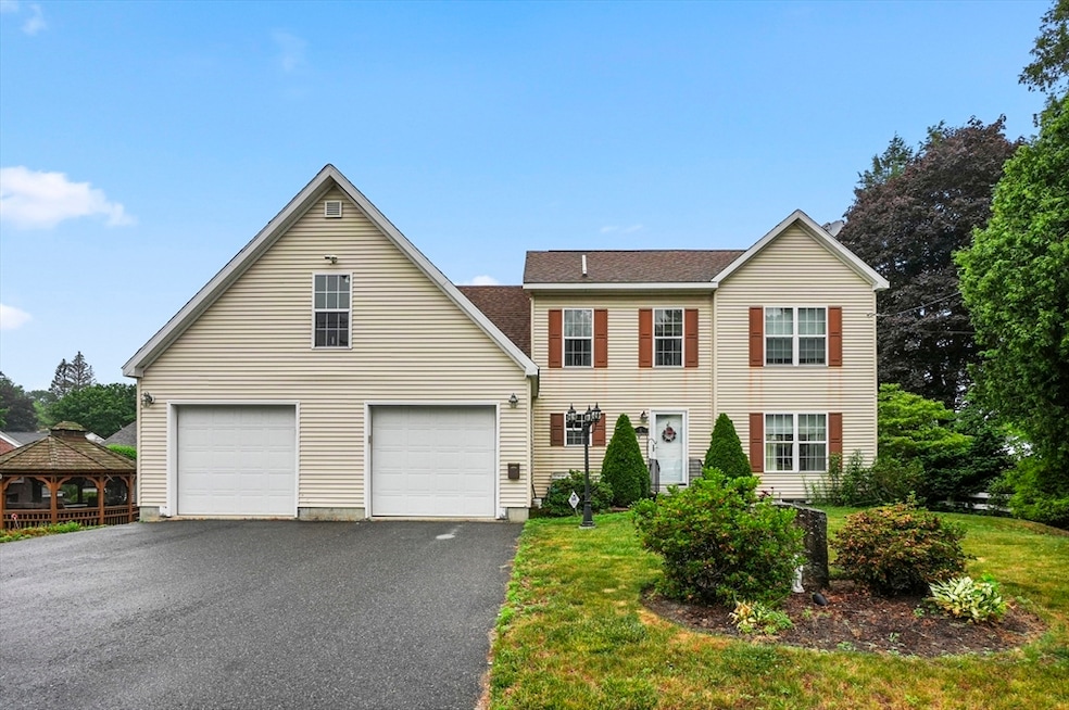
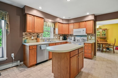
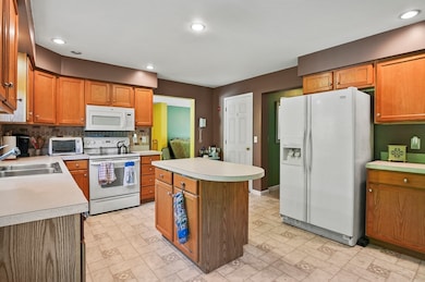
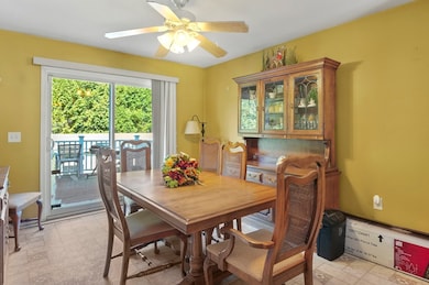
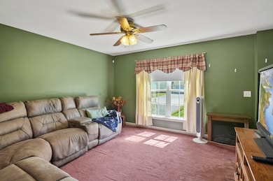
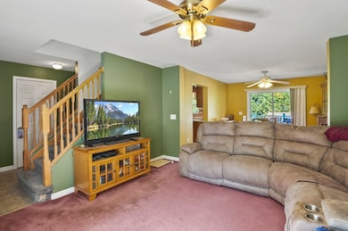
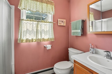
Welcome to this spacious colonial nestled in the Grafton Hill area of Worcester. Step inside and you’re greeted by a spacious kitchen featuring plenty of cabinets and a center island. The dining room offers sliding glass doors open to your own private deck and also flows effortlessly into the open concept living room - ideal for gathering with family or friends. Off the kitchen, you’ll find a second large family room, offering endless possibilities. A mudroom/laundry area with a bathroom connects directly to the two-car garage, keeping life organized and functional. Upstairs you will find three generously sized bedrooms and two full bathrooms. Over the garage, unfinished space is waiting for your imagination. The lower level also holds potential, with a full basement ready to be transformed into the perfect bonus area. This home offers the space and flexibility you’ve been searching for. Don’t miss the opportunity to make it your own!
| Date | Type | Sale Price | Title Company |
|---|---|---|---|
| Deed | $515,000 | -- | |
| Deed | -- | -- |
| Date | Status | Loan Amount | Loan Type |
|---|---|---|---|
| Open | $499,500 | New Conventional | |
| Previous Owner | $280,000 | Purchase Money Mortgage |
| Date | Event | Price | List to Sale | Price per Sq Ft |
|---|---|---|---|---|
| 12/03/2025 12/03/25 | Sold | $515,000 | +3.2% | $238 / Sq Ft |
| 09/26/2025 09/26/25 | Pending | -- | -- | -- |
| 09/18/2025 09/18/25 | For Sale | $499,000 | -- | $230 / Sq Ft |
| Year | Tax Paid | Tax Assessment Tax Assessment Total Assessment is a certain percentage of the fair market value that is determined by local assessors to be the total taxable value of land and additions on the property. | Land | Improvement |
|---|---|---|---|---|
| 2025 | $7,038 | $533,600 | $117,700 | $415,900 |
| 2024 | $6,920 | $503,300 | $117,700 | $385,600 |
| 2023 | $6,803 | $474,400 | $102,400 | $372,000 |
| 2022 | $6,379 | $419,400 | $81,900 | $337,500 |
| 2021 | $6,556 | $402,700 | $65,500 | $337,200 |
| 2020 | $6,370 | $374,700 | $65,500 | $309,200 |
| 2019 | $6,138 | $341,000 | $58,900 | $282,100 |
| 2018 | $6,049 | $319,900 | $58,900 | $261,000 |
| 2017 | $5,787 | $301,100 | $58,900 | $242,200 |
| 2016 | $5,864 | $284,500 | $42,900 | $241,600 |
| 2015 | $5,710 | $284,500 | $42,900 | $241,600 |
| 2014 | $5,559 | $284,500 | $42,900 | $241,600 |
Seller's Agent in 2025
Liz Puchala
Lamacchia Realty, Inc.
(774) 276-5986
1 in this area
50 Total Sales
Buyer's Agent in 2025
Eric Stinehelfer
Mathieu Newton Sotheby's International Realty
(978) 888-5640
1 in this area
55 Total Sales
Source: MLS Property Information Network (MLS PIN)
MLS Number: 73432615
APN: WORC-000035-000019-000250-000002
Disclaimer: Certain information contained herein is derived from information provided by parties other than Homes.com. All information provided is deemed reliable, but is not guaranteed to be accurate and should be independently verified.
![]() The property listing data and information, or the Images, set forth herein were provided to MLS Property Information Network, Inc. from third party sources, including sellers, lessors and public records, and were compiled by MLS Property Information Network, Inc. The property listing data and information, and the Images, are for the personal, non-commercial use of consumers having a good faith interest in purchasing or leasing listed properties of the type displayed to them and may not be used for any purpose other than to identify prospective properties which such consumers may have a good faith interest in purchasing or leasing. MLS Property Information Network, Inc. and its subscribers disclaim any and all representations and warranties as to the accuracy of the property listing data and information, or as to the accuracy of any of the Images, set forth herein.
The property listing data and information, or the Images, set forth herein were provided to MLS Property Information Network, Inc. from third party sources, including sellers, lessors and public records, and were compiled by MLS Property Information Network, Inc. The property listing data and information, and the Images, are for the personal, non-commercial use of consumers having a good faith interest in purchasing or leasing listed properties of the type displayed to them and may not be used for any purpose other than to identify prospective properties which such consumers may have a good faith interest in purchasing or leasing. MLS Property Information Network, Inc. and its subscribers disclaim any and all representations and warranties as to the accuracy of the property listing data and information, or as to the accuracy of any of the Images, set forth herein.
Ask me questions while you tour the home.