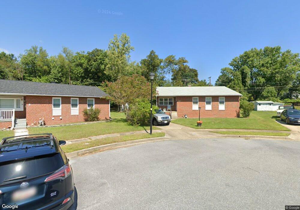
8 Calgary Ct Randallstown, MD 21133
Estimated Value: $316,217 - $396,000
Studio
2
Baths
1,270
Sq Ft
$287/Sq Ft
Est. Value
About This Home
This home is located at 8 Calgary Ct, Randallstown, MD 21133 and is currently estimated at $364,804, approximately $287 per square foot. 8 Calgary Ct is a home located in Baltimore County with nearby schools including Randallstown Elementary School, Deer Park Middle Magnet School, and Randallstown High School.
Ownership History
Date
Name
Owned For
Owner Type
Purchase Details
Closed on
Aug 28, 2006
Sold by
Holmes Jesse
Bought by
Holmes Jesse and Gaskins Sheila
Current Estimated Value
Purchase Details
Closed on
Aug 2, 2006
Sold by
Holmes Jesse
Bought by
Holmes Jesse and Gaskins Sheila
Purchase Details
Closed on
Apr 13, 2006
Sold by
Holmes Jesse J
Bought by
Holmes Jesse
Purchase Details
Closed on
Mar 9, 2006
Sold by
Holmes Jesse J
Bought by
Holmes Jesse
Purchase Details
Closed on
Mar 10, 1989
Sold by
Closic Joseph M
Bought by
Holmes Jesse J
Create a Home Valuation Report for This Property
The Home Valuation Report is an in-depth analysis detailing your home's value as well as a comparison with similar homes in the area
Home Values in the Area
Average Home Value in this Area
Purchase History
| Date | Buyer | Sale Price | Title Company |
|---|---|---|---|
| Holmes Jesse | -- | -- | |
| Holmes Jesse | -- | -- | |
| Holmes Jesse | $10,000 | -- | |
| Holmes Jesse | $10,000 | -- | |
| Holmes Jesse J | $81,000 | -- |
Source: Public Records
Tax History
| Year | Tax Paid | Tax Assessment Tax Assessment Total Assessment is a certain percentage of the fair market value that is determined by local assessors to be the total taxable value of land and additions on the property. | Land | Improvement |
|---|---|---|---|---|
| 2025 | $3,098 | $281,067 | -- | -- |
| 2024 | $3,098 | $251,400 | $74,700 | $176,700 |
| 2023 | $1,480 | $239,367 | $0 | $0 |
| 2022 | $2,821 | $227,333 | $0 | $0 |
| 2021 | $2,624 | $215,300 | $56,700 | $158,600 |
| 2020 | $2,624 | $214,533 | $0 | $0 |
| 2019 | $2,524 | $213,767 | $0 | $0 |
| 2018 | $2,769 | $213,000 | $56,700 | $156,300 |
| 2017 | $2,561 | $191,367 | $0 | $0 |
| 2016 | $2,194 | $169,733 | $0 | $0 |
| 2015 | $2,194 | $148,100 | $0 | $0 |
| 2014 | $2,194 | $148,100 | $0 | $0 |
Source: Public Records
Map
Nearby Homes
- 9063 Meadow Heights Rd
- 1205/99 Winands Rd
- 3723 Eastman Rd
- 8829 Sigrid Rd
- 4048 Carthage Rd
- 9202 Samoset Rd
- 4226 Huntshire Rd
- 9208A Liberty Rd
- 3 Dajobe Ct
- 3506 Bayer Ave
- 4112 Spider Lily Way
- 4023 Paige View Rd
- 8604 Woodbrook Ct
- 9129 Marlove Oaks Ln
- 8811 Stoneridge Cir Unit 103
- 8541 Lucerne Rd
- 8809 Stone Ridge Cir Unit 204
- 9130 Marlove Oaks Ln
- 9104 Marlove Oaks Ln
- 8807 Stone Ridge Cir Unit 101
Your Personal Tour Guide
Ask me questions while you tour the home.