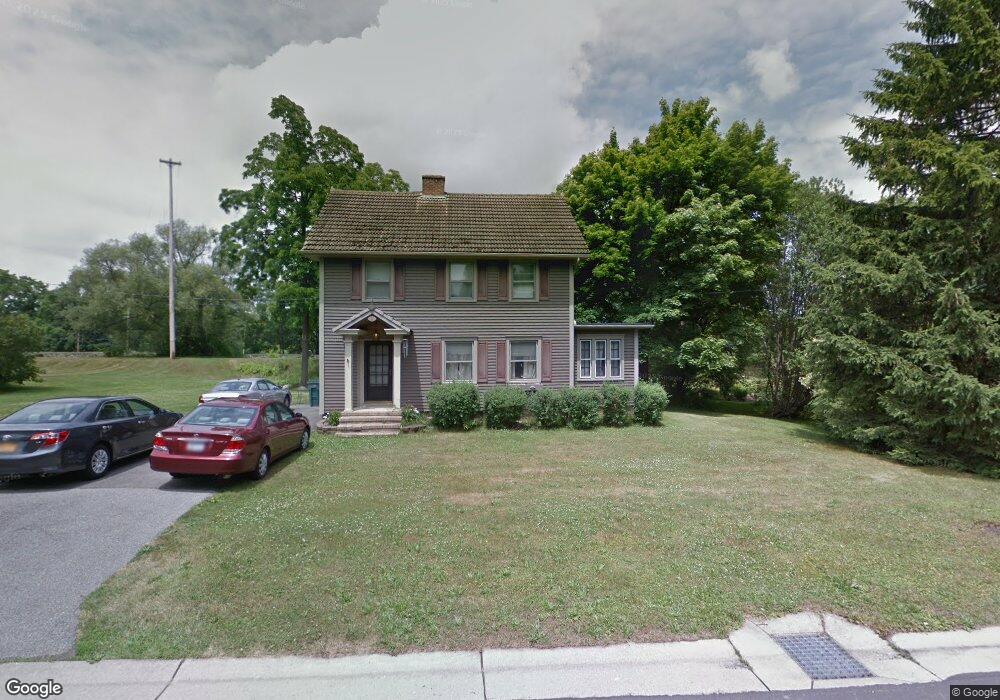
8 Canalside Dr Spencerport, NY 14559
Estimated Value: $270,000 - $319,000
3
Beds
1
Bath
1,440
Sq Ft
$198/Sq Ft
Est. Value
About This Home
This home is located at 8 Canalside Dr, Spencerport, NY 14559 and is currently estimated at $285,508, approximately $198 per square foot. 8 Canalside Dr is a home located in Monroe County with nearby schools including A M Cosgrove Middle School and Spencerport High School.
Ownership History
Date
Name
Owned For
Owner Type
Purchase Details
Closed on
Jun 17, 2014
Sold by
Jenco David A and Jenco Michele G
Bought by
Jenco Michele G
Current Estimated Value
Home Financials for this Owner
Home Financials are based on the most recent Mortgage that was taken out on this home.
Original Mortgage
$75,000
Outstanding Balance
$23,363
Interest Rate
4.19%
Mortgage Type
New Conventional
Estimated Equity
$262,145
Purchase Details
Closed on
Jan 24, 2002
Sold by
Miller James H
Bought by
Jenco David A
Create a Home Valuation Report for This Property
The Home Valuation Report is an in-depth analysis detailing your home's value as well as a comparison with similar homes in the area
Home Values in the Area
Average Home Value in this Area
Purchase History
| Date | Buyer | Sale Price | Title Company |
|---|---|---|---|
| Jenco Michele G | -- | None Available | |
| Jenco David A | $80,000 | Robert Gray |
Source: Public Records
Mortgage History
| Date | Status | Borrower | Loan Amount |
|---|---|---|---|
| Open | Jenco Michele G | $75,000 |
Source: Public Records
Tax History Compared to Growth
Tax History
| Year | Tax Paid | Tax Assessment Tax Assessment Total Assessment is a certain percentage of the fair market value that is determined by local assessors to be the total taxable value of land and additions on the property. | Land | Improvement |
|---|---|---|---|---|
| 2024 | $5,924 | $206,600 | $81,000 | $125,600 |
| 2023 | $4,884 | $111,600 | $44,900 | $66,700 |
| 2022 | $5,238 | $111,600 | $44,900 | $66,700 |
| 2021 | $5,111 | $111,600 | $44,900 | $66,700 |
| 2020 | $4,312 | $111,600 | $44,900 | $66,700 |
| 2019 | $4,077 | $111,600 | $44,900 | $66,700 |
| 2018 | $4,280 | $111,600 | $44,900 | $66,700 |
| 2017 | $1,740 | $101,500 | $44,900 | $56,600 |
| 2016 | $4,077 | $101,500 | $45,700 | $55,800 |
| 2015 | -- | $101,500 | $45,700 | $55,800 |
| 2014 | -- | $101,500 | $30,400 | $71,100 |
Source: Public Records
Map
Nearby Homes
- 154 Amity St
- 78 Clark St
- 0000 Bay Leaf Cir Lot#119
- 000
- 00 Bay Leaf Circle Lot#117
- 0 Unit R1620030
- 87 Highview Dr
- 326 Village Walk Cir
- 62 Clearview Dr
- 24 Birdsong Terrace
- 28 Coolidge Ave
- 64 Coleman Ave
- 92 Coolidge Ave
- 76 Hawthorne Dr
- 607 Trimmer Rd
- 420 Ogden Parma Town Line Rd
- 49 Hillcrest Dr
- 2283 S Union St
- 4028 Canal Rd
- 57 Glenn Haven
- 4 Canalside Dr
- 10 Canalside Dr
- 2 Canalside Dr
- 3 Canalside Dr
- 21 Ballard Ave
- 14 Ballard Ave
- 1 Canalside Dr
- 12 Canalside Dr
- 20 Ballard Ave
- 25 Ballard Ave
- 4 Waterside Ln
- 26 Ballard Ave
- 3 Waterside Ln
- 2 Orchard Rd
- 31 Ballard Ave
- 00 Canalside Dr (Waterside Lane)
- 9 Canalside Dr
- 32 Evergreen St
- 18 Canalside Dr
- 32 Ballard Ave