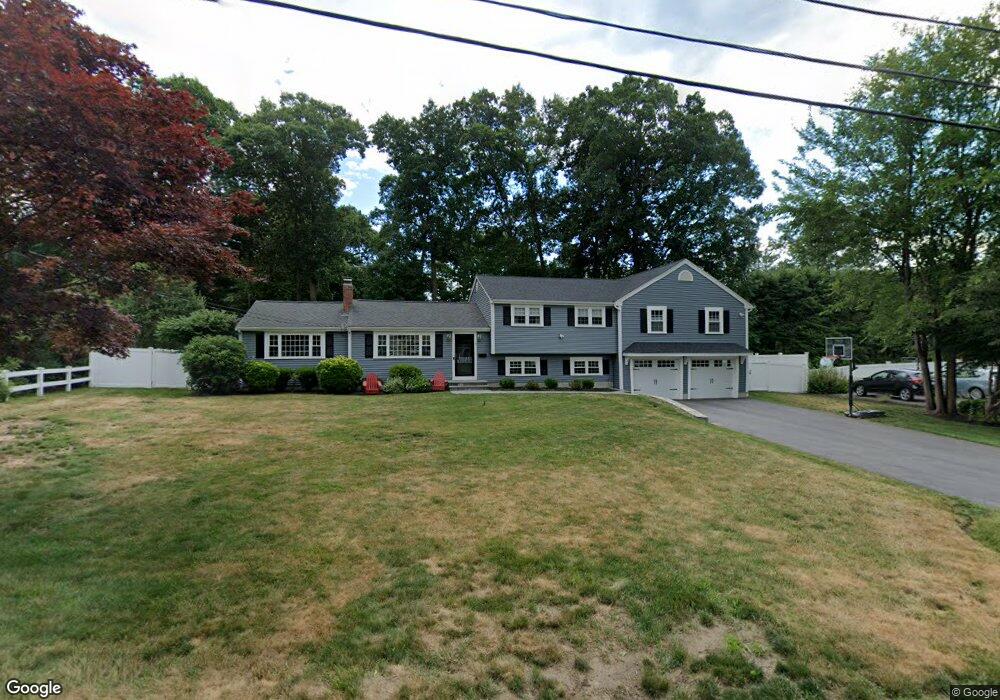
8 Carlson Cir Natick, MA 01760
Estimated Value: $864,000 - $1,021,052
3
Beds
2
Baths
1,700
Sq Ft
$568/Sq Ft
Est. Value
About This Home
This home is located at 8 Carlson Cir, Natick, MA 01760 and is currently estimated at $966,013, approximately $568 per square foot. 8 Carlson Cir is a home located in Middlesex County with nearby schools including Natick High School, J F Kennedy Middle School, and Johnson Elementary School.
Ownership History
Date
Name
Owned For
Owner Type
Purchase Details
Closed on
Apr 23, 2018
Sold by
Salis Peter G
Bought by
Salis Peter G and Salis Mara M
Current Estimated Value
Purchase Details
Closed on
Jan 10, 2005
Sold by
Gleeson Caryl A
Bought by
Salis Peter G
Home Financials for this Owner
Home Financials are based on the most recent Mortgage that was taken out on this home.
Original Mortgage
$268,000
Interest Rate
5.75%
Mortgage Type
Purchase Money Mortgage
Create a Home Valuation Report for This Property
The Home Valuation Report is an in-depth analysis detailing your home's value as well as a comparison with similar homes in the area
Home Values in the Area
Average Home Value in this Area
Purchase History
| Date | Buyer | Sale Price | Title Company |
|---|---|---|---|
| Salis Peter G | -- | -- | |
| Salis Peter G | $451,000 | -- |
Source: Public Records
Mortgage History
| Date | Status | Borrower | Loan Amount |
|---|---|---|---|
| Previous Owner | Salis Peter G | $268,000 |
Source: Public Records
Tax History
| Year | Tax Paid | Tax Assessment Tax Assessment Total Assessment is a certain percentage of the fair market value that is determined by local assessors to be the total taxable value of land and additions on the property. | Land | Improvement |
|---|---|---|---|---|
| 2025 | $11,355 | $949,400 | $438,400 | $511,000 |
| 2024 | $10,856 | $885,500 | $412,600 | $472,900 |
| 2023 | $10,583 | $837,300 | $395,900 | $441,400 |
| 2022 | $10,197 | $764,400 | $358,800 | $405,600 |
| 2021 | $9,738 | $715,500 | $338,300 | $377,200 |
| 2020 | $9,528 | $700,100 | $322,900 | $377,200 |
| 2019 | $6,626 | $521,300 | $322,900 | $198,400 |
| 2018 | $6,490 | $497,300 | $307,600 | $189,700 |
| 2017 | $6,081 | $450,800 | $264,500 | $186,300 |
| 2016 | $5,808 | $428,000 | $243,500 | $184,500 |
| 2015 | $5,539 | $400,800 | $243,500 | $157,300 |
Source: Public Records
Map
Nearby Homes
- 28 Sylvester Rd
- 5 Lanes End
- 1 Fern St
- 79 Speen St
- 46 Silver Hill Ln Unit 1
- 36 Silver Hill Ln Unit 21
- 3 Silver Hill Ln Unit 6
- 1 Post Oak Ln Unit 19
- 34 Walden Dr Unit 5
- 8 Walden Dr Unit 13
- 26 Wellesley Ave Unit B
- 52 Village Brook Ln Unit 14
- 57 Village Brook Ln Unit 5
- 16 West St
- 27 Stillman St
- 15 Village Way Unit 8
- 62 Oakland St
- 44 Village Hill Ln
- 11 Village Rock Ln Unit 21
- 4 Village Rock Ln Unit 9
Your Personal Tour Guide
Ask me questions while you tour the home.