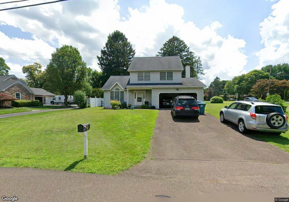
8 Catherine Ave Doylestown, PA 18901
Estimated Value: $572,000 - $718,000
3
Beds
3
Baths
1,790
Sq Ft
$345/Sq Ft
Est. Value
About This Home
This home is located at 8 Catherine Ave, Doylestown, PA 18901 and is currently estimated at $617,931, approximately $345 per square foot. 8 Catherine Ave is a home located in Bucks County with nearby schools including Linden El School, Lenape Middle School, and Central Bucks High School-West.
Ownership History
Date
Name
Owned For
Owner Type
Purchase Details
Closed on
Nov 19, 1998
Sold by
Krapf Kathleen M and Johnson Kathleen M
Bought by
Krapf Daniel E and Krapf Kathleen M
Current Estimated Value
Home Financials for this Owner
Home Financials are based on the most recent Mortgage that was taken out on this home.
Original Mortgage
$139,500
Interest Rate
6.68%
Purchase Details
Closed on
Apr 13, 1993
Bought by
Krapf Daniel E
Create a Home Valuation Report for This Property
The Home Valuation Report is an in-depth analysis detailing your home's value as well as a comparison with similar homes in the area
Home Values in the Area
Average Home Value in this Area
Purchase History
| Date | Buyer | Sale Price | Title Company |
|---|---|---|---|
| Krapf Daniel E | -- | T A Title Insurance Company | |
| Krapf Daniel E | $165,000 | -- |
Source: Public Records
Mortgage History
| Date | Status | Borrower | Loan Amount |
|---|---|---|---|
| Closed | Krapf Daniel E | $139,500 |
Source: Public Records
Tax History
| Year | Tax Paid | Tax Assessment Tax Assessment Total Assessment is a certain percentage of the fair market value that is determined by local assessors to be the total taxable value of land and additions on the property. | Land | Improvement |
|---|---|---|---|---|
| 2025 | $5,847 | $33,040 | $5,840 | $27,200 |
| 2024 | $5,847 | $33,040 | $5,840 | $27,200 |
| 2023 | $5,575 | $33,040 | $5,840 | $27,200 |
| 2022 | $5,513 | $33,040 | $5,840 | $27,200 |
| 2021 | $5,400 | $33,040 | $5,840 | $27,200 |
| 2020 | $5,375 | $33,040 | $5,840 | $27,200 |
| 2019 | $5,317 | $33,040 | $5,840 | $27,200 |
| 2018 | $5,300 | $33,040 | $5,840 | $27,200 |
| 2017 | $5,259 | $33,040 | $5,840 | $27,200 |
| 2016 | $5,226 | $33,040 | $5,840 | $27,200 |
| 2015 | -- | $33,040 | $5,840 | $27,200 |
| 2014 | -- | $33,040 | $5,840 | $27,200 |
Source: Public Records
Map
Nearby Homes
- 16 Greenway Dr
- 7 Broadale Ct
- 6 Hillcrest Cir
- 333 Lacey Ave Unit A2
- 333 Lacey Ave Unit B9
- 4570 Louise Saint Claire Dr
- 528 E Court St
- 3752 William Daves Rd Unit 7
- 3688 Christopher Day Rd
- 150 Selner Ln
- 169 N Main St
- 3611 Jacob Stout Rd Unit 7
- 209 Harvey Ave
- 612 S Chubb Dr
- 146 E Court St
- 3913 Charter Club Dr
- 4061 Sawmill Rd
- 3951 Cephas Child Rd Unit 11
- 118 Westbury Ct
- 180 N Clinton St
- 12 Catherine Ave
- 65 Campbell Ave
- 101 Park Dr
- 80 Campbell Ave
- 68 Campbell Ave
- 15 Catherine Ave
- 98 Campbell Ave
- 56 Campbell Ave
- 51 Campbell Ave
- 109 Park Dr
- 16 Catherine Ave
- 19 Catherine Ave
- 18 Dorothy Ave
- 127 Cottonwood Ct
- 20 Dorothy Ave
- 125 Cottonwood Ct
- 102 Park Dr
- 108 Park Dr
- 44 Campbell Ave
- 31 Campbell Ave
Your Personal Tour Guide
Ask me questions while you tour the home.